
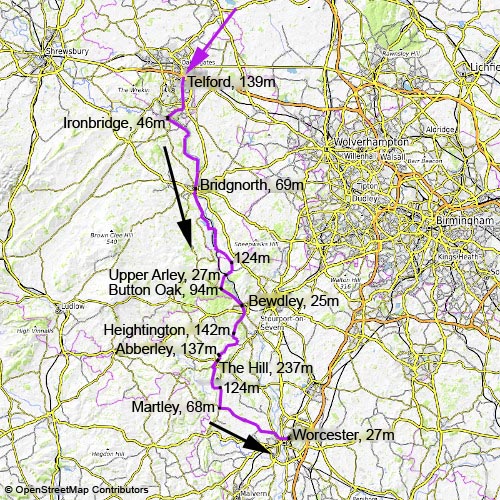
Severn Valley from Telford to Worcester
25. 8. 2025
Peter Schrammel
Weather
sunny, 27° in the afternoon
Interest 
***: Following the Severn Valley railway tracks through medieval towns, former mining villages and across the Abberley Hills
Route
Telford, 139m - Ironbridge, 46m - Bridgnorth, 69m - 124m - Upper Arley, 27m - Button Oak, 94m - Bewdley, 25m - Heightington, 142m - Abberley, 137m - The Hill, 237m - 124m - Martley, 68m - Worcester, 27m
Elevation gain
1275m/-1387m
Distance
84km
Timing
5 1/2h (1/2 + 1 1/4 + 1 + 1/6 + 1/4 + 1/4 + 2/3 + 1/2 + 1/4 + 1/2 + 1/6 + 1/2)
Stamina
F: The first half is mostly flat, not so the second...
Difficulty
+-++: some gravel sections to Silkin Way 0; almost continuous gravel from Ironbridge to Bridgnorth, sometimes quite rough +; rough gravel from B4555 +, then a narrow bridleway +, with a relatively steep downhill section (100m) with good grip +-++ and ford (announced as a "water hazard"); from Hampton to Severn Valley Country Park mostly tarmacked, one extremely section (>40% over 20m), some rough gravel +; Heightington Road with steep downhill (15%), ford (was dry) and similarly steep and long uphill; long, steep ascent (Wynniats Way) to The Hill after Abberley (21%); gravel road through the Abberley Hall estate +
Danger
0
Visitor frequency
c: Lots of dog walkers
Comments
Gravel bike recommended. Better take the private road turning left after the bridge over Mor Brook rather than the dangerous uphill section of the B4555.
Report
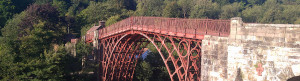
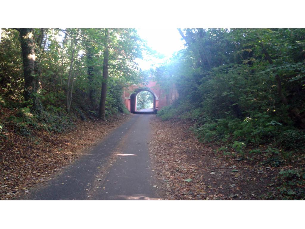
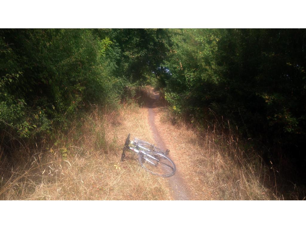
After two mediocre weeks the weather forecast for this bank holiday Monday was surprisingly good. So, I simply had to do something and decided to cycle from Telford down the Severn valley to Worcester, since both cities are reachable by train. However, as usual I couldn’t get any cycle reservations; so, I just tried my luck and got on the train at 5.20am via Banbury and Birmingham. After a quite ride in pretty much empty trains I arrived in Telford at 8am. It was already hot in the morning, so I stowed away my jacket right away. I took the shortest path around the city center that is hardly distinguishable from the industrial areas surrounding it to the wilderness of the town park area. The Silkin Way on the track of a former railway line cuts right through the park leading south, passing by former station platforms and arched underpasses. I turned right before Madeley to pedal over the hill and then roll down to the village of Ironbridge with its houses stacked against the steep hillside. I crossed the famous bridge and turned left to follow the cycle path, again on a former railway line. That one soon turned into a gravel path which was a pleasure to ride, but my rear tire didn’t like it and so it went flat after a few minutes. 10 minutes later I was pedalling again, a bit more careful when the gravel was rough. That road is mostly in the woods. Only occasionally the river could be seen. There were quite a few dog walkers who enjoyed the sunshine too. After an hour from Ironbridge I reached a narrow tarmac road which led me into Bridgnorth. I decided not to take the shortcut along the river, but climbed up to the town center. This was a good decision because it is really pretty, with a town gate, a medieval town hall that sits like on stilts above the marketplace. There was also a castle hill which approached following my instinct via the castle walk, which offers breathtaking views from a cliff over the Severn. There is little left of the castle, but a broken tower leaning at 30°. The castle gardens were pretty. So, I decided to take my lunch break there, even though it was just after 10am, watching a heritage train preparing for departure in the station opposite. After refreshing my sunscreen, I rolled down the hill and continued following the cycle path signs, with deviations though, to take the more direct route through Eardington. However, there was clearly a reason why the cycle path didn’t use these roads because there are two steep sections where car drivers are clearly too much tempted to dangerously overtake slow cyclists. Off the B4555 again, the cycle route turned onto a bridleway that was more suitable for mountainbikes, but fun to ride. From Hampton Loade, the cycle path was tarmacked again and offered more frequent views of the river. Often it runs directly next the railroad which started singing when the heritage train approached at 30km/h. An increase in frequency of dog walkers announced the Severn Valley Country Park, which allowed me to cross the river via a footbridge. Stand-up paddlers and kayakers were enjoying the river. The cycle route now climbs on quiet single lane roads up the hills before it falls down steeply into Upper Arley. There was quite a traffic jam as people were flocking into the sports field for some vintage car event. The river crossing is again just a footbridge, followed by a steep climb past beautifully decorated Arley train station. To avoid a lengthy detour I took the B4194 from Button Oak into Bewdley. This was a very busy road with a fast downhill section. The beer gardens along the river were busy in Bewdley. I also sat down for a couple of minutes and watched the crowd. After 1.30pm I continued, not along the river, but on Heightington Road – nomen est omen: it climbs up a hill. And then it falls down steeply into a valley, crosses a little river via a ford and climbs up as steeply again – quite exhausting. Now, I could see the reason for my detail off the Severn valley: Abberley Hill, the only significant mountainous feature in the area. To get there, I had to roll down the hill again and follow the shallow valley. Finally, the road gets steeper again as it leads into the village of Abberley with its church that is half in ruins, but only half. Now, it was going to get serious as I had to cross The Hill, which was really quite steep and felt even steeper as my energy reserves were declining. After crossing the A443 a gravel road led through the grounds of the Abberley Hall school. Coming from this side, I didn’t even notice the enormous clock tower on the top of the hill. Leaving the fenced estate via the south lodge, I kind of crossed the B4203 to continue on another single-track road along Walsgrove and Woodbury Hill. Occasionally, there were beautiful views down into the Teme valley. After a short steep hill, I rolled down to B4197. Now, I could cycle across Wichenford to the A443 or further south from Martley via the B4204 more directly into Worcester. I decided for the latter. The car traffic was not too bad. However, my legs felt really tired now, so that even the bump through Lower Broadheath felt like a hill. I took the footbridge across the river and followed the viaduct to Foregate Street station. I had 45min until my train at 4.12pm. So, I bought some ice cream and a large bottle of water that I emptied while waiting on the platform. And of course, the train’s cycle compartment was empty.
On the Silkin Way in Telford
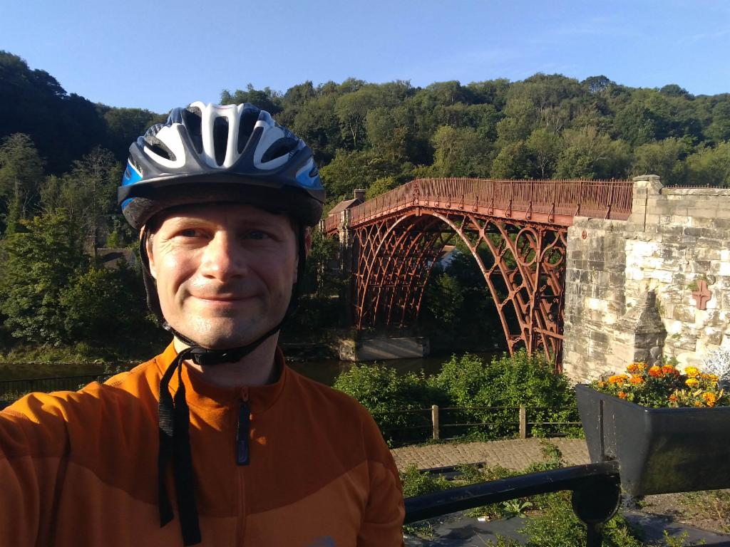
At the Ironbridge
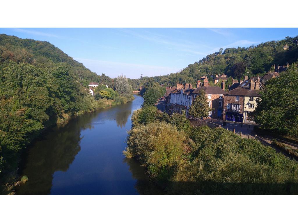
From the Ironbridge upstream
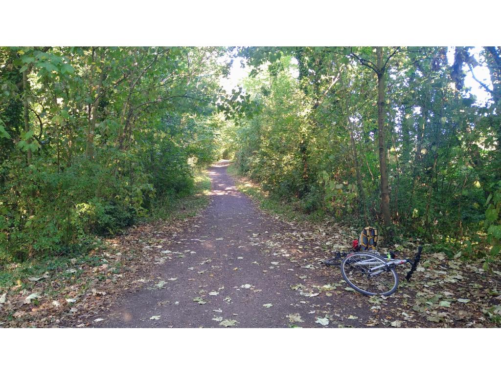
Cycle path on former railroad track
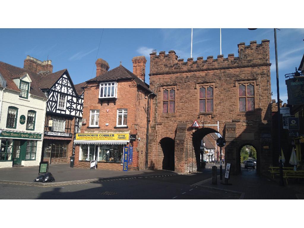
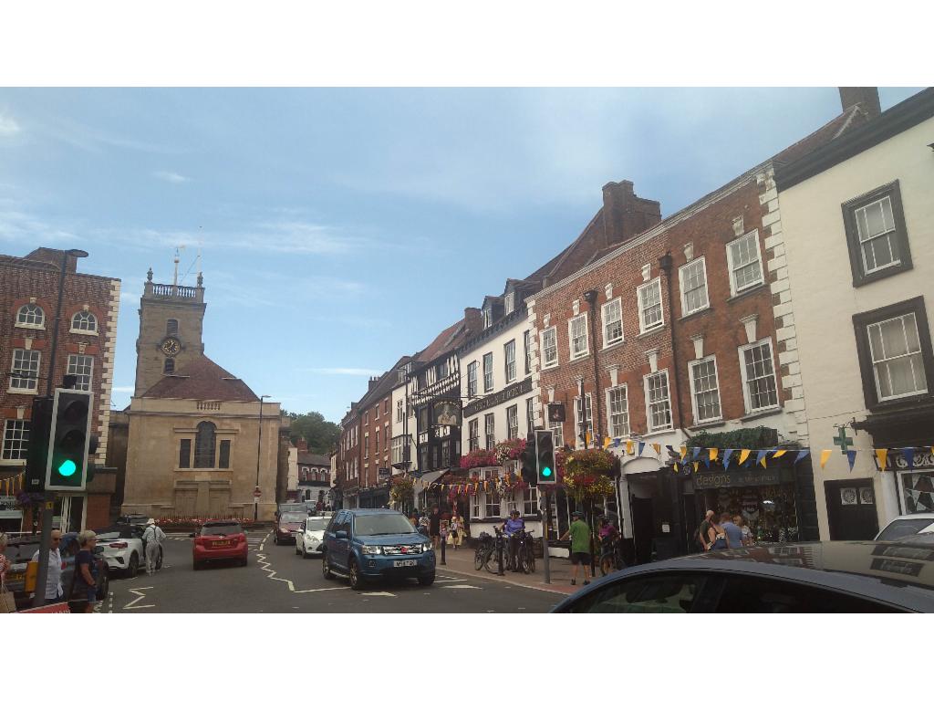
Northgate of Bridgnorth
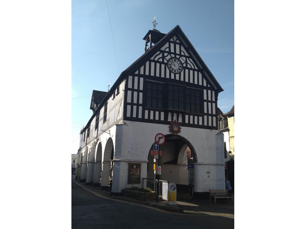
Bridgnorth town hall
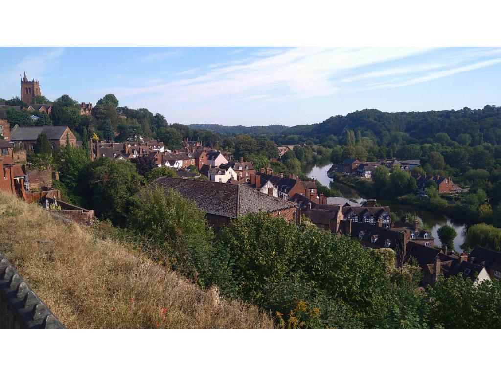
Severn valley at Bridgnorth
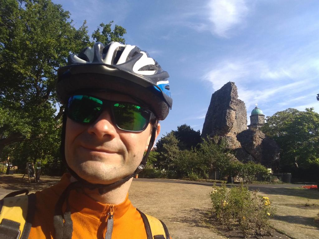
Slanting tower of Bridgnorth Castle
Path near Chelmarsh Reservoir
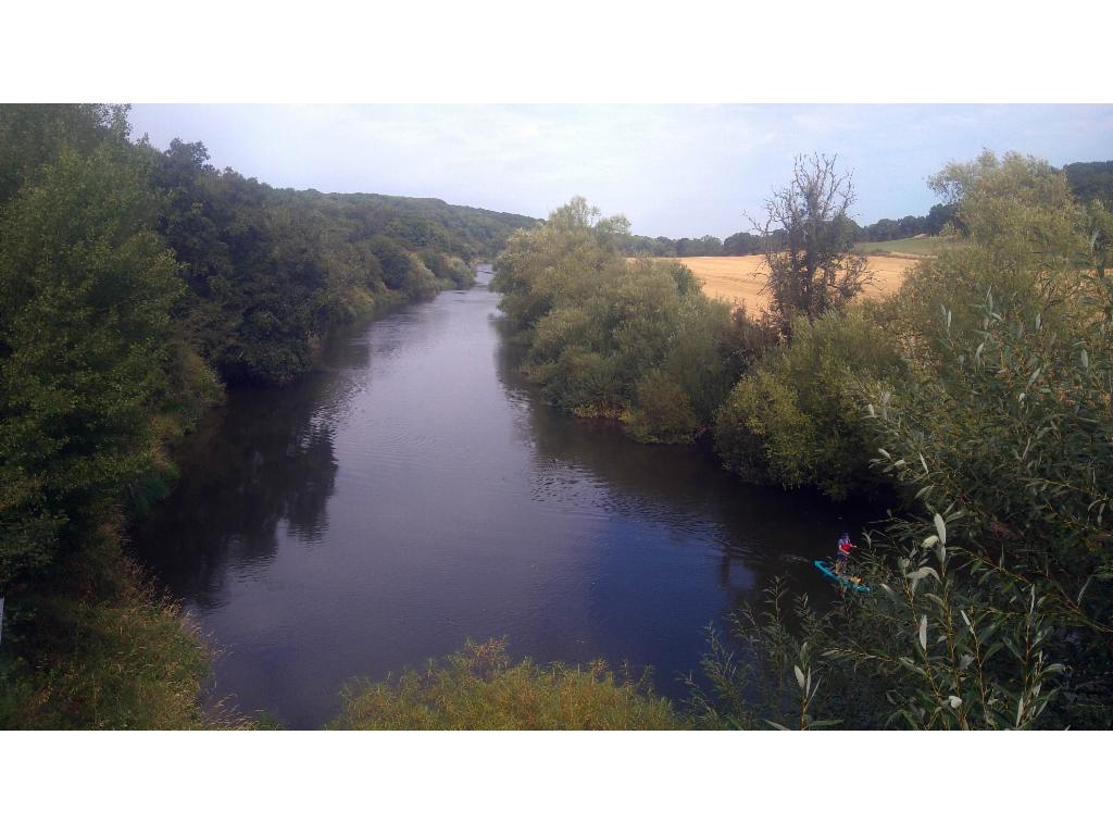
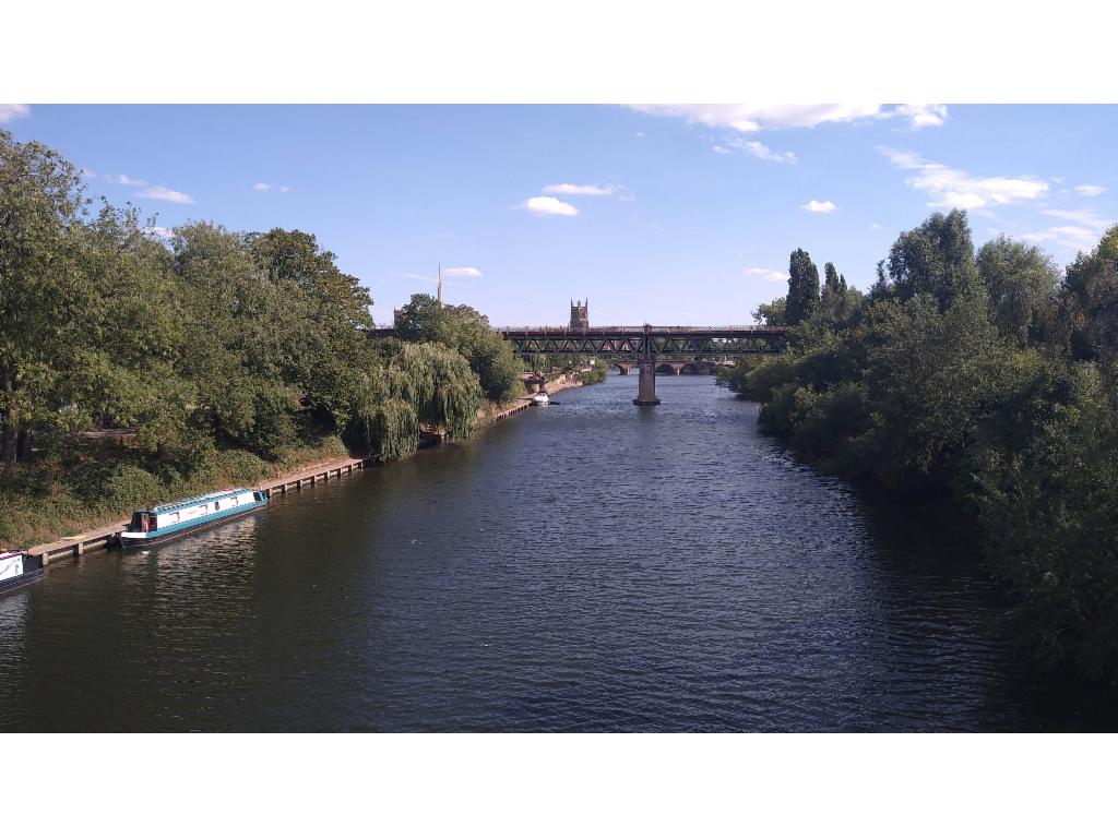
View upstream from Severn Valley Country Park footbridge
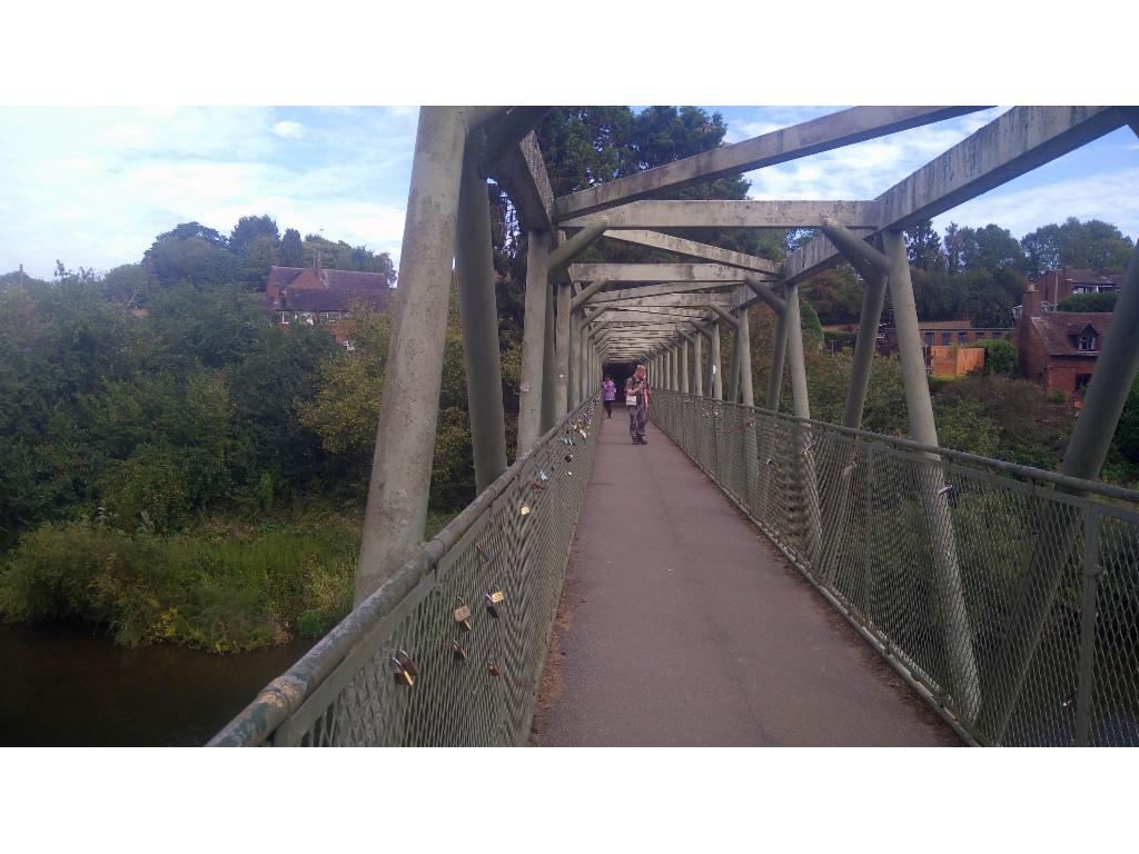
Footbridge at Upper Arley
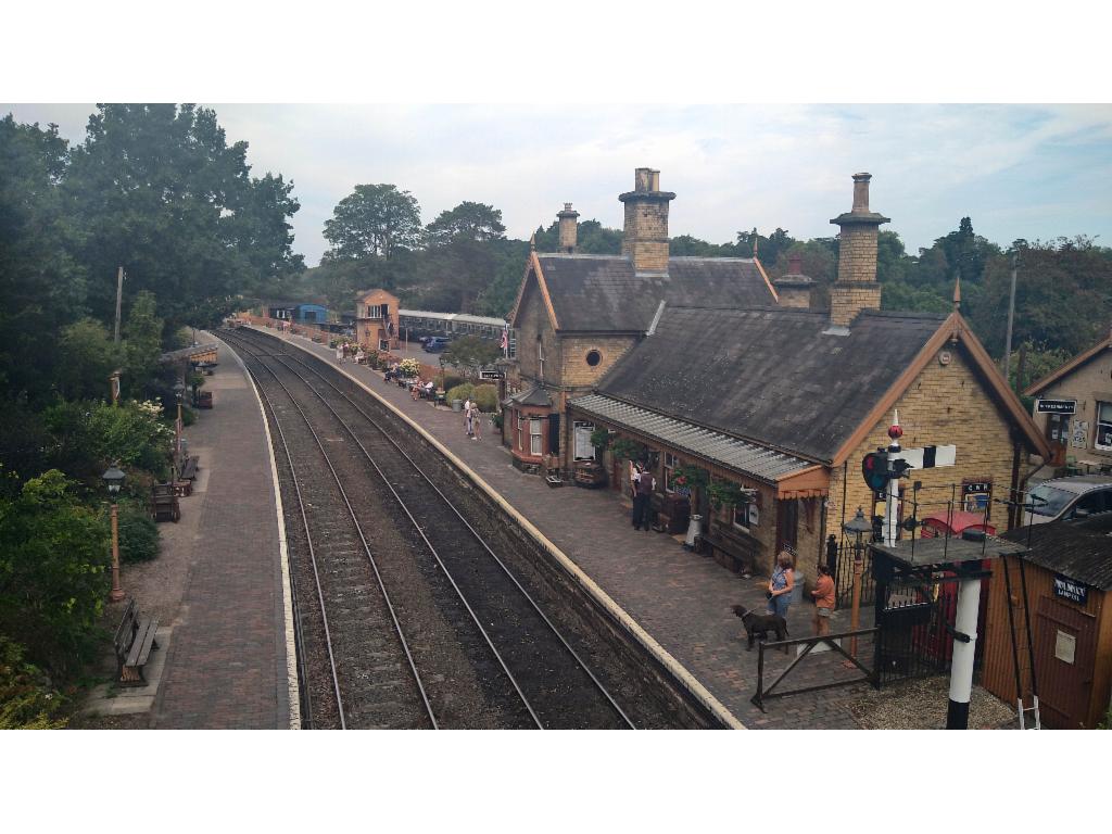
Upper Arley Station
Bewdley Load Street
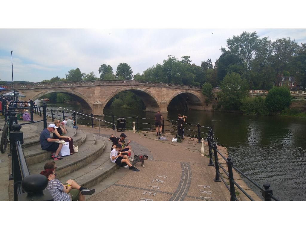
Severn at Bewdley
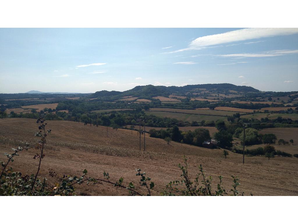
View from Heightington to Abberley Hill
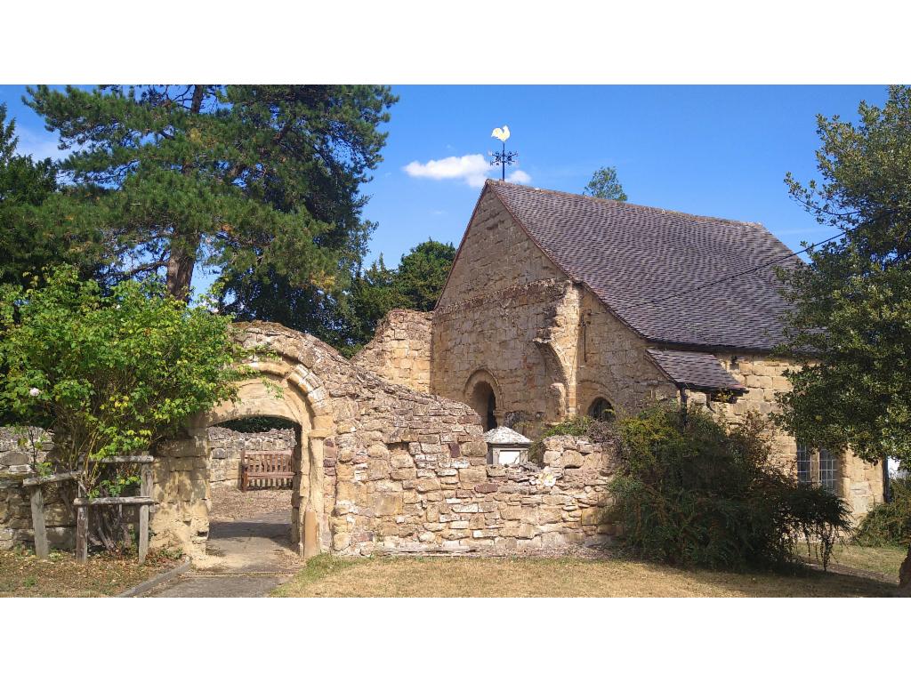
St MIchael's church in Abberley
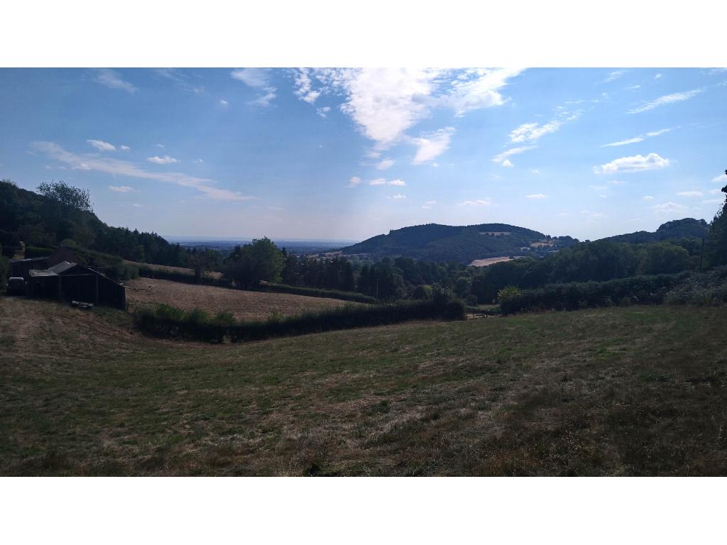
Woodbury Hill from the descent from Abberley Hill
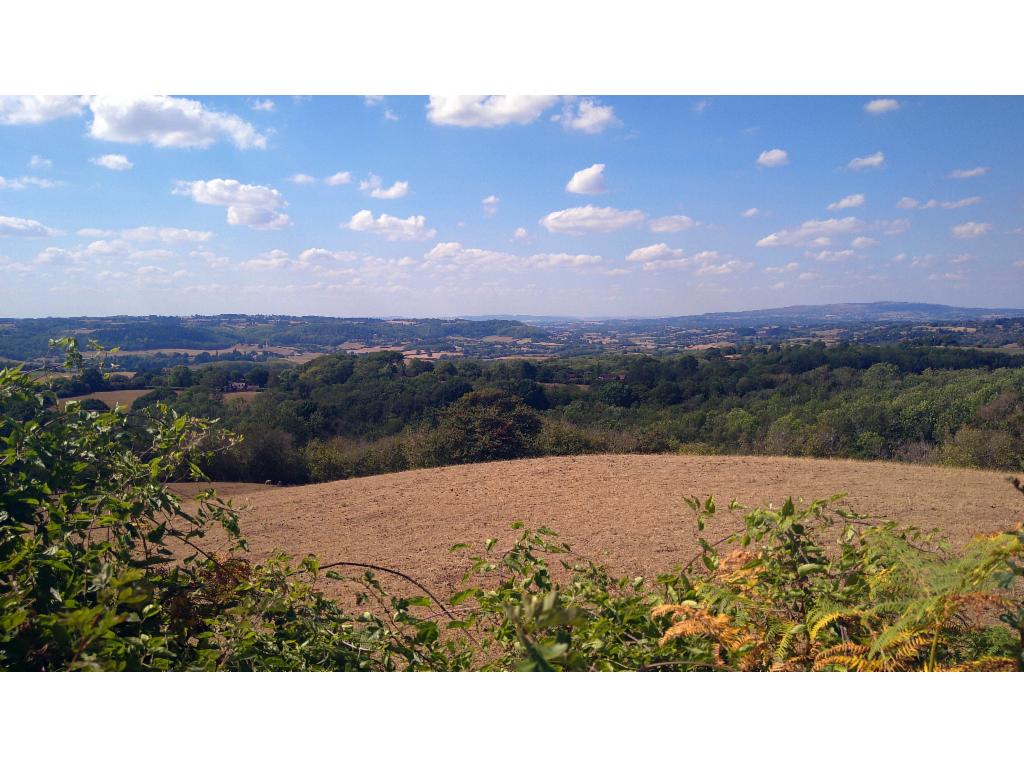
Teme Valley
Severn at Worcester