
Mount Edgcumbe and Rame Head
27. 5. 2023
Peter Schrammel
Weather
cloudless
Interest 
***: Cornwall Coast path section around the Mount Edgcumbe peninsula
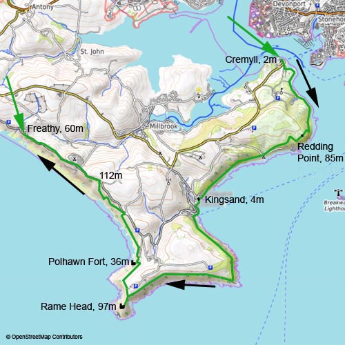
Route
Cremyll, 2m - Redding Point, 85m - Kingsand, 4m - Rame Head, 75m - Polhawn Fort, 36m - Military Road, 112m - Freathy, 60m
Elevation gain
+494m/-436m
Distance
16km
Timing
4h (1/2 + 3/4 + 1 1/4 + 1/2 + 1/2 + 1/2)
Stamina
D: quite long
Difficulty
0: some high steps to Rame Head
Danger
3: hidden cliff next to the path after Polhawn Fort; otherwise mostly 1
Visitor frequency
c: quite busy, but not too terrible
Comments
Cremyll Ferry £2.50
Report
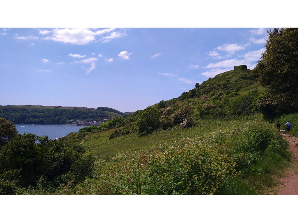
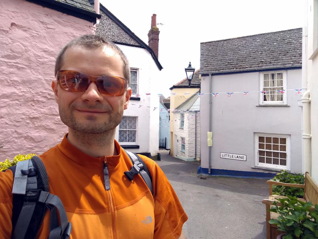
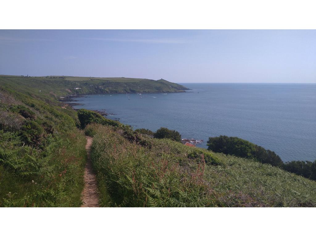
Spending a bank holiday weekend in Cornwall, I wanted to explore the coast paths. The first route was from Cremyll towards the west. It was hard to estimate how long it would take me. So, I planned loosely and considered multiple options for returning to Plymouth. Having stayed overnight in Tavistock I arrived in Plymouth after 11am, dropped my luggage in the hotel and walked to the Cremyll Ferry pier. Queues were building up quickly as Plymothians didn‘t want to miss out on a beautiful picnic day in the parks of Mount Edgcumbe. After 12pm I reached the busy entrance of Mount Edgcumbe Country Park with its imposing manor. I followed the path along the coast with views to Royal William Yard and Drake‘s Island. The path slowly rises to a glade below the hill crowned by the ruins of Mount Edgcumbe folly. After some ups and downs I reached a nice belvedere at Redding point with views over the mouth of river Tamar. When reaching another glade, the distinctive pyramid of Rame Head appears for the first time. After passing a Scout camp site, the path leads through dark, cool woods and a leaning meadow down to Kingsand and Cawsand, fishing villages with very narrow, steep streets. Intrepid people were swimming between the waves that rolled onto the small patch of beach packed with sun worshippers. I got a cone of excellent icecream at the village shop. It was half past one. So, I still had enough time to walk to Rame Head. The coast path continues along a small tarmac road up to the southeastern point of the peninsula. From there I walked on a nice path that roughly follows the contour line and offers gorgeous views to Rame Head. Wild ponies were grazing next to the path. For the final ascent to St. Michael‘s chapel on top of Rame Head I had to climb some rocky steps. Rame Head offers spectacular views of the coast to the east and west. The inside of the chapel is empty and cool like a fridge. I wanted to be back in Plymouth at 7pm at latest. So, I could walk for another 90 minutes before I had to find a bus stop. Getting to the train line was out of reach – I had left much too late in the morning. I followed the path above the cliffs leading through narrow alleys of dense scrubs down to Polhawn. It was quite hot and the path continued to climb up and down in unexpected ways, first following the edges of the cliffs and then through holiday huts built into the steep slopes without any road access. Finally I reached the military road that coasts the edge of the plateau. It didn‘t make much sense to use any of the paths in the slopes and I wanted to get to Freathy to catch the bus from there. I arrived at the bus stop 20 minutes in advance. It was quite impressive how the bus driver drove the double-decker bus on these steep and narrow roads down to Torpoint. From there the bus took the ferry across the estuary to Plymouth.
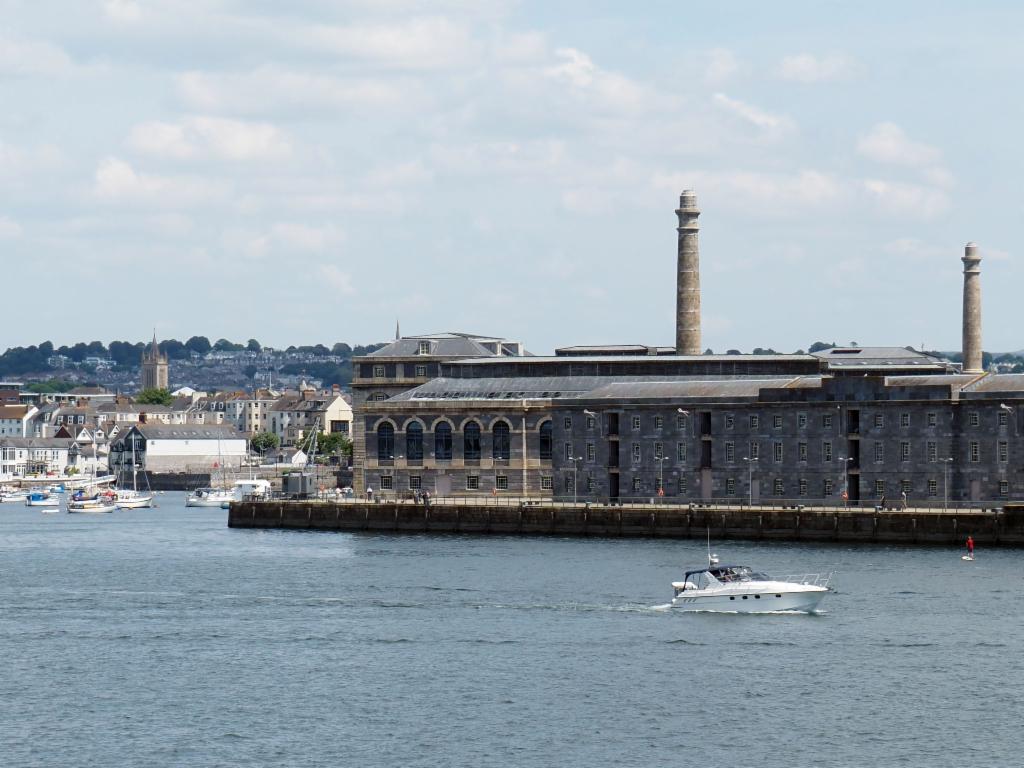
Royal William Yard from Cremyll
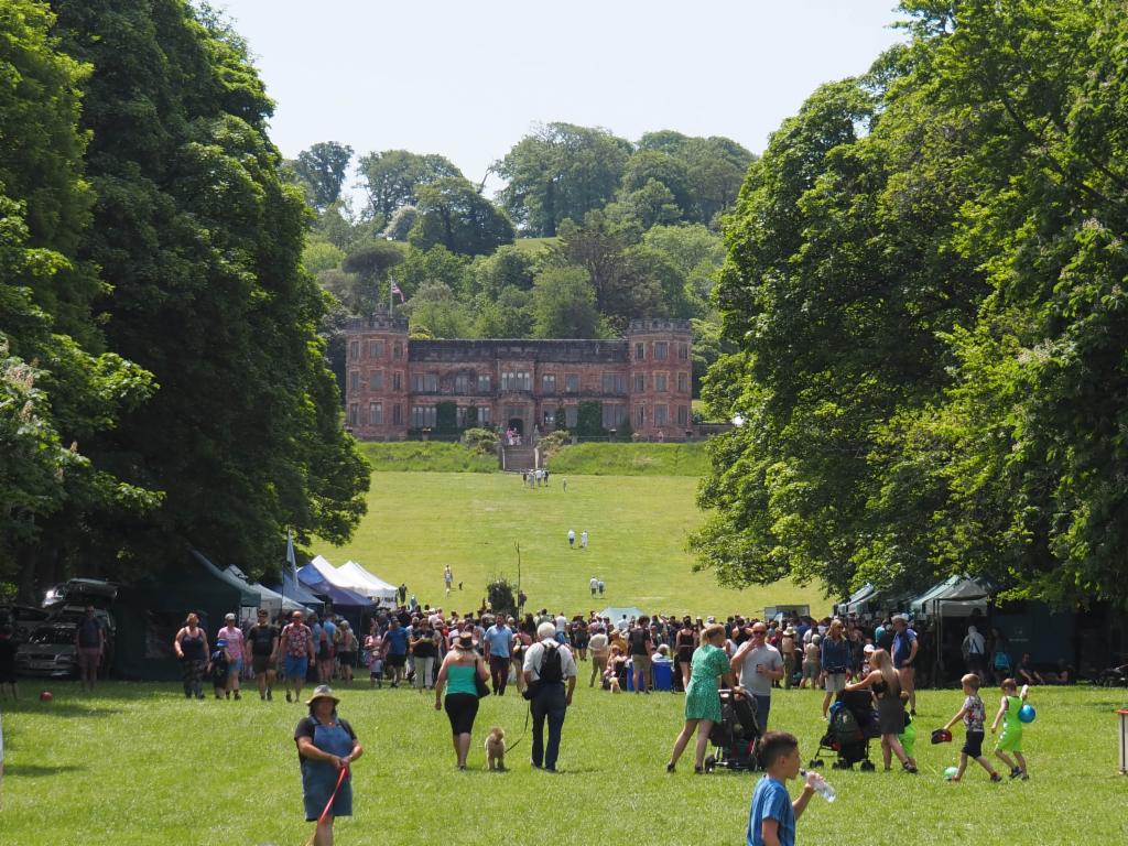
Mount Edgcumbe House
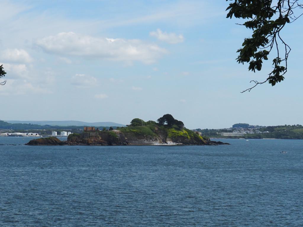
Drake's Island
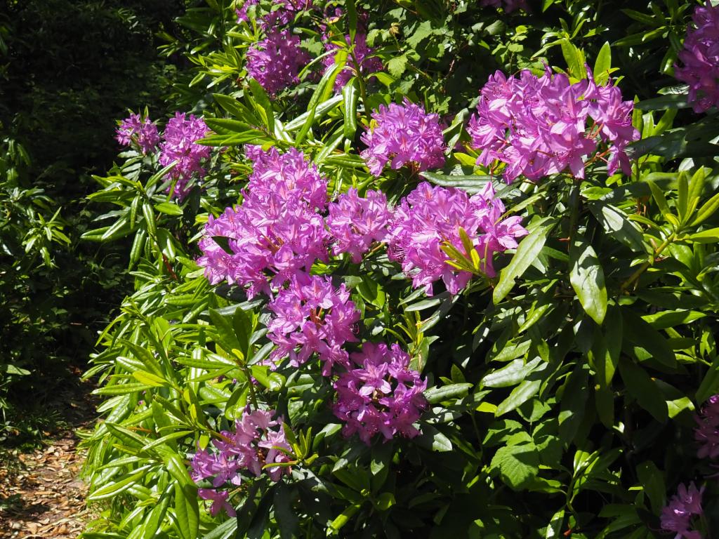
Rhododendron
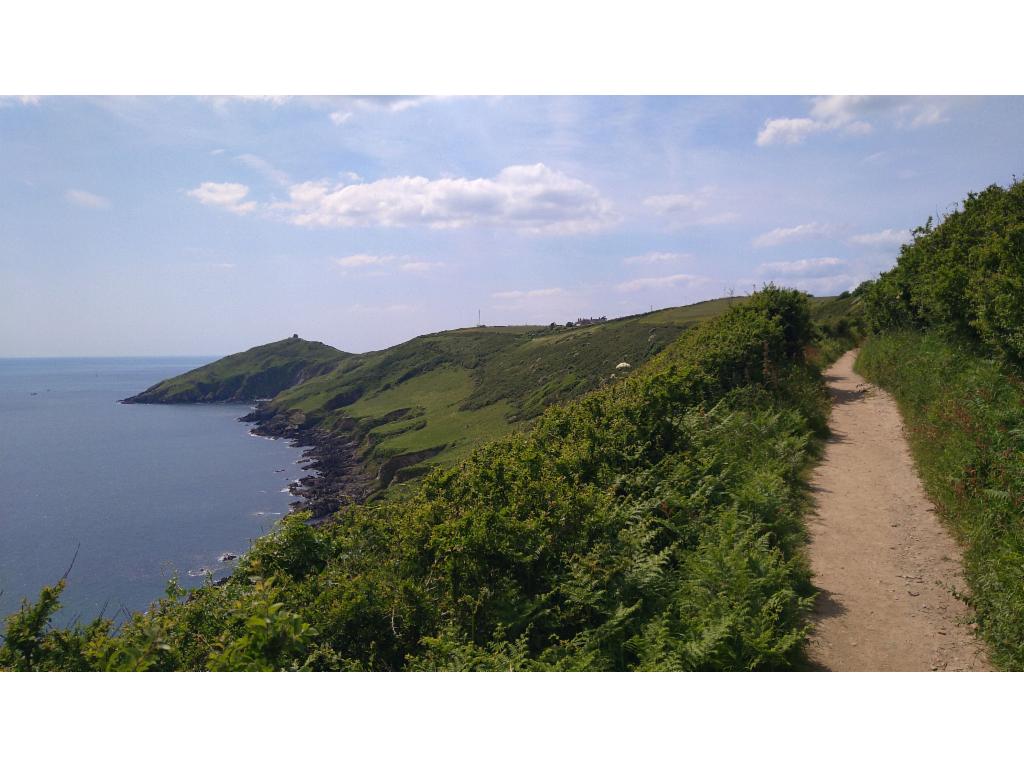
Path towards Kingsand
In Kingsand
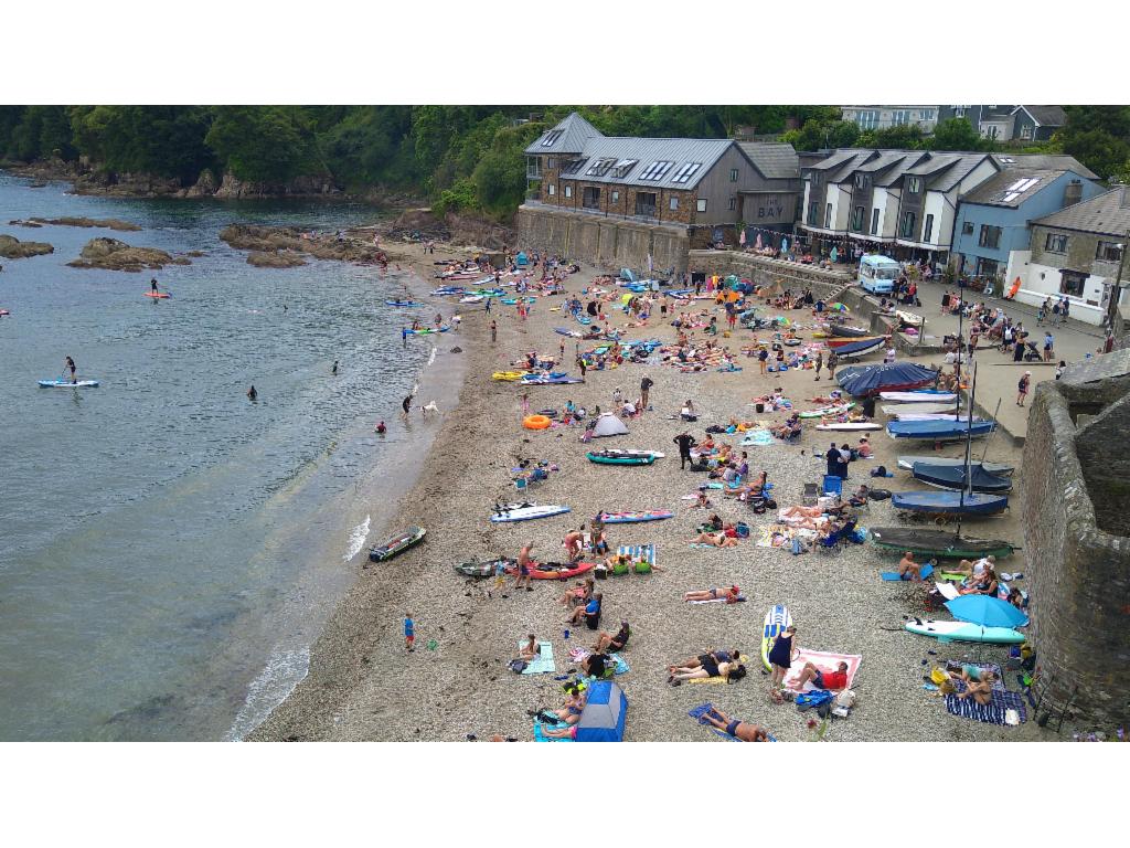
Village beach of Cawsand
Path to Rame Head
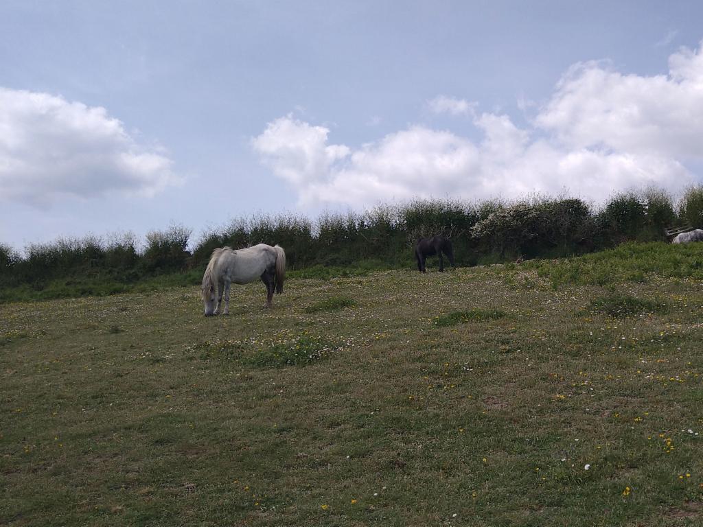
Wild ponies
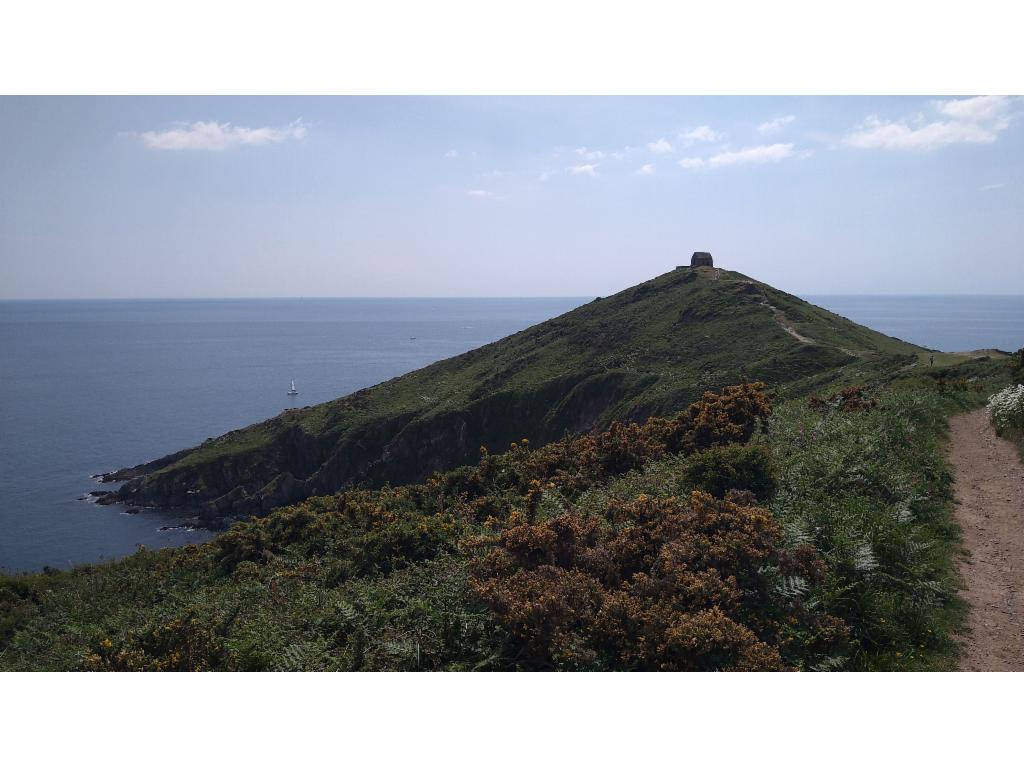
Arriving at Rame Head
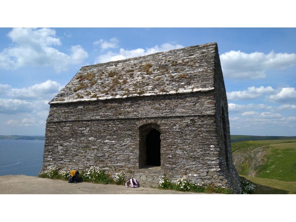
St Michael's Chapel
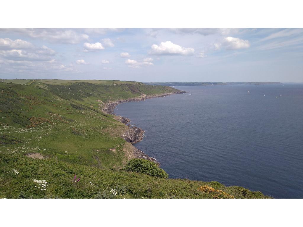
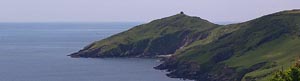
View from Rame Head towards the east
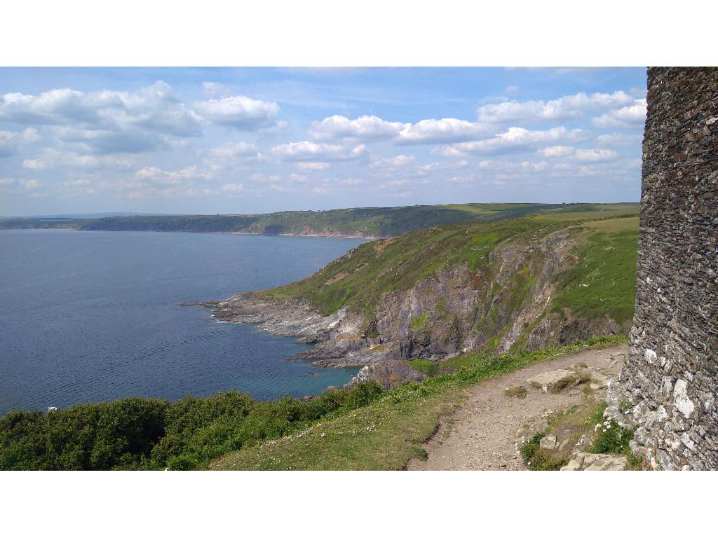
View from Rame Head towards the west
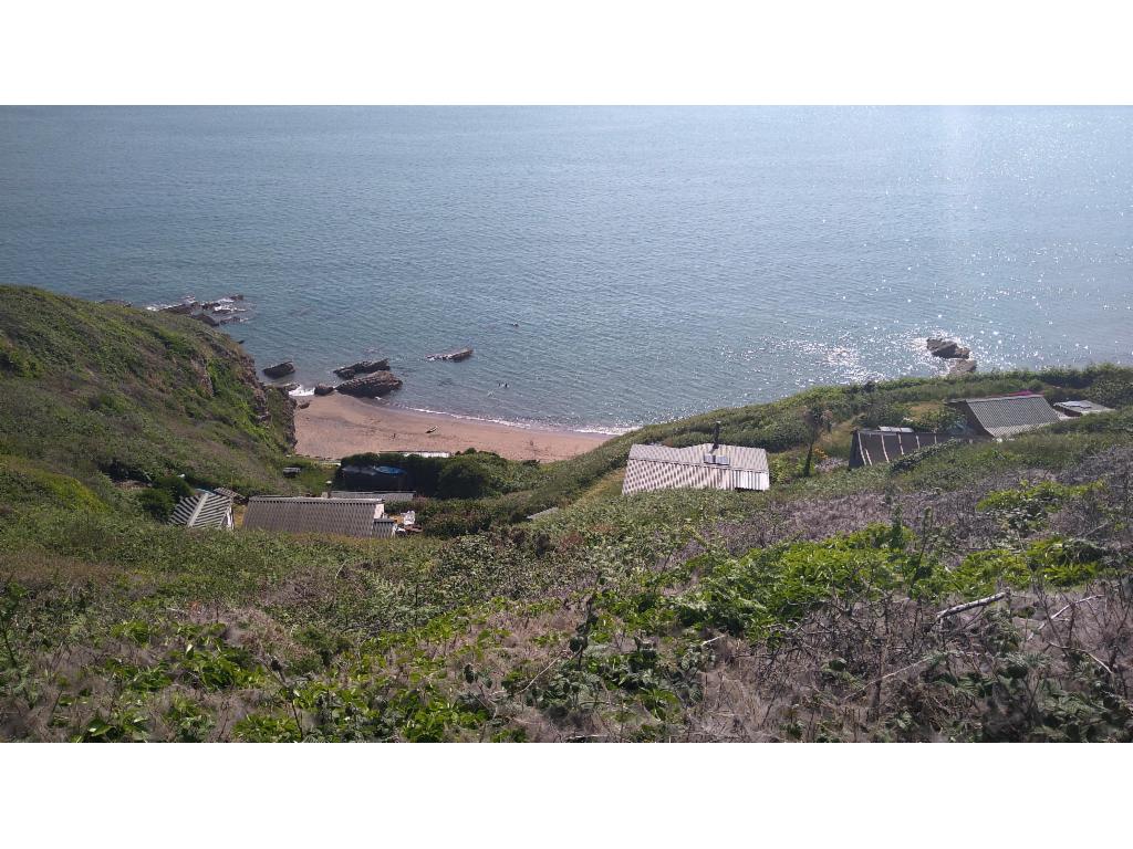
Chalets scattered along the steep coast line
View back to Rame Head