
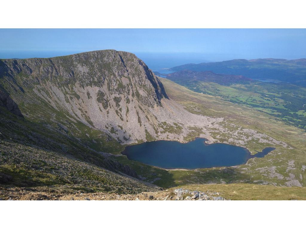
Llyn Cau, Llyn y Gader and Tyrrau Mawr
28. 8. 2022
Peter Schrammel
Weather
sunny, some clouds
Interest 
****: Very long traverse of the western part of the Cadair Idris range
Route
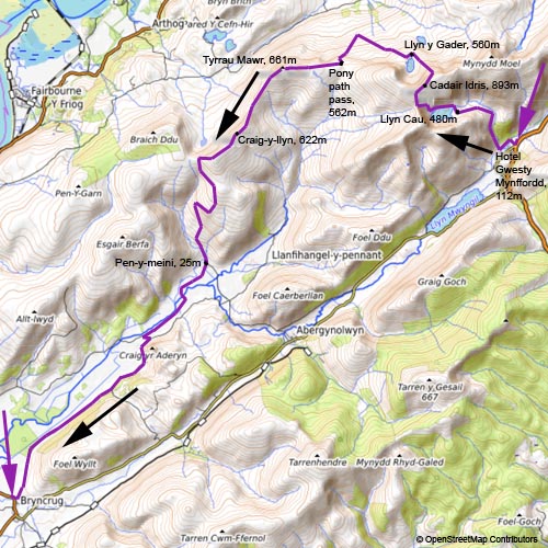
Hotel Gwesty Mynffordd, 112m - Llyn Cau, 480m - Cadair Idris, 893m - Llyn y Gader, 560m - Pony path pass, 562m - Tyrrau Mawr, 661m - Craig-y-llyn, 622m - Pen-y-meini, 25m - Bryncrug, 8m
Elevation gain
+1303/-1407
Distance
27km
Timing
8h (3/4 + 1 1/4 + 3/4 + 3/4 + 1/2 + 2/3 + 1 1/3 + 2)
Stamina
G: The last 8km are tough.
Difficulty
I: smaller steps along Llyn Cau 0+, several variants up to the pass 0+ up to I-, the direct canyon is very wet with two difficult steps I; very tedious descent to Llyn y Gader on loose scree, multiple variants 0+ to I-
Danger
3-4: up to pass above Llyn Cau 3-4, traverse and descent to Llyn Gader 3, rest not more than 2; huge drops in vicinity of the path all along the ridge via Tyrrau Mawr and Craig-y-llyn, but mostly separated by a fence, except for the summits
Visitor frequency
d: very busy until Pony path pass; afterwards very lonely
Comments
Rather than aiming for the scree up to the pass above Llyn Cau, there is a path starting at the prominent buttress first following the brook and then turning left towards the scree. The path then takes a second switchback to avoid the narrow canyon towards the pass. From Llyn y Gader to the Pony path I missed the path traversing from 480m towards the west; there are several traces towards the left; the path passes above the distinctive rocks in the middle of the slope. Towards Nantcaw Fawr farmhouse, follow the paths exactly as indicated in the map even if no traces are visible on the ground in order not to get stuck between fences, scrubs and muddy trenches.
Report
I had spent the night at Hotel Gwesty Mynffordd. I had a sumptuous breakfast at 7.30am so that I could leave early. I had a long day ahead to reach my next accommodation at Bryncrug. I estimated 22km. I wanted to hike the paths over Cadair Idris that I hadn't done the day before. Finally, I left at 8.15am. When crossing the parking lot, I met a guy from Telford who had come for the day. We chatted all along the steep first part of the ascent. The guy then took the bridge consisting of two large slate slabs towards Mynydd Moel. I continued to Llyn Cau. The sky was overcast, but the sun was close to breaking through. There were several tents on the shores of Llyn Cau. A couple was swimming in the middle of the lake. My plan was to take the direct path that leads from the far end of the lake up to the pass between Craig Cwm Amarch and Penygader. I followed a good path along the northern side of the lake. A few hikers in front of me were already engaged in the steep slope. The day before I had noticed from Craig Cwm Amarch that there was a switchback path avoiding the scree. I scrambled down a buttress towards the scree, only to realise later that the sought path was likely east of the brook. So, I traversed the brook again and found the path. After the switchback I reached the scree. Another switchback was expected higher up, but I decided to take the direct canyon, which involved a bit of delicate scrambling on wet, brittle rock, but not exposed. I overtook a couple that scrambled in the grassy slope. On the pass the skies had turned blue skies. In comparison to the previous day it was not busy at all. Towards 10.30am, I reached the top. Minutes later clouds had engulfed the top from the southeast. I took a quick look into the summit shelter, and continued immediately descending towards Mynydd Moel, but then turned left on Fox's path towards Llyn y gader. The visibility had become better again, but the summit was still hidden in the clouds. Multiple path traces were carved into the steep scree slope. The descent was very tedious and sometimes the use of my hands was necessary. A strong, but warm wind from the south was visibly causing waves on the lake. I had a short break, observing two families with small children arriving and preparing to picnic on the lake in the sunshine. One of the men swam back and forth across the lake. There were also climbers in the walls of Cyfrwy. I continued the descent. At some point I heard the rustling of a brook, but I couldn't see any brook until I noticed that the water was flowing under the pile of boulders that I was crossing. On the map, there was a path traversing to Pony path, but I missed the intersection and hit Pony path much lower. So, I had to hike up a few extra-meters. From the other end, the traversing path was clearly visible. Looking at the OS map later, it became clear where I missed the path. I should have looked at the map before walking down too far. Lots of people use Ponly Path to ascend Cadair Idris. The summit is hidden behind Cyfrwy, which makes the ascent much farther than it seems when arriving on the pass. My way went in the other direction to the next summit west on the ridge, Tyrrau Mawr. Via a path crossing a swampy meadow, I reached the summit after 1pm. I had my lunch break aross the fence, with great views over Mawddach estuary and turquoise waters, and vertical views down to the Cregennen lakes. I was still far away from the half-way point for today, so I continued down to the pass that separated me from Craig-y-llyn. I encountered a hill runner, the last person until reaching the valley in the late afternoon. During the ascent to Craig-y-llyn a sheep kept running away from me. Staying on the path, it ran all the way up to the top, where I went a bit off path to give it a chance to pass by me back down. Eventually, it was courageous enough to do that. After having enjoyed the views down to Llyn Cyri and the expansive moor land surrounding it, I didn't want to continue on the ridge because I would have to go all the way to the A493 in Llanegryn to be able to cross river Dysynni to Bryncrug. So, I descended along the fence to the dirt road that leads close to the pass above Llyn Cyri. The pasturages were full of sheep. The road was full of droppings - impossible to put my foot anywhere without touching them. Here the sheep had a better avoidance strategy: they ran a bit on the road until they found a place to leave it left or right. The track was a bit lost in some sections and then it was not clear whether I would need to cross a fence or not. I walked a bit along the fence until it was clear that I had to cross it, but not sure whether there was a gate further ahead, so I walked back. Then walking along on the other side, I saw that there would have been a gate too. Again, it was clearly indicated on the OS map where the fences need to be crossed. Also, for the first time I saw yellow signposts that marked the path, but they didn't seem to be maintained. Suddenly the track ended again and I was in the middle of a pasture. It would have been easy if I looked closely at the map, but I didn't look. So I walked down crossing muddy trenches, until I reached the gate to leave the pasturage towards Nantcaw Fawr farmhouse. From there I followed the tarmac road to Pen-y-meini. It was almost 4pm. The map indicated a dirt road to shortcut the tarmac road and cross river Dysynni further down. I thought it was worth trying. I encountered a man with his son and asked them to gain some further evidence, but they didn't know either whether the bridge at the other end actually existed. I still continued and finally everything was fine. There was a massive bridge leading to a campsite. I continued in adventurous spirits and decided to take a marked path along the river that wasn't even on the map - everything that reduces the amount I would have to walk on the tarmac road was worth it. And it was a good choice. There were lots of campers sitting next to the river, piling up empty beer cans in the afternoon sun, which also highlighted the precipitous walls of Craig yr Aderyn. Finally, I had to engage on a long walk on a narrow tarmac road with some traffic, cars and cyclists, now and then. Towards 6pm, I arrived at Peniarth Arms in Bryncrug, a very busy pub. In the end, I had walked more than 26km.
Combe below Llyn Cau
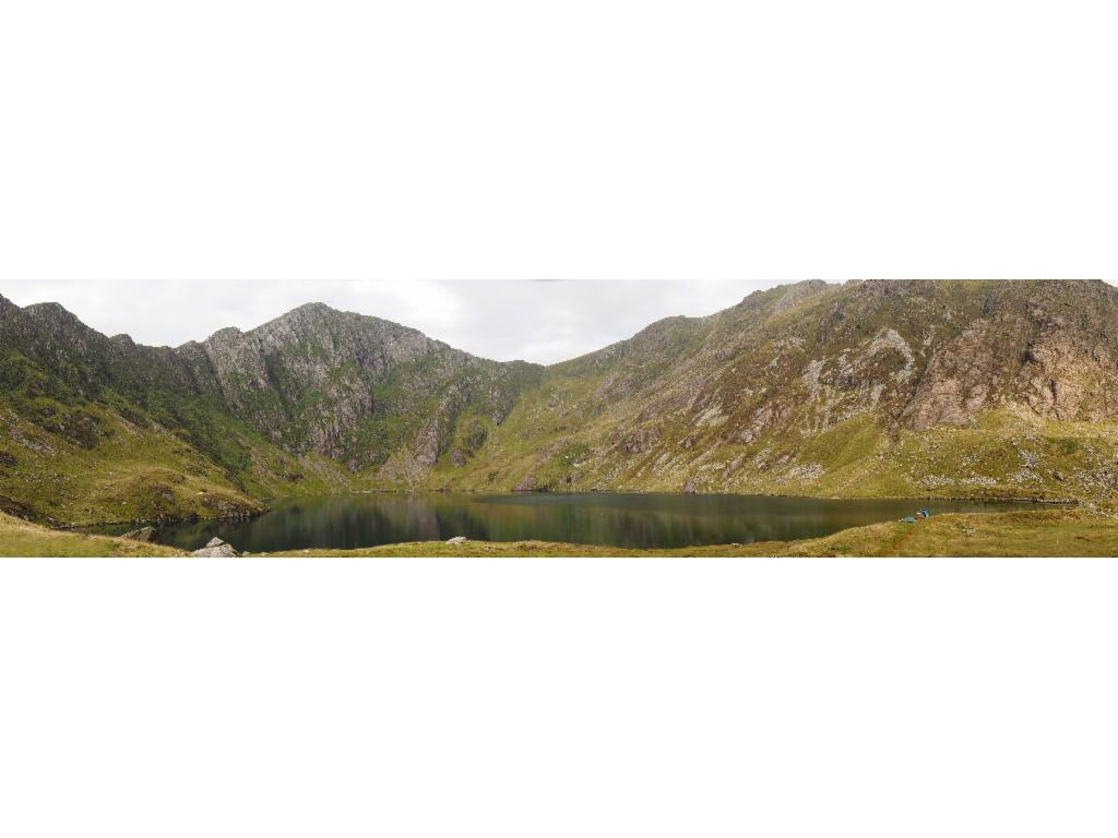
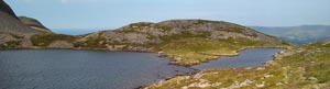
Llyn Cau
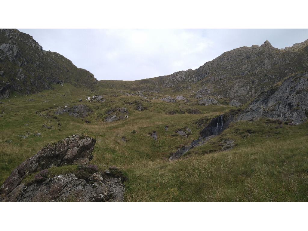
Steep ascent
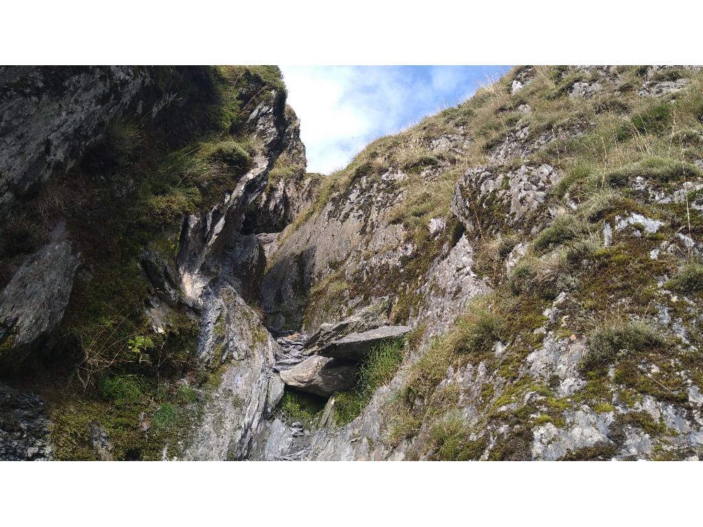
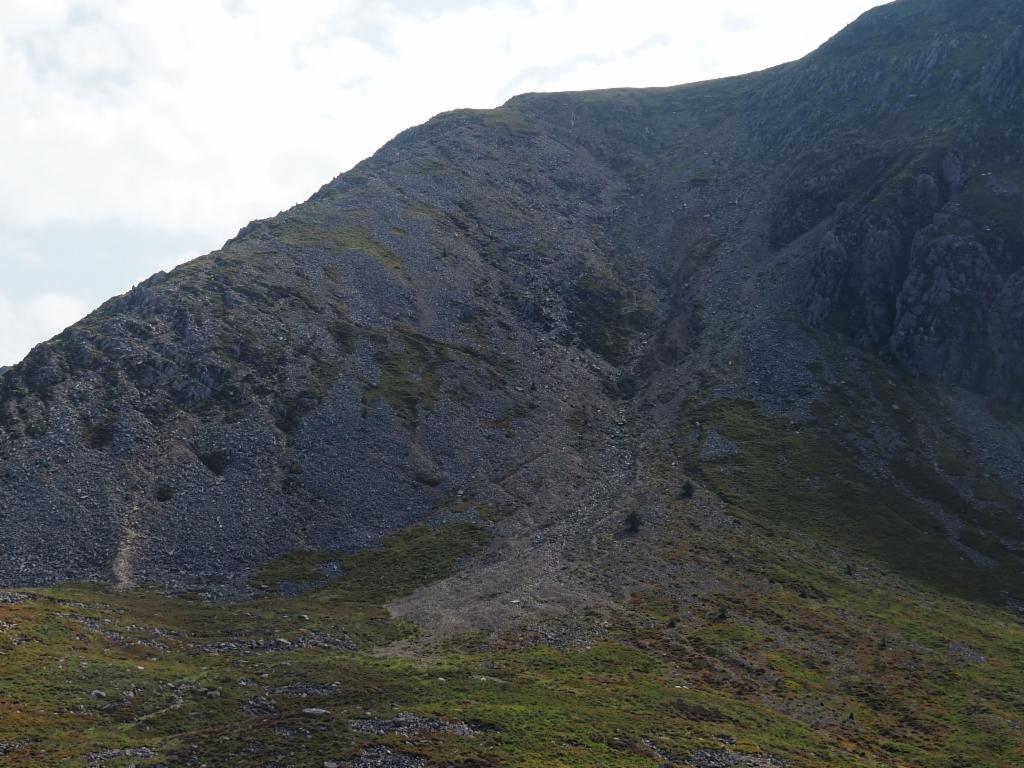
Gully
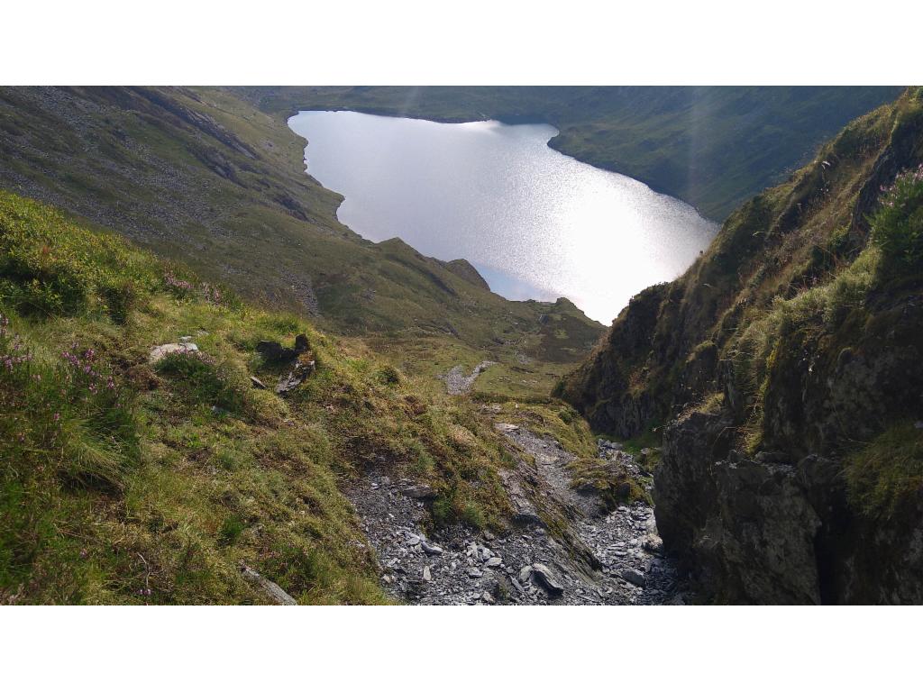
View from the gully down to Llyn Cau
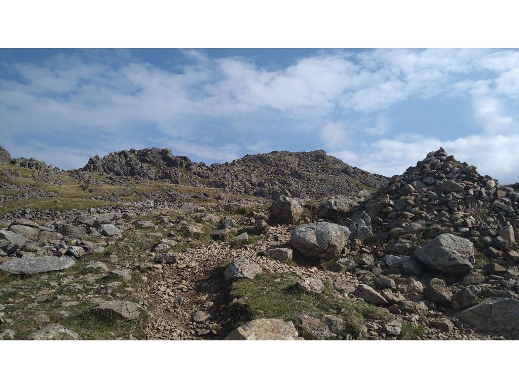
Path to the summit of Penygader
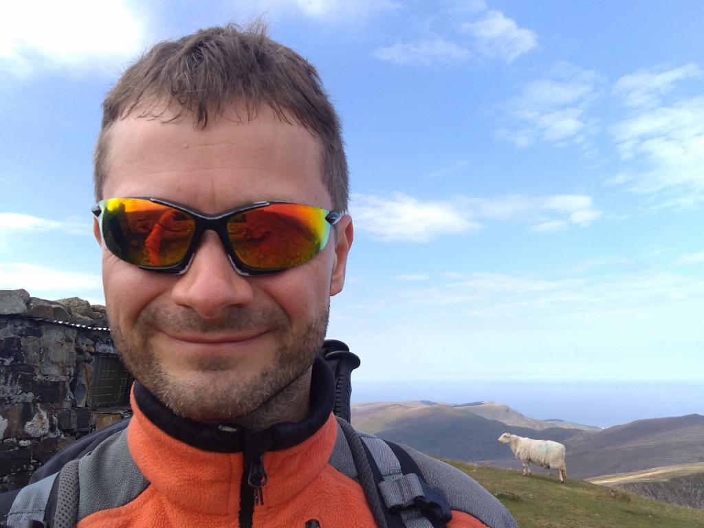
On Penygader
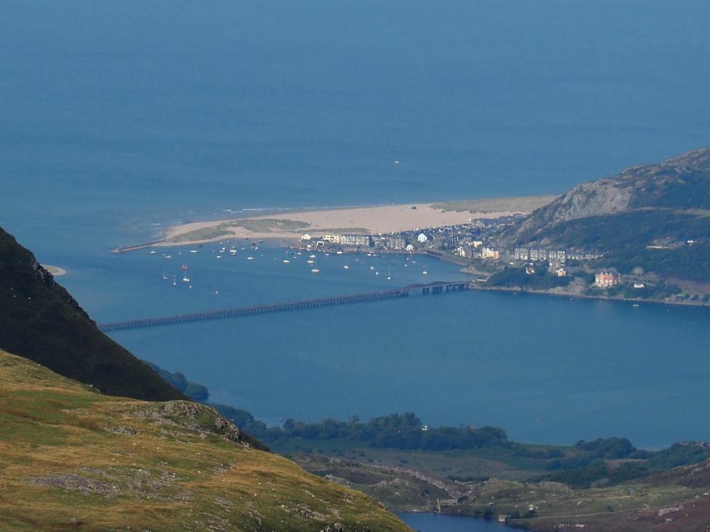
Barmouth from Penygader
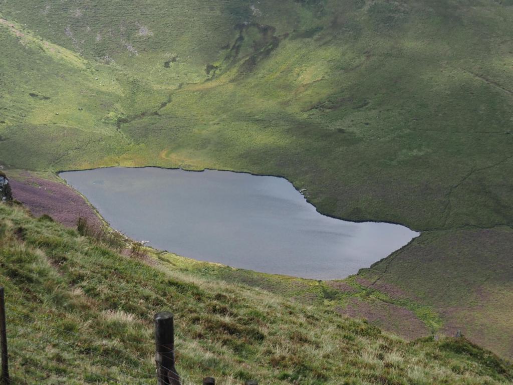
Descent to Llyn y Gader
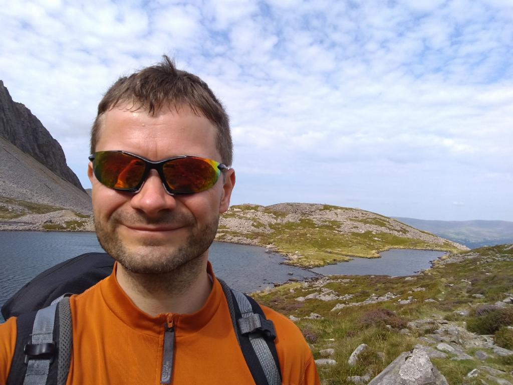
Arriving at Llyn y Gader
Path down to Llyn y Gader
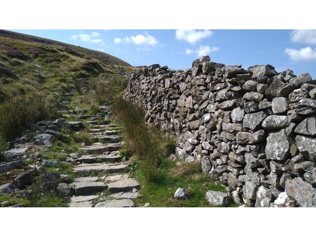
Well-paved Pony path
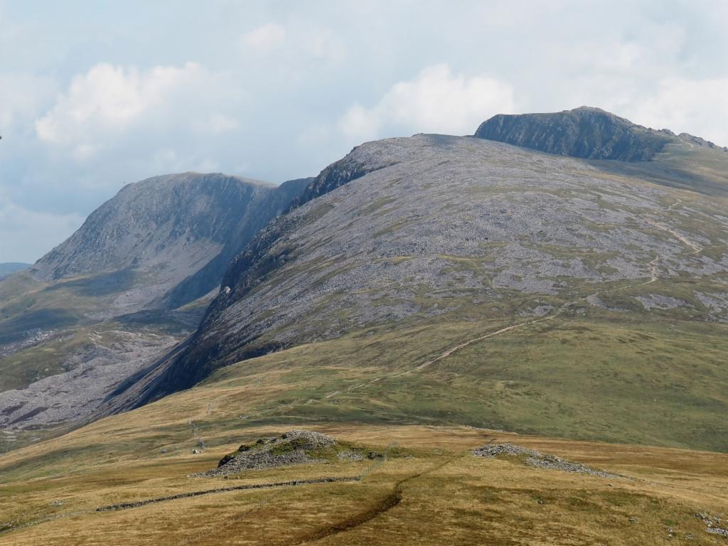
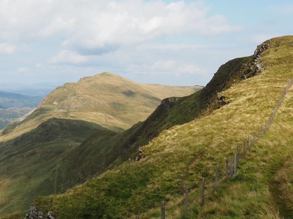
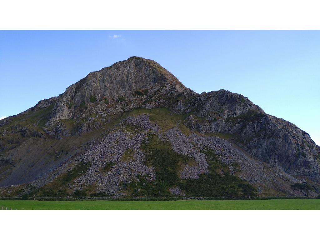
View from Tyrrau Mawr to Cadair Idris
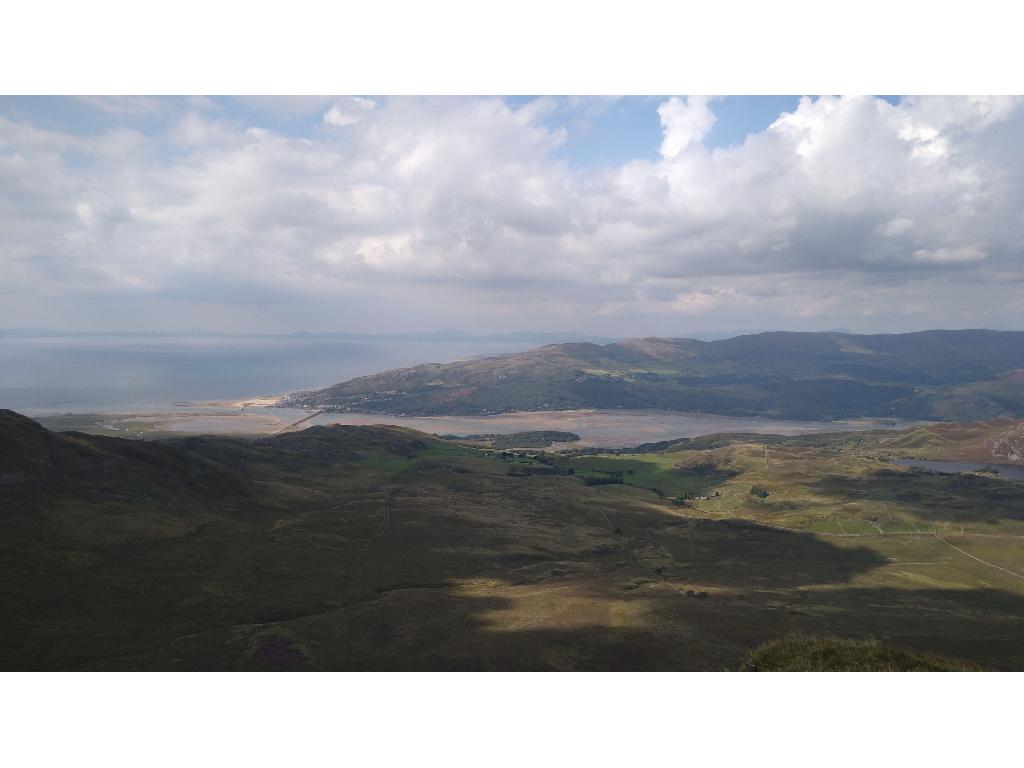
Mawddach estuary from Craig-y-llyn
Tyrrau Mawr from the descent from Craig-y-llyn
Llyn Cyri from Craig-y-llyn
Densely sh...
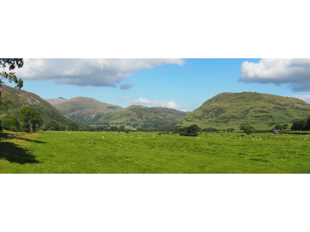
Dysynni valley
Impressive north face of Craig yr Aderyn