

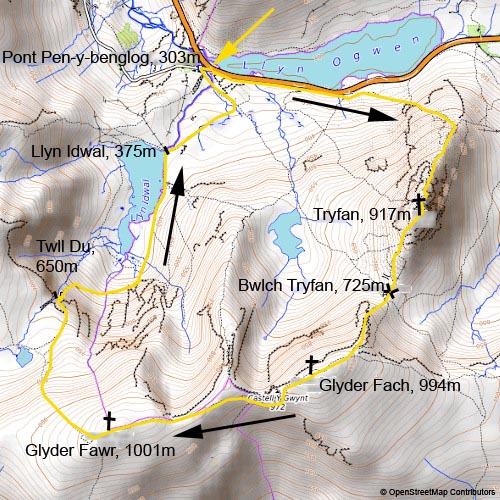
Tryfan and Glyders
15. 4. 2022
Peter Schrammel
Weather
partly cloudy, sunny
Interest 
*****: One of the most epic scrambles in Wales
Route
Pont Pen-y-benglog, 303m - Tryfan, 917m - Bwlch Tryfan, 725m - Glyder Fach, 994m - Glyder Fawr, 1001m - Twll Du, 650m - Llyn Idwal, 375m - Pont Pen-y-benglog
Elevation gain
1131m
Distance
10km
Timing
5h (1 3/4 + 1/4 + 1 + 3/4 + 1/2 + 1/2 + 1/4)
Stamina
E: The endless block fields are very tiring.
Difficulty
II: access to Tryfan north ridge several steps I-, lower part of north ridge many steps I- to I+ depending on variant; upper part of north ridge starting with a 8m chimney lower half II-, upper half can be circumwented on the left I+ (straight up III, very exposed), then several steps I, descent into a gully separating two pinnacles I, then I- to climb out of it and I over the pinnacle (direct climb over the gully III+, very exposed), chimney to first summit II (can be circumwented on the right I), main summit direct ridge I+ (I- on the right); descent continuously 0+ to I-; Bristly ridge first chimney I, one high step can be circumwented on the right (direct III); then exposed, inclined slabs on the right side of the ridge I; some steps I up to a knife edge that goes across the ridge I, over the knife edge II (can be circumwented on the right I); then 10m down in a chimney on the right I- to avoid a pinnacle that is a dead end; after 20m traverse two possible chimneys to reach a gully I+; then step gully several steps I-; summit blocks of Glyder Fach I; descent to Llyn Idwal some high steps I-
Danger
5: Tryfan north ridge mostly 3, chimney before the Cannon 4, traverse before the gully between the pinnacles 4, chimney to the first peak 4, descent to Blwch Tryfan 3; Bristly ridge first chimney 2-3, then traverse 4-5, gully 4; blocks to summit of Glyder Fach falling would cause serious injuries 3; descent to Llyn Idwal 3
Visitor frequency
e: extremely busy all the way
Comments
Many variants on the ridges. It's easy to get into scabrous terrain or miss the most interesting parts.
Report
At 9.07am I took the train from Llandudno to Bangor, from where I continued at 10.25am by bus T10 to Pont Pen-y-benglog (bridge above the steep rock). Bangor was not very interesting, at least around the station. The entry into the Ogwen valley was very impressive, though, with high rock walls seemingly closing off the end. The weather was already a bit sunny. Towards 11am I started walking along Llyn Ogwen. The winds were very chilly, so I had to put on my jacket and hat. The parking lots were overflowing, cars were parked along the road. I could hear the voices of climbers in the rocks of the Milestone Buttress. A few meters away from the road, the path already led through blockfields, a theme repeating for the rest of the circuit. It was not clear where the best path was as one could see a 'path' everywhere. The slope became steeper, and a wooden ladder allowed me to climb over a stone fence. On the following steep winding path, I overtook a couple of touristy hikers put off by the tedious path. Then I met a guy who wanted to continue but was not too sure. We then joined two young women who seemed well prepared. The main path was far from obvious even though the terrain became more and more difficult. There were lots of traces everywhere. The north ridge is rather a very broad, steep slope here. Depending on the path, the climbing difficulty ranged from easy to rather difficult. I put away my poles when it got steeper. Groups of hikers appeared out of nowhere around every corner. I joined them, overtook them and continued. After a short flatter section, the view opened up towards the much rockier section ahead. The obvious ascent starts in an almost vertical chimney. The group in front of me continued to climb the chimney, which was really quite difficult, going beyond grade 3. I looked for another way circumventing part of the chimney on the left, where it was slightly easier. The route continued with quite difficult scrambling. I overtook the group, until I reached weird section: suddenly I was stuck at a traverse into gully between two pinnacles, which seemed too difficult. I looked for easier path and in discussion with the group behind me, we decided to climb down over high steps into the gully. From there it was possible to access a bridge formed by a huge slab via a ramp on the left. Passing over the bridge, further up another bridge led to the top of the pinnacle. Several groups advanced slowly as tedious scrambling up and down brought me to the foot of the first summit. I attempted the direct climb through a chimney, which was quite difficult but very solid and with massive holds. From the summit I had to climb down again a bit to reach the middle summit via a slightly easier ridge. There was an even easier path avoiding the first summit, but extremely busy. About 100 people were crouching between the rocks of the summit slope to protect themselves from the fierce wind. I found a quiet hole to eat my lunch at 1pm. The visibility towards the surrounding mountains was degraded. I continued 20min later, skipping the summit blocks where people where queuing for a photo. I had to put on my gloves now due to the very strong winds. The path down was very tedious. I had to overtake at least 100 hikers. There were dark clouds above Glyder Fach, but no rain was expected. So, I decided to continue. I observed a large group hiking up towards Bristly Ridge through the rubble. I took a trace further to the left which seemed less tedious. It was a good choice. There were several chimneys to reach the ridge. I took one of them that looked easiest. In the middle of that narrow canyon, there was nonetheless a high step that I had to circumvent on the right. The group was resting at the top of the chimney, not sure how to continue. The obvious path led over quite exposed slabs until I reached a blade-like rock crossing ridge. There was an easier path on the right, but climbing over it was doable. Suddenly I encountered a guy who was climbing down the ridge, telling me that he was blocked at the next pinnacle. Believing him, I climbed down 20m to the path on the right. From there I could spot a broad gully right of the ridge that was a clear path to the summit. To get there, there were two chimneys, wet and equally difficult. The following gully was steep but easier. The pinnacle on the ridge looked really unsurmountable, although later I read in a guidebook that the actual way leads directly over the ridge - possibly I had missed the best part. The summit was covered by enormous blockfields of all shapes and sizes. The summit looked close, but I only advanced slowly as any mistake slipping into the holes between the rocks would certainly break my leg. There was one flat, horizontal slab called the cantilever where people took pictures. Finally, I reached the actual summit formed of huge blocks. Reaching the top block consisted of serious climbing. The top block could only be traversed horsy style. At 2.20pm I made my way climbing down on the other side, which was not much easier. The path leads around the next blocky crown summit called Castell y Gwynt (wind castle). It was an easy walk now, but the winds got increasingly stronger. At 3pm I reached Glyder Fawr, with scattered little block crowns over the flat summit. It was sunny, but the stiff breeze, though relatively warm, did not invite me to stay for long. Tryfan in the shadow in the distance looked very awe-inspiring. I decided not to continue over the ridge to Bethesda, but via Hell's kitchen back to Pont Pen-y-benglog to catch the bus at 5pm. I had less than 2 hours to get there. Traces were leading steep down in the rubble towards Llyn y Cwn (dog's lake), which drains through hell's kitchen to Llyn Idwal. The path passing through the rocky north face was paved with slabs like a gigantic staircase. I made a brief detour to exit of hell's kitchen to take pictures. It was already 4.10pm. I needed to further speed up to reach bus. The slabs continued, but less tedious. I overtook many hikers along Llyn Idwal, from where a broader paved path led down to Pont Pen-y-benglog. Masses of lightly shoed tourists were moving around in that area. At the bus stop I learned that the bus was going to leave at 5.21, actually. So, I had some time left to eat an apple and rest next to Llyn Ogwen. In the meanwhile, Tryfan was brightly lit as the sky was turning cloudless. At 6pm I reached my accommodation the Slate in Tal-y-pont, also a good restaurant.
Arrived at Pont Pen-y-benglog by bus
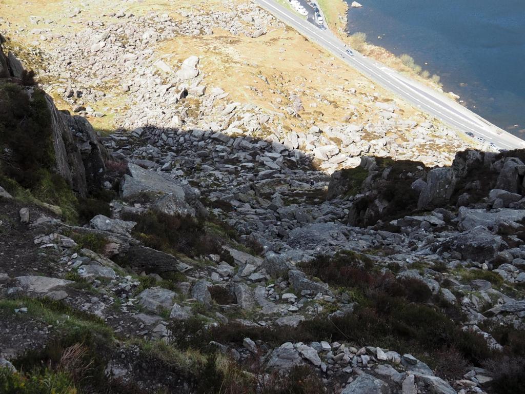
Bumpy path towards the north ridge
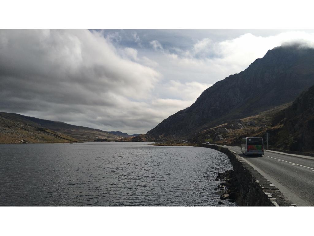
Llyn Ogwen with Pont Pen-y-benglog at the far end
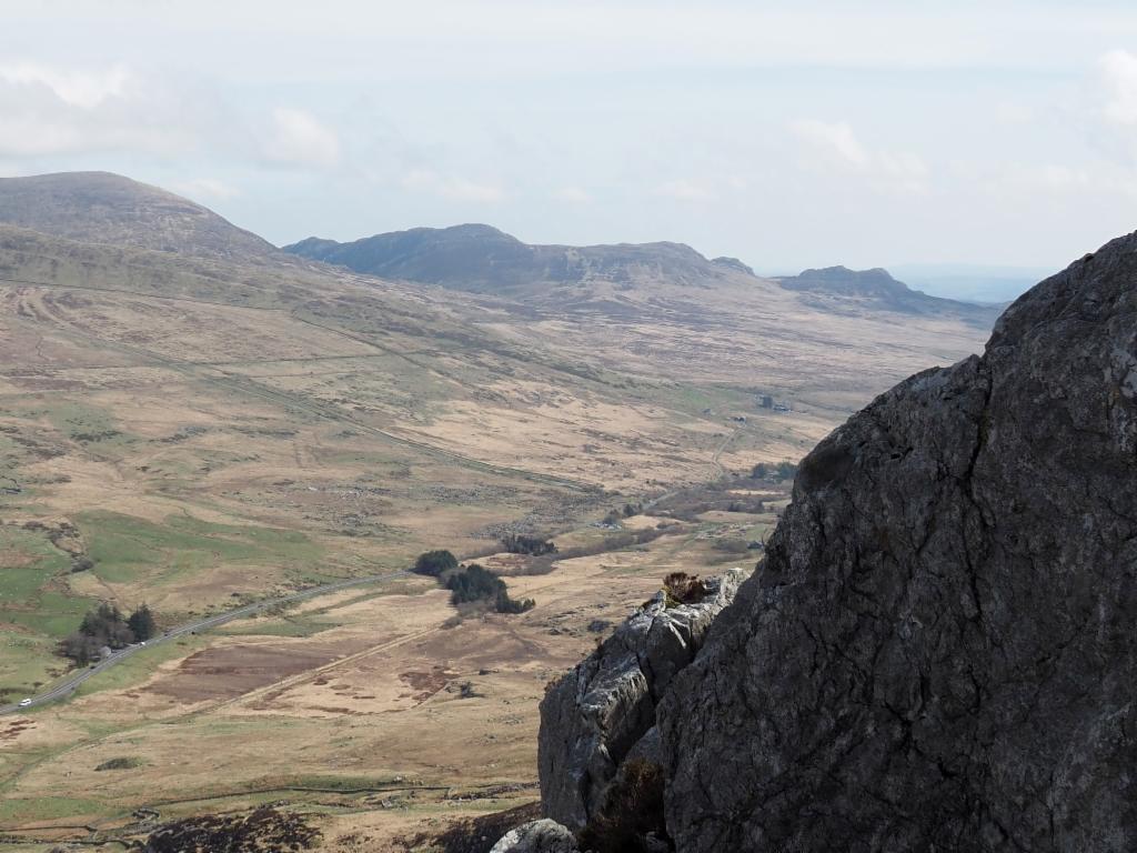
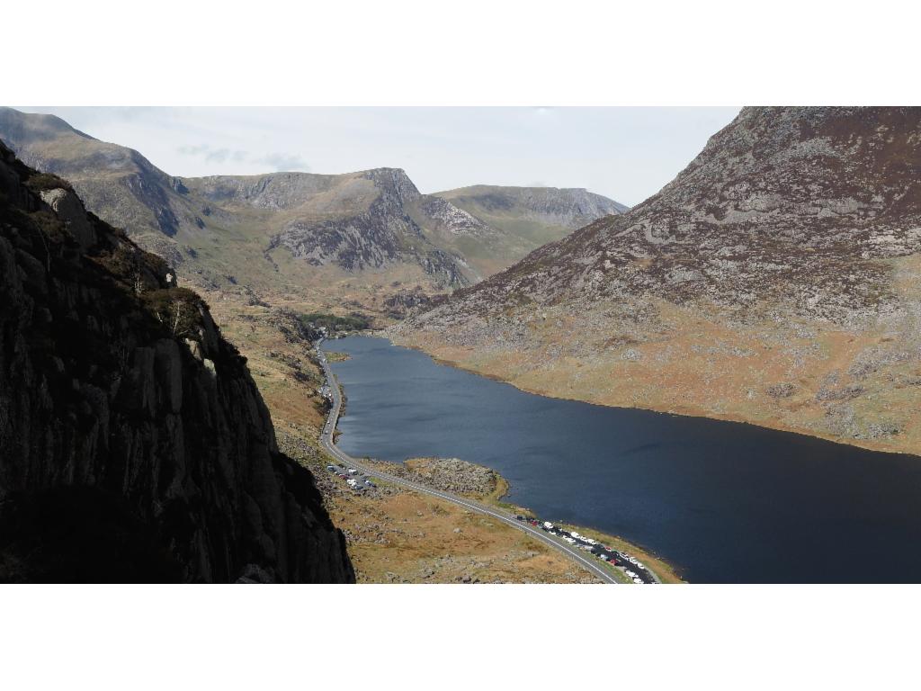
Upper Ogwen Valley towards Capel Curig
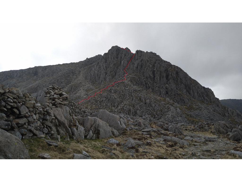
Lower part of Tryfan north ridge
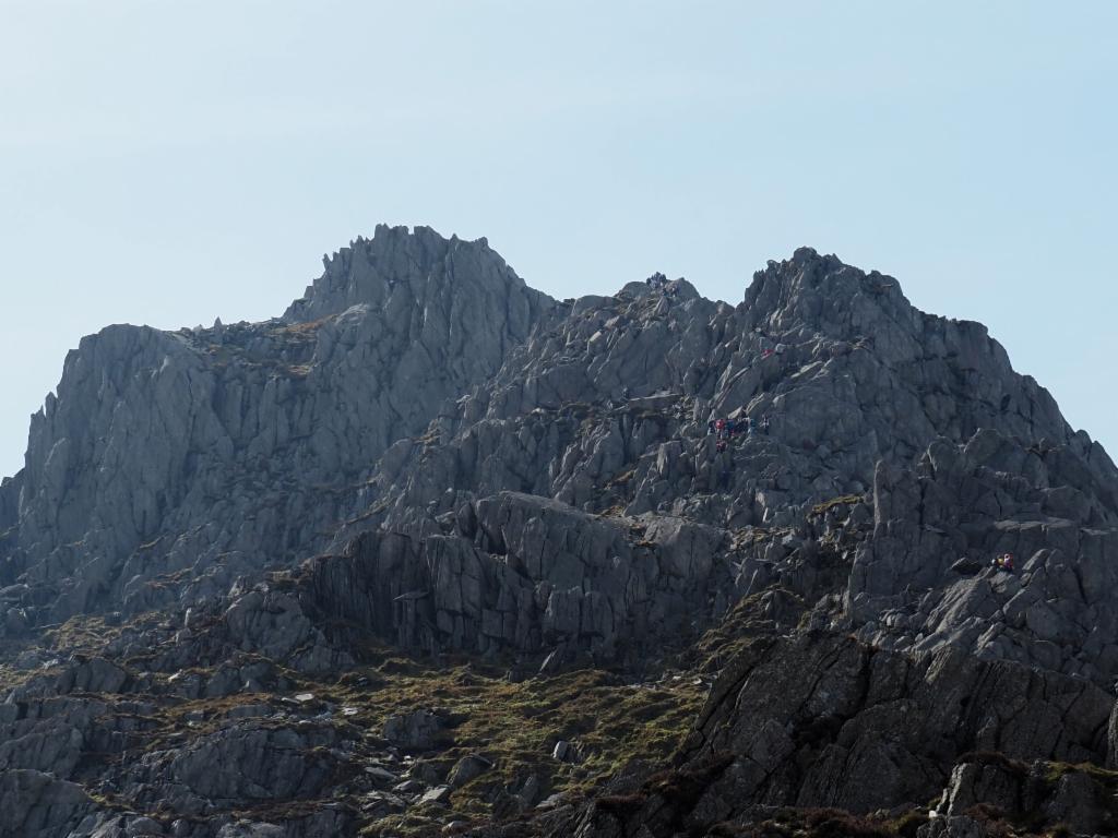
Upper part of Tryfan north ridge: now it's getting more serious...
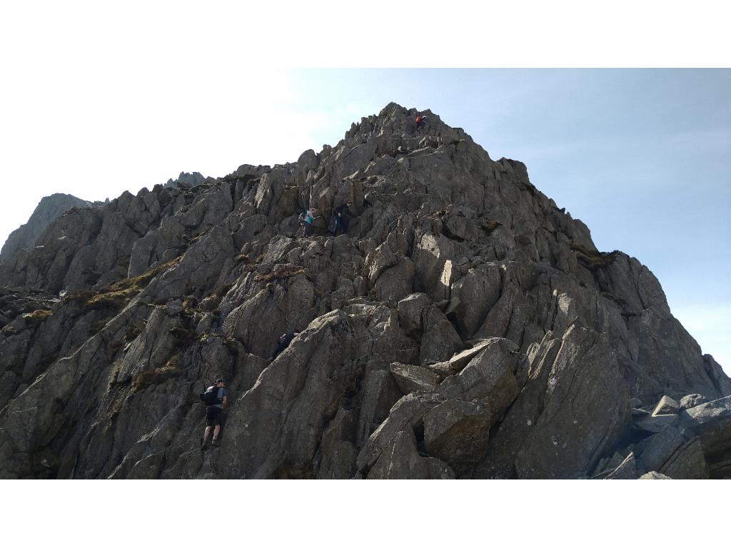
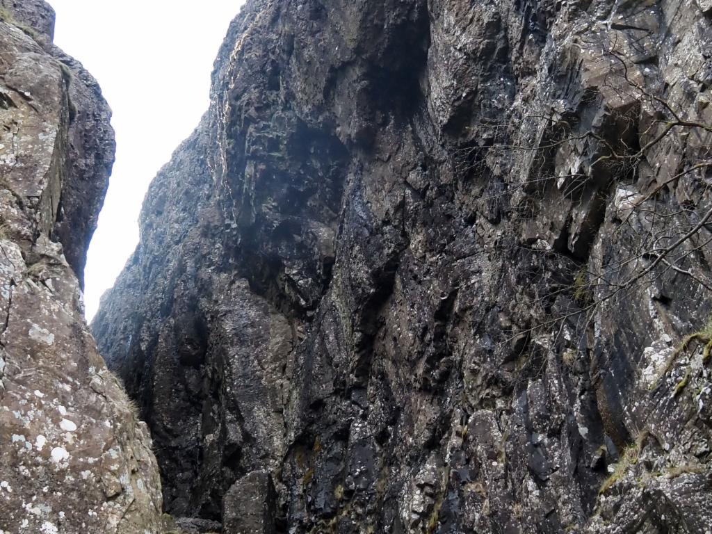
The real scrambling starts...
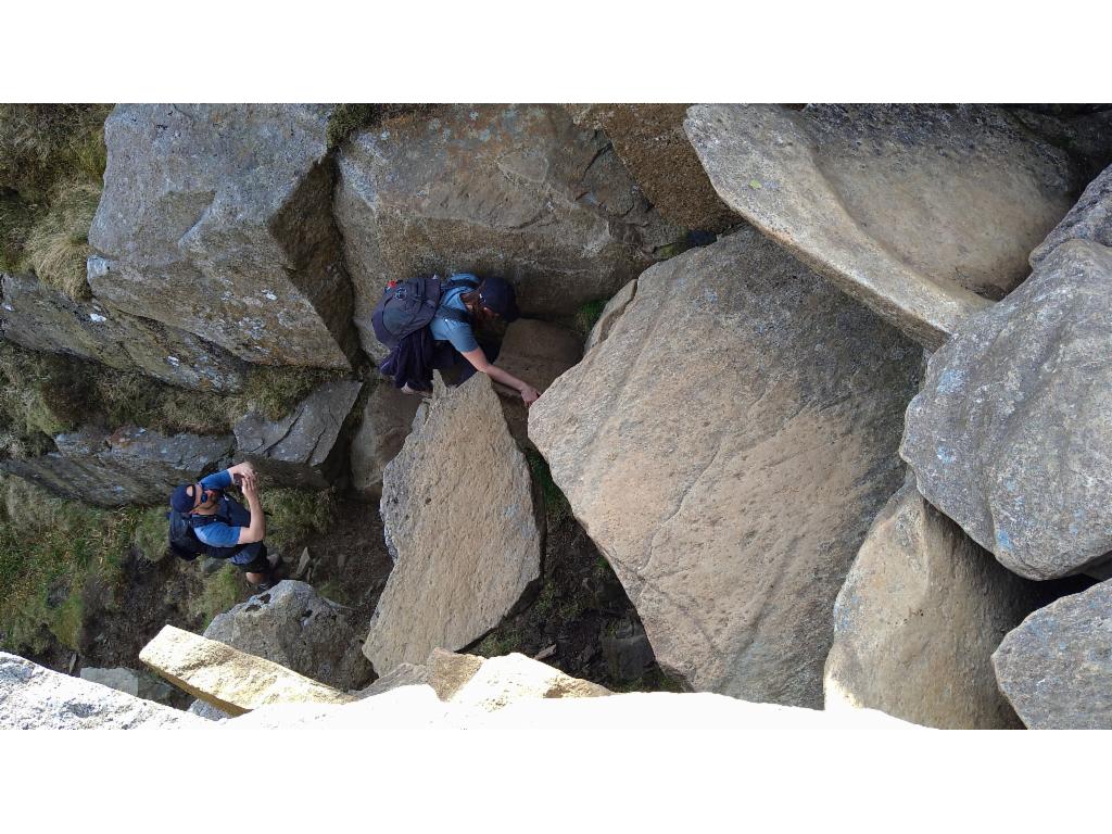
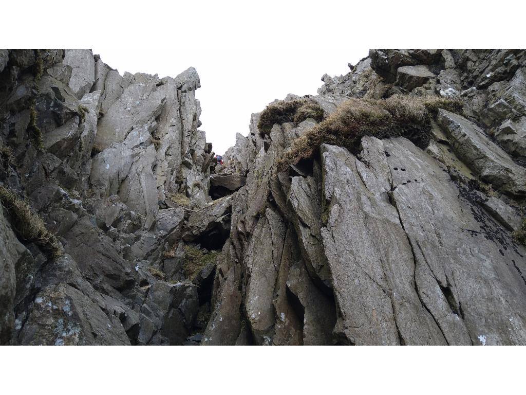
Gully between the pinnacles
The gap between the pinnacles: exit upwards towards the left
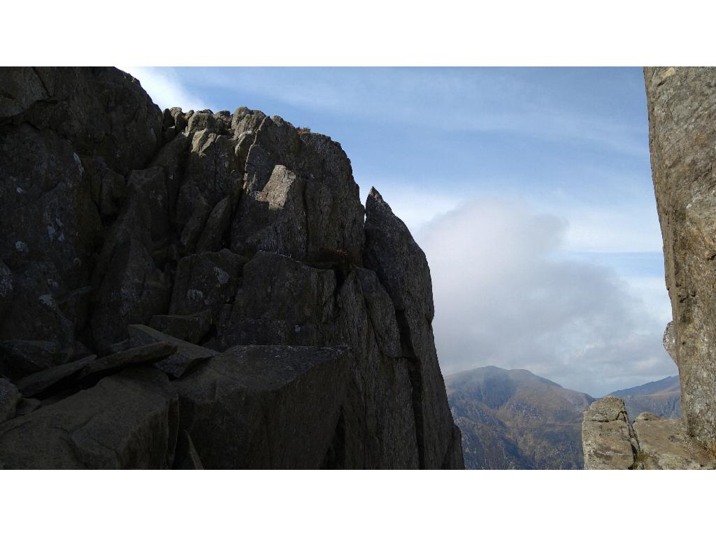
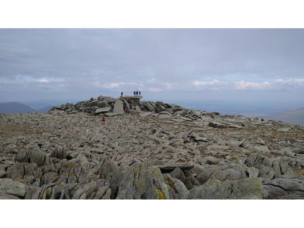
View from the north summit to the main summit
View from the main summit back to the north summit
Chosen path from Bwlch Tryfan to Bristly Ridge
Chimney up to Bristly Ridge
On the Bristly Ridge
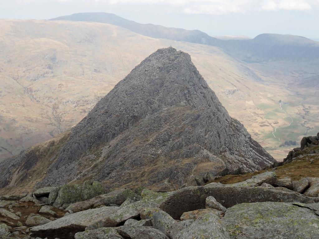
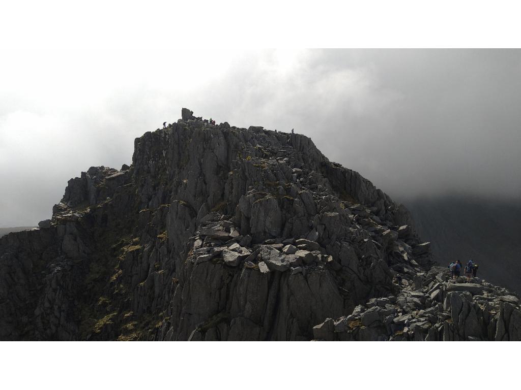
View from Bristly Ridge to Tryfan south ridge
Cantilever
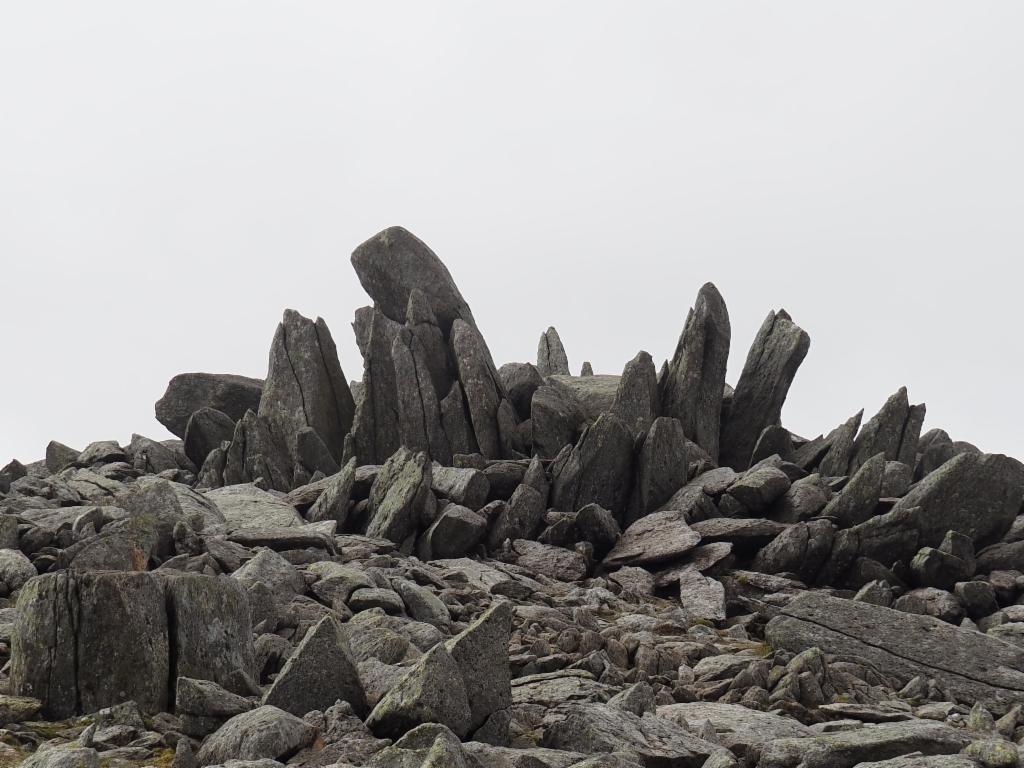
The well-guarded summit of Glyder Fach
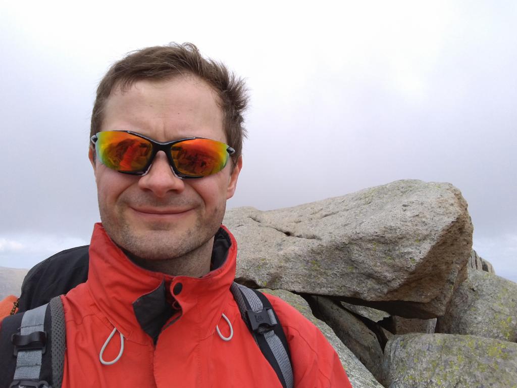
On the summit of Glyder Fach
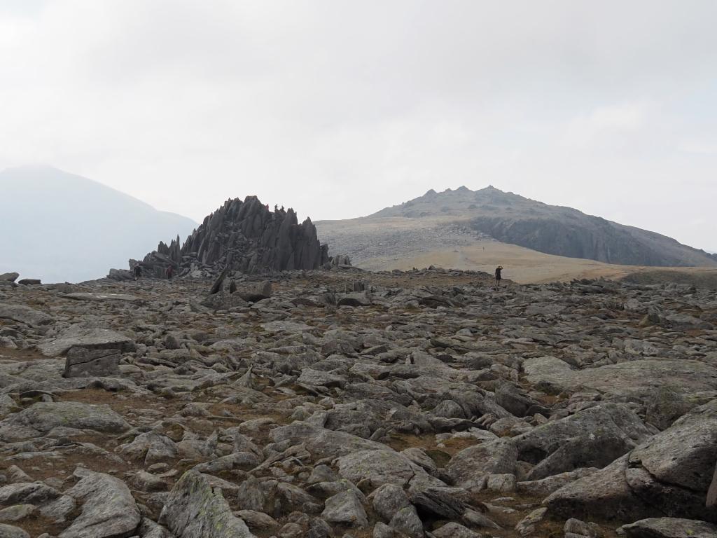
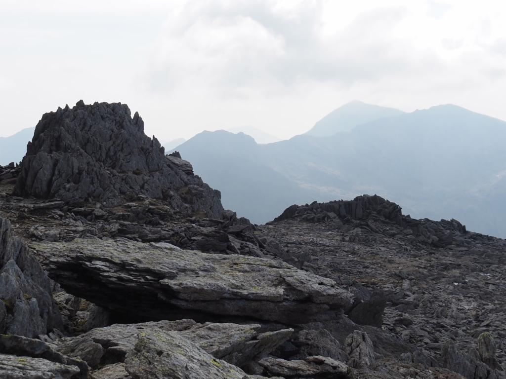
Castell Y Gwynt and Glyder Fawr from Glyder Fach
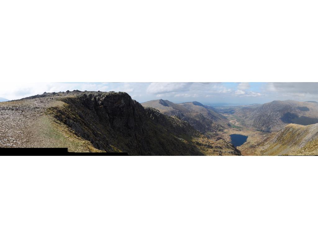
Panorama of Glyder Fawr and the Ogwen Valley
Summit rock of Glyder Fawr and Mount Snowdon in the background
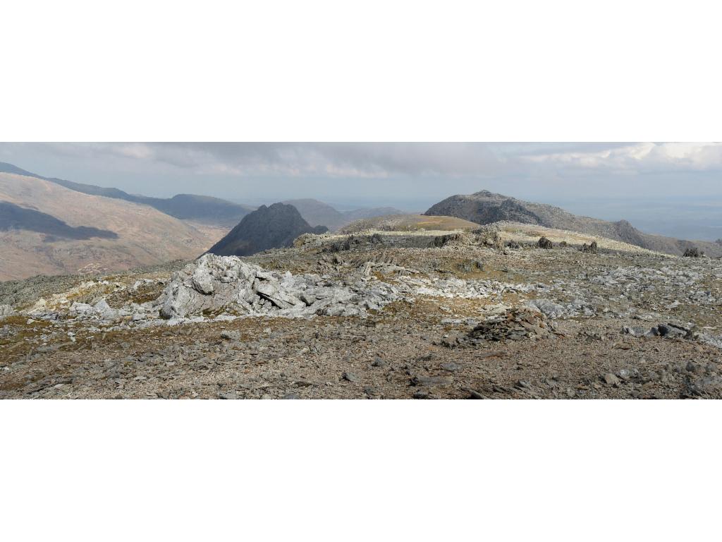
View from Glyder Fawr to Tryfan and Glyder Fach
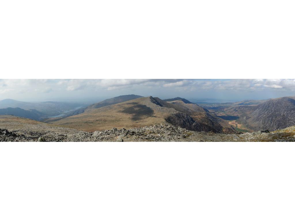
Panorama from Glyder Fawr westwards
Twil Du - Hell's Kitchen
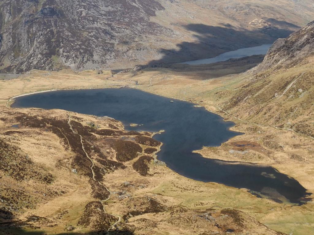
Llyn Idwal from Twil Du
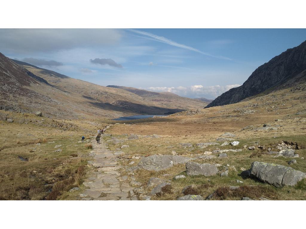
Paved path from Llyn Idwal to Pont Pen-y-benglog
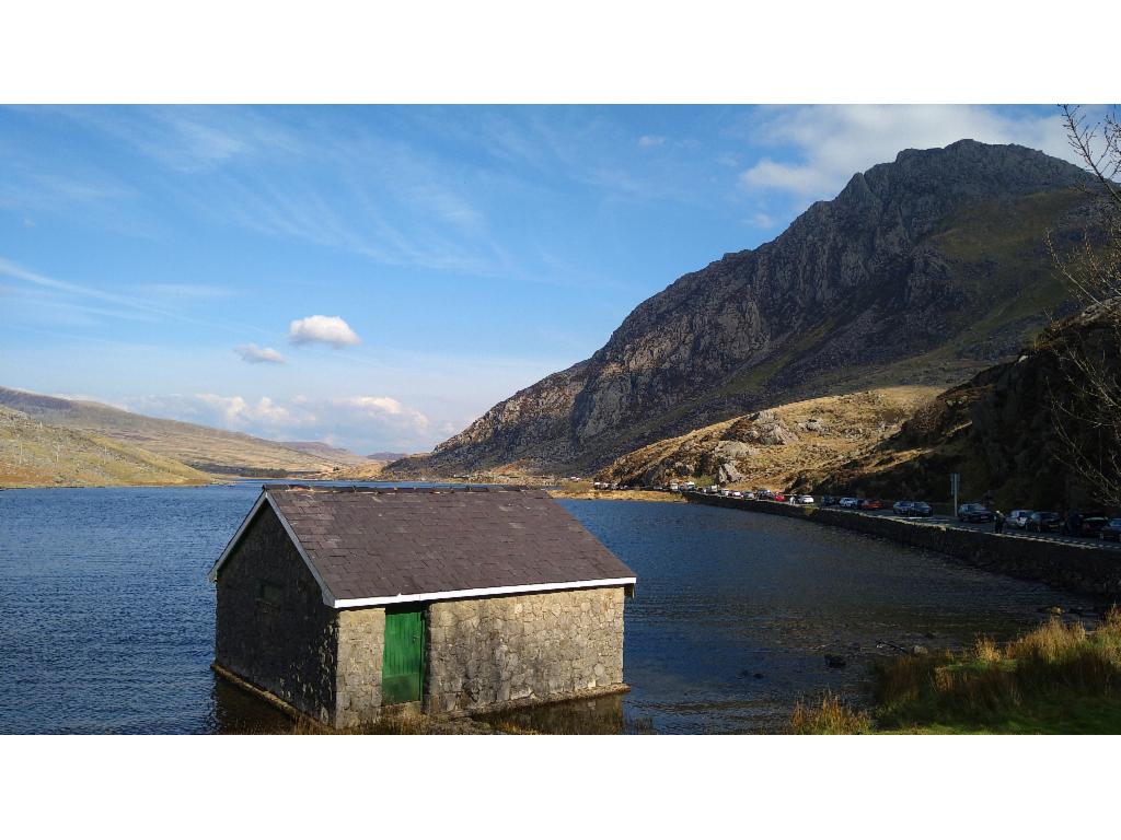
Llyn Ogwen and Tryfan from Pont Pen-y-benglog
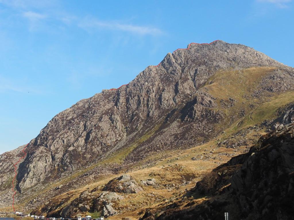
Path over the north ridge of Tryfan
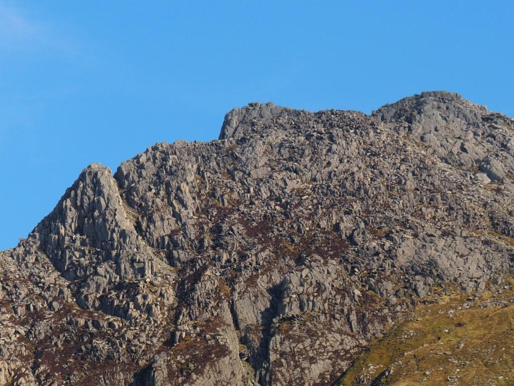
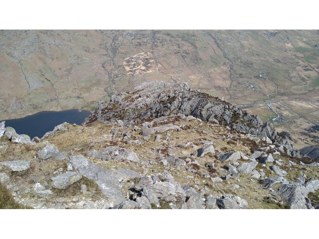
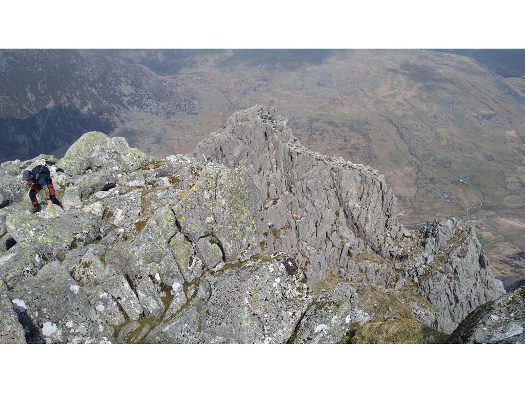
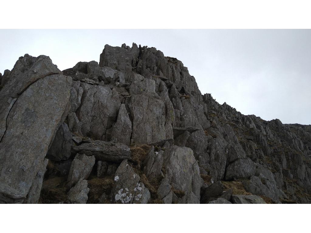
Upper part of the north ridge: gap between pinnacles, north summit, main summit