
Carnedd Llywelyn
16. 4. 2022
Peter Schrammel
Weather
sunny, cloudy in the late afternoon
Interest 
****: Long traversal of a mountain range with vast panoramic views
Route
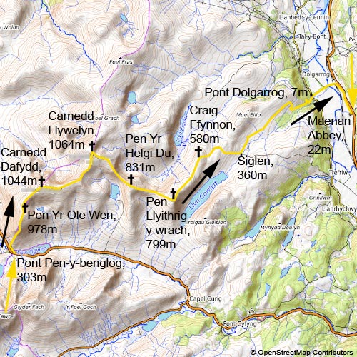
Pont Pen-y-benglog, 303m - Pen Yr Ole Wen, 978m - Carnedd Dafydd, 1044m - Carnedd Llywelyn, 1064m - Pen Yr Helgi Du, 831m - Pen Llyithrig y wrach, 799m - Craig Ffynnon, 580m - Siglen, 360m - Pont Dolgarrog, 7m - Maenan Abbey Hotel, 22m
Elevation gain
+1381/-1662
Distance
24km
Timing
7 1/2h (1 3/4 + 1/2 + 1 + 3/4 + 3/4 + 3/4 + 1/2 + 1 + 1/2)
Stamina
G: The descent is endless.
Difficulty
I+: two steps I and many steps I- up to Pen Yr Ole Wen; 0 to Carnedd Llywelyn; descent to ridge towards Pen Yr Helgi Du several steps I-, one 4m slab I+; ascent to Pen Yr Helgi Du many steps I- to I
Danger
5: at most 3 to Pen Yr Ole Wen, 2 to Carnedd Llywelyn (very steep faces not far way from the path), descent to ridge towards Pen Yr Helgi Du mostly 3, short sections 4, ascent to Pen Yr Helgi Du 3-4, 1 to Pen Llyithrig y wrach (summit!), 1 to Pont Dolgarrog, except last section of the path above the canyon of Afon Ddu with a large waterfall 5 (!)
Visitor frequency
c: four groups, two climbers and a couple of single walkers; only one walker between Pen Llyithrig y wrach and Pont Dolgarrog
Comments
The footbridge over Conwy river at Dolgarrog is closed.
Report
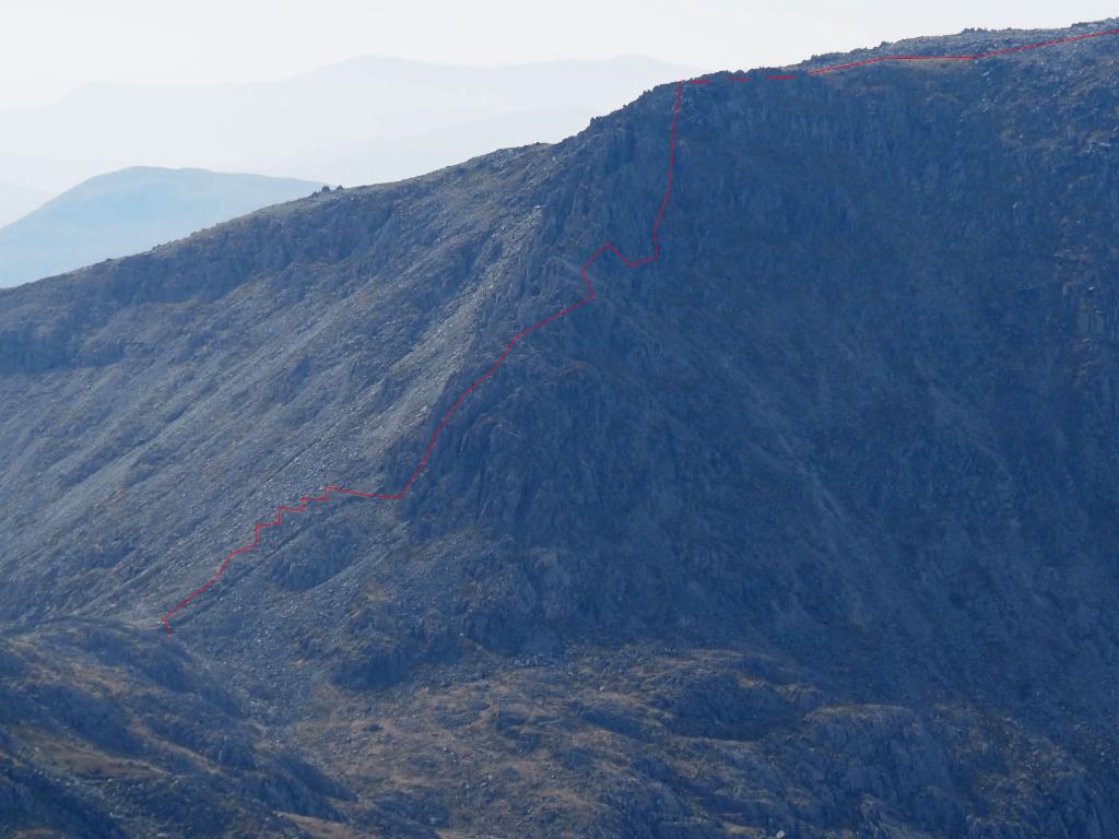
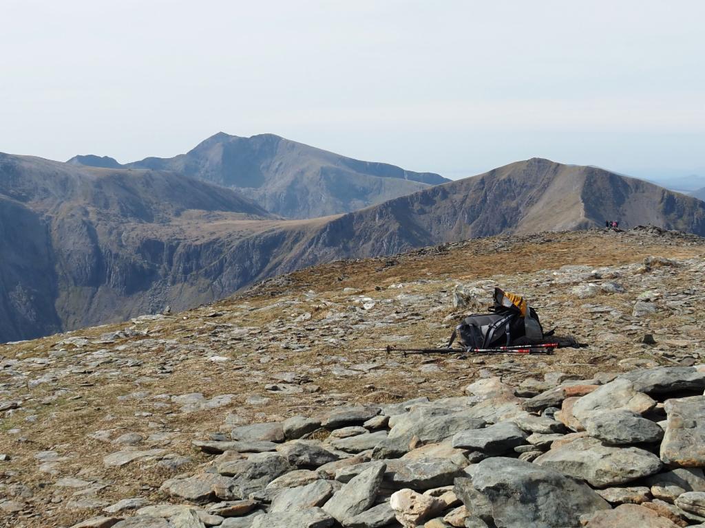
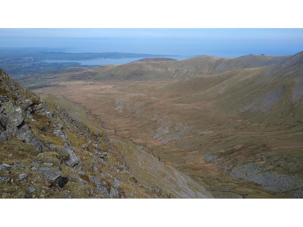
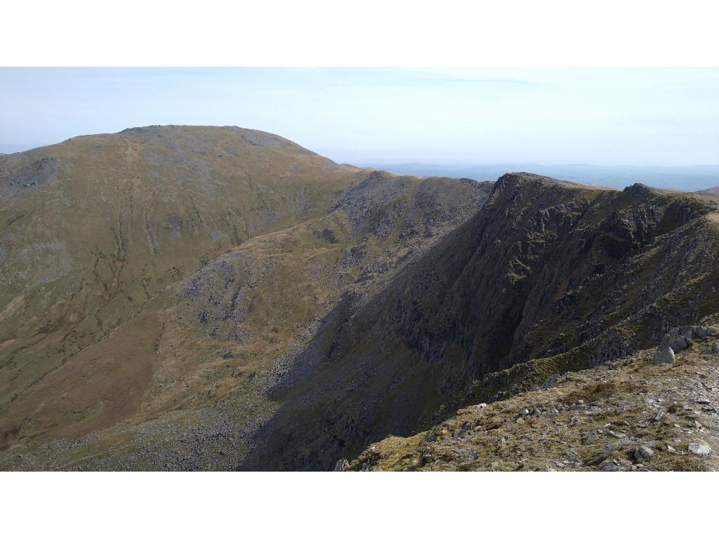
After breakfast, I took bus T10 to Pont Pen-y-benglog. The weather was cloudless, but I was expecting rain towards the evening. At 9am, I was climbing the steep, winding, paved path. There were even paved water drains. The slope was covered in low, black bushes. There was lots of scrambling over high steps as the lakes opposite became slowly visible. Two groups were in front of me, three men and a couple. They took the straight path directly over the rocky section of the ridge, whereas I followed the path going around it. There was also some scrambling there, though. I overtook them on the flatter section towards Pen Yr Ole Wen. There were some wind protections built from stones on the Southern summit. I had a nice view down Ogwen valley and towards Bangor. Mount Snowdon appeared behind Glyder Fawr. From the flat summit of Pen Yr Ole Wen, I looked down down into Ffynnon Lloer, but the lake was only visible when continuing to walk down to the pass. I climbed over a the block castle Carnedd Fach and then quite fast up to Carnedd Dafydd (Dafydd's cairn). There are also several wind protections on the summit, for a good reason as the summit is extremely exposed to any bad weather approaching from the Irish Sea. Several people were having lunch there at 11am. I enjoyed the view down to the large valley of meandering Afon Llafar. The couple that I had overtaken earlier, now also arrived. I continued along the impressive north face to Carnedd Llywelyn (Llywelyn's cairn; or incorrectly spelled Llewelyn on the OS map). A mountainbiker was descending from the summit as well as three trail runners. I reached the summit shortly after 12pm. A group was occupying the only space protected from the wind. Fortunately, the wind was not too cold. A wheatear bird was flying around in some distance. While I had my lunch the couple arrived too. I took some pictures from the view into Afon Eiglau and further to the estuary of river Conwy. As I started the descent via the south-eastern ridge at 1pm, another mountainbiker was crossing the summit. I heard climbers in the rocky north face falling into Eiglau valley, where I could see buildings of former mines. A few steps later, a rope party was resting in the sun. A steep section with scrambling followed, in particular one quite difficult slab. Afterwards, I continued on the path over the broad ridge, while all other hikers walked down to Ffynnon Llugwy. I scrambled up to the broad summit of Pen Yr Helgi Du (black hounds' head). In the distance, I could see two hikers descending from the summit towards the south. I descended a bit to find a place with view down into Eiglau valley. I took a brief break before I walked down the easy grassy slope to the pass and up to Pen Llyithrig y wrach (witty witch's head), the last summit for today. White and black horses were strolling over the vast grassland rolling down towards the south. At 3pm I was stunned by the view down the almost vertical east face of Pen Llyithrig y wrach to Llyn Cowlyd, which is dammed towards the north with a huge pipeline leading down to a power station in the Conwy valley. Some darker clouds were now forming over Carnedd Llywelyn. I still expected 2h of descent. The path leading down was clearly recognizable from the summit. It traversed the broad flat north-east ridge. On this path I encountered the last hiker for the rest of the day. The path was getting swampier towards Craig Ffynnon (crag of the well). After a fence with a ladder, there were only traces. I continued along the fence to tackle the steeper section down to a pass. From there I decided to use the ladder towards the west to reach the path indicated on the map that traverses to a further pass further north instead of fighting my way down to the lake directly. Again, it was very swampy, and the path was not as good as expected, but I made good progress. After the pass, there was a good path down to the pipeline. I had to walk around lots of sheep with lambs. I tried to follow the footpath along the river, but soon gave up as it ended in a swamp again. So, I hiked back up to the dirt road and followed that one. In front of a gate, I encountered two sheep who could not escape. I stepped aside so that they could get past myself, but instead they got nervous and jumped over the brook. On the map there was a path down to a house which had to pass over a clearly visible footbridge over a canal carrying water from the river to a reservoir in another valley. The gates of the bridge were locked, though, but I could easily climb over them. Then I reached another dirt road again. The bad weather was now approaching at speed and was expecting rain soon. The road got steeper and steeper down to a Wales Water building. A bit later there was a signpost for a foot path. The path was hardly visible, though, and led down dangerously close to a cliff of a canyon with an impressive waterfall. Further down, I reached the road again. I didn't dare further experiments now even though there were further signposts without visible paths. At Pont Dolgarogg, there was sunshine. The bad weather had not arrived yet. Towards 5.30pm, I took the footpath towards the footbridge over river Conwy. A man playing with two dogs asked me where I was going. He told me that the bridge was closed, but everyone just climbs over the fence. Having arrived at the bridge, climbing over the fence did not look easy until I spotted a metal fence leaning against the wall. The wooden panels of bridge felt a bit scary, which may be the reason for closing it. The barricade on the other side had been completely broken. I crossed railway and walked along the dangerous A road to Maenan Abbey hotel. I arrived at 6pm and cleaned my dirty trousers so that I could go for dinner.
The Slate pub at Tal-y-bont
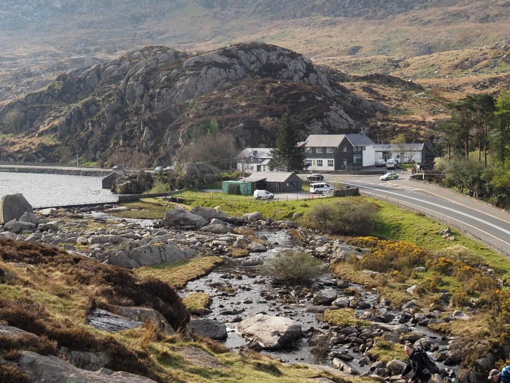
Pont Pen y Benglog
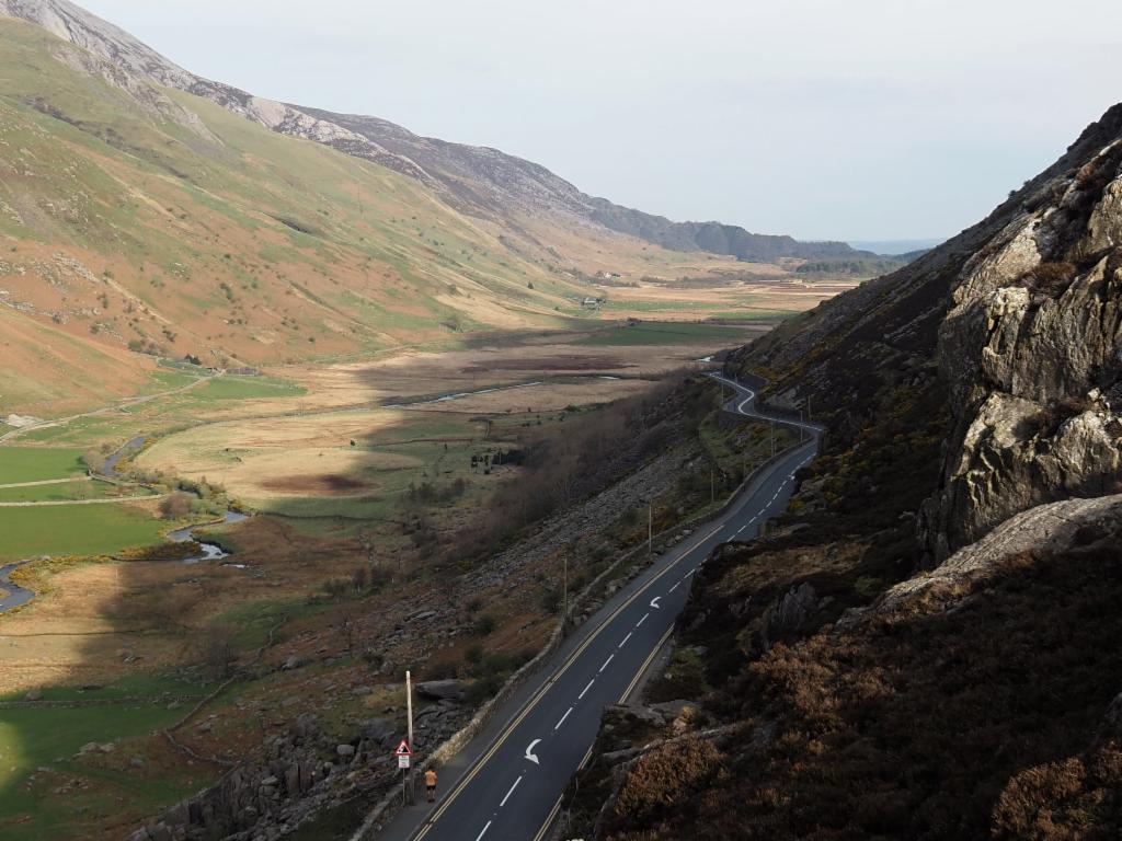
Ogwen valley
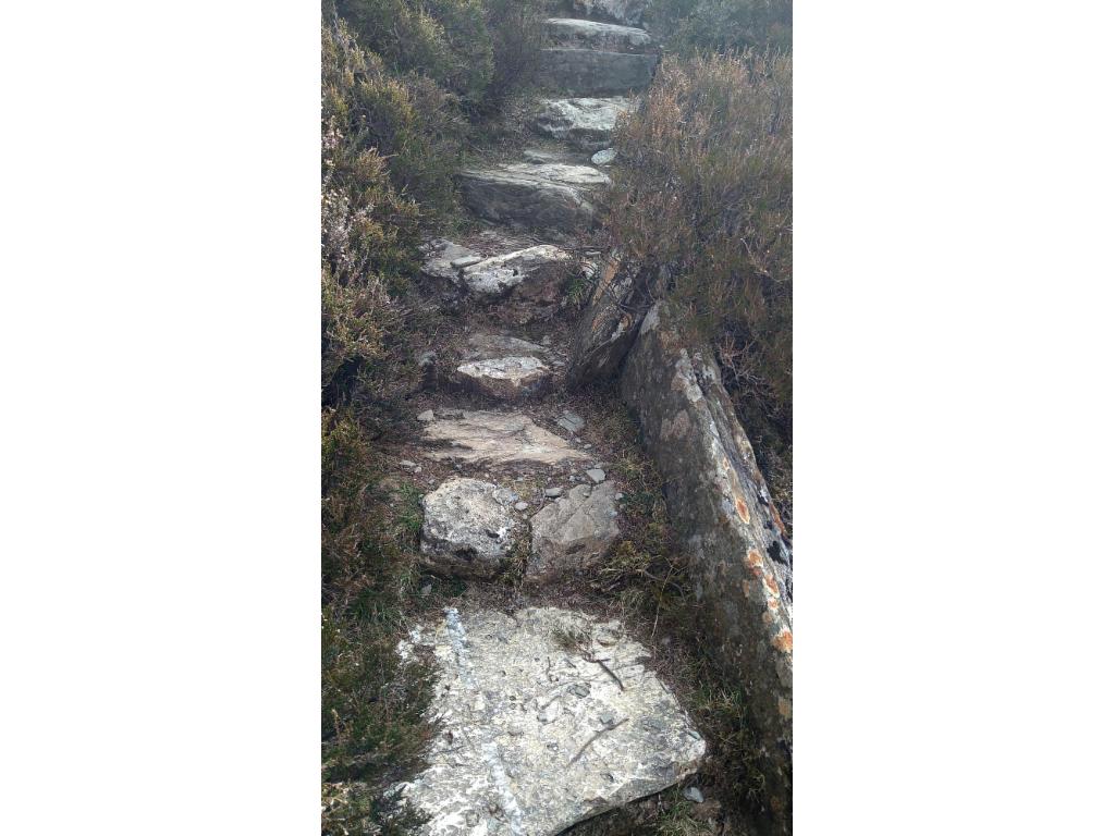
Paved path to Pen Yr Ole Wen
Ogwen valley from Pen Yr Ole Wen
Path along the north ridge to Tryfan
Yesterday's path along Bristly Ridge
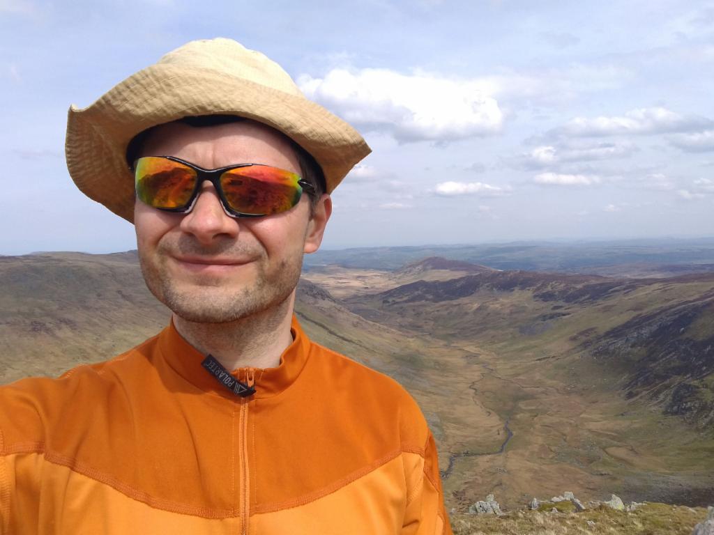
On the summit of Carnedd Dafydd with Mount Snowdon in the background
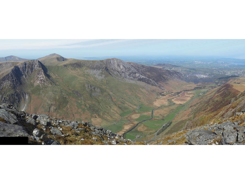
Llafar valley from Carnedd Dafydd
Carnedd Llywelyn from Carnedd Dafydd
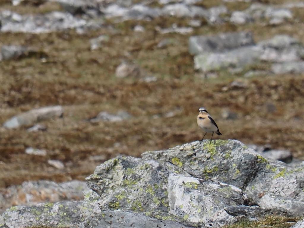
Wheatear
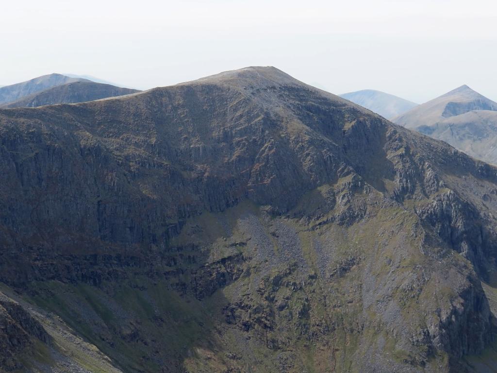
North face of Carnedd Dafydd from Carnedd Llywelyn
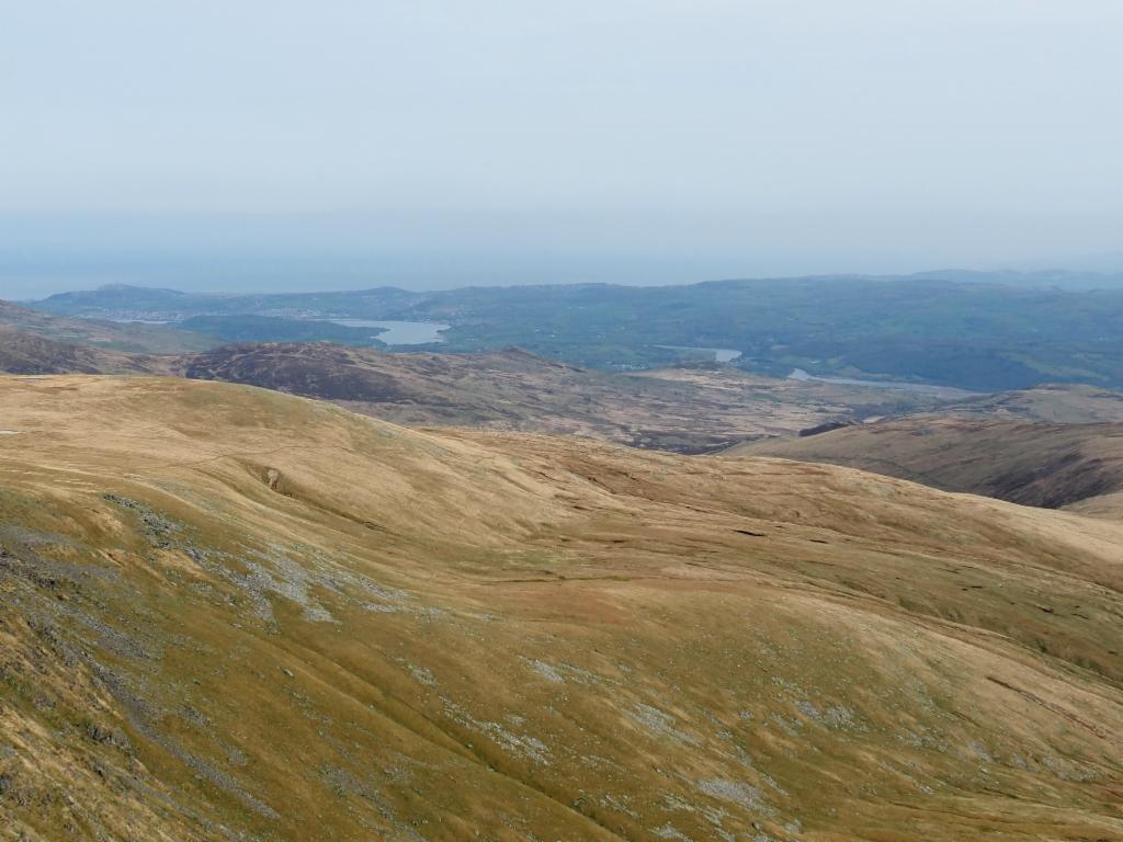
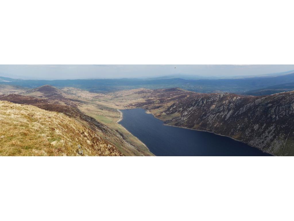
View from Carnedd Llywelyn to Conwy river
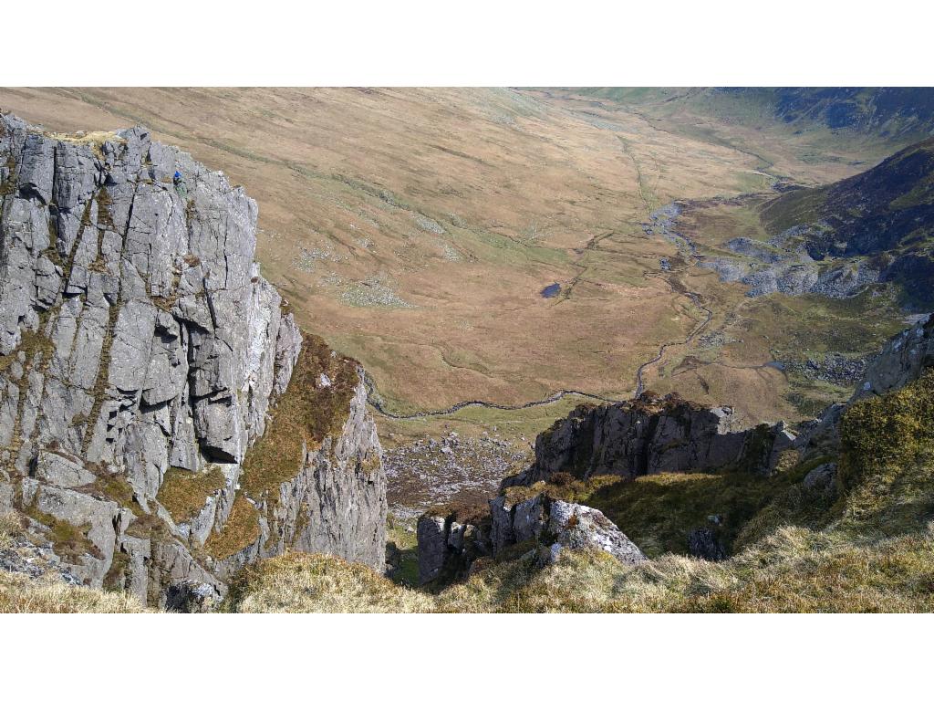
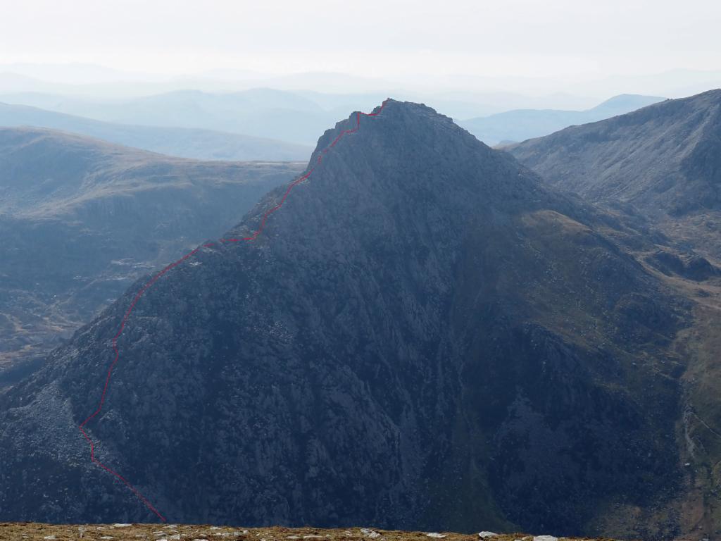
Climbers in the walls above Eigiau valley
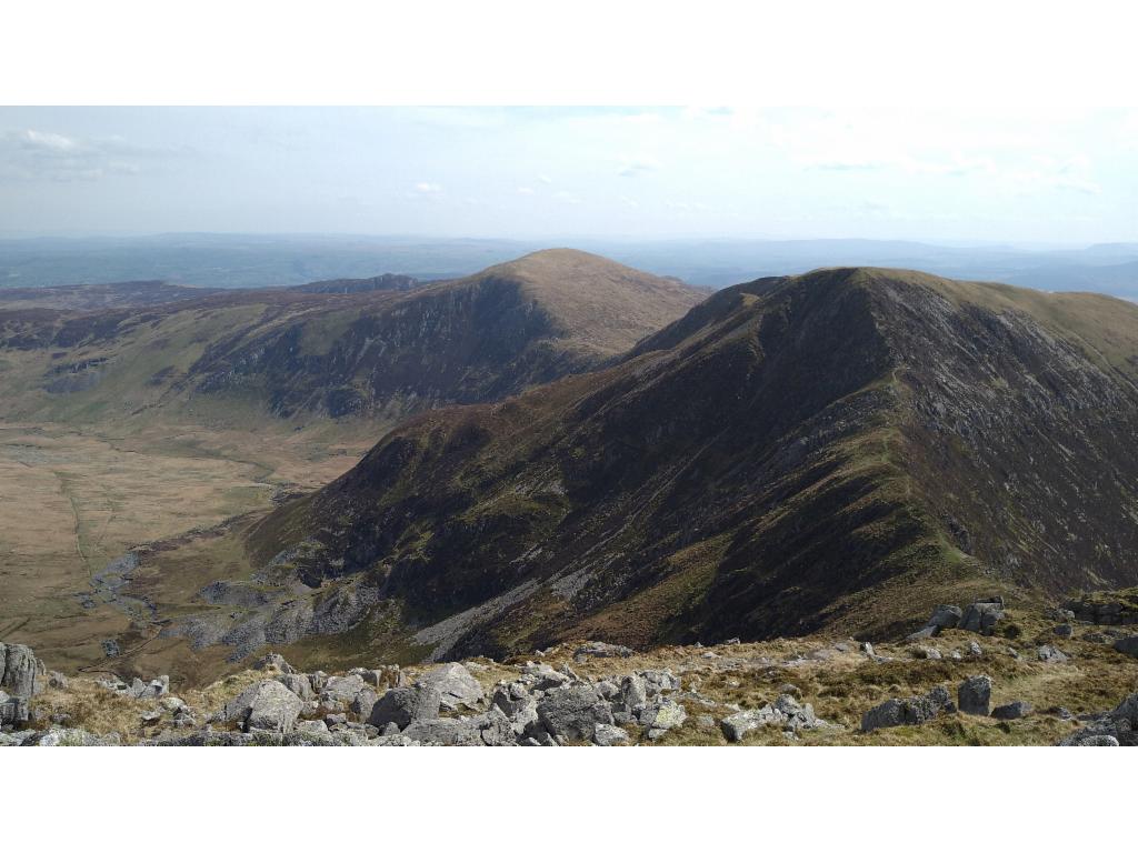
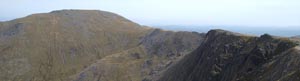
Ridge to Pen Yr Helgi Du
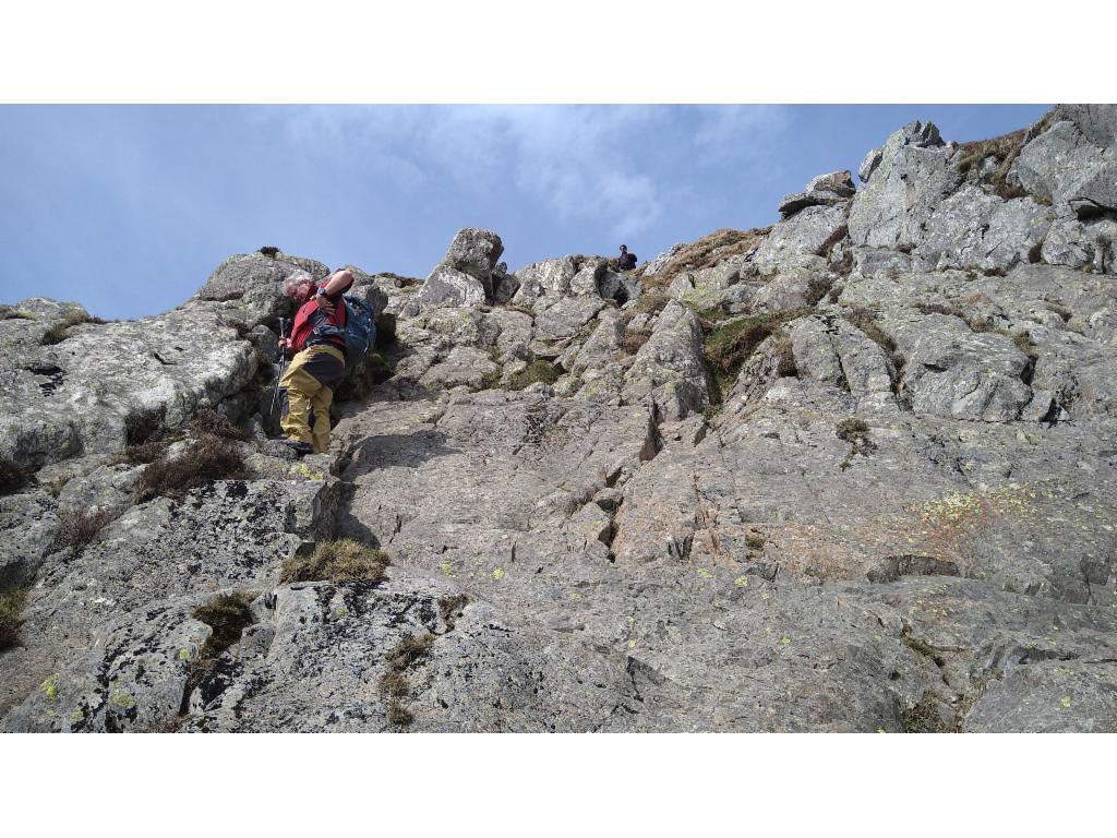
Climbing down to the ridge to Pen Yr Helgi Du
On the summit of Pen Yr Helgi Du
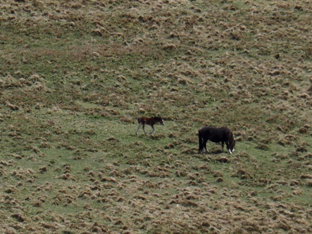
Black horses
View over Llyn Cowlyd from Pen Llythrig y Wrach
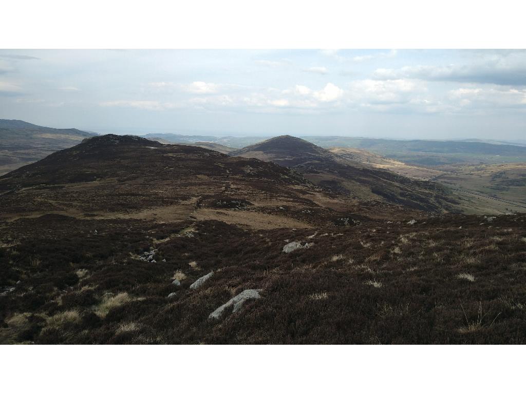
From Pen Llythrig y Wrach towards Craig Ffynnon
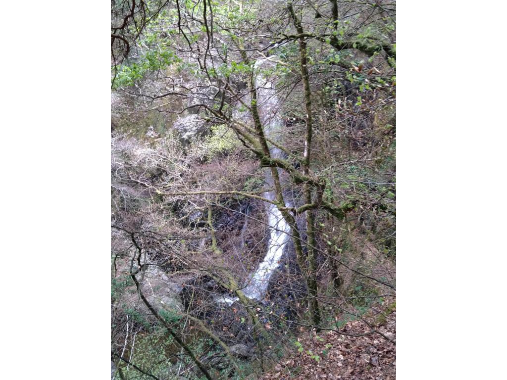
Waterfall Afon Ddu