
Mount Snowdon
12. 6. 2021
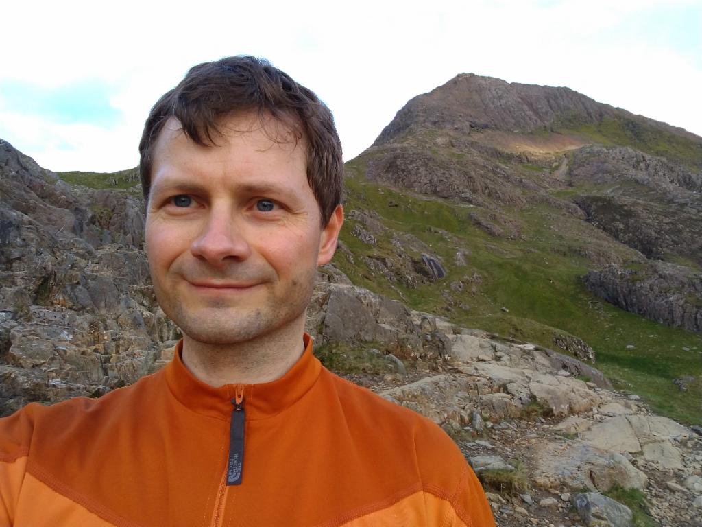
Peter Schrammel
Weather
overcast in the morning, then sunny
Interest 
*****: One of the most alpine peaks on the island of Great Britain
Route
Hafod y Gwynt, 230m - Pen-y-pass, 359m - Bwich y Moch, 569m - Crib Goch, 923m - Crib y Ddysgi, 1065m - Yr Wyddfa / Snowdon, 1085m - Bwich Ciliau, 744m - Y Lliwedd, 898m - Llyn Llydaw, 440m - Pen-y-pass - Hafod y Gwynt
Elevation gain
1328m
Distance
17km
Timing
6 1/2h (1/2 + 1/2 + 3/4 + 1 1/4 + 1/3 + 2/3 + 1/2 + 1 + 1/2 + 1/2)
Stamina
F
Difficulty
III-: from Bwich y Moch to Crib Goch: several steps 0+, then several steps I- in the approach to the crux, a close to vertical wall 5-6m high, several variants III-, then several shallow chimney-like structures, several variants II-, finally along the rugged ridge to the east summit I-, to the west summit: sustained knife edge with solid rock I+, ups and downs over the ridge, sometimes avoiding the pinnacles via the gullies on the south side, often I; 10m scrambling over several steps to reach the upper part of the ridge to Crib y Ddysgi I, then avoiding the narrow edge on the north side I-; descent to Bwich Ciliau: several steps 0+; ascent to Y Lliwedd: several steps I-; descent over Lliwedd Bach: 3 steps 0+; steep section down to Llyn Llydaw: I-
Danger
7: to Bwich y Moch 2, to Crib Goch 5, crux 5-6, knife edge between Crib Goch summits 6-7, further ridge to Bwich Coch often 6, ridge to Crib y Ddysgi 3, sometimes 5, Snowdon 0 (beware of northeast face), descent to Bwich Ciliau 5, traverse of Y Lliwedd summits 3 (beware of north face), descente to Llyn Llydaw 3-4
Visitor frequency
d: quite busy on the ridges, completely overrun on the main routes
Report
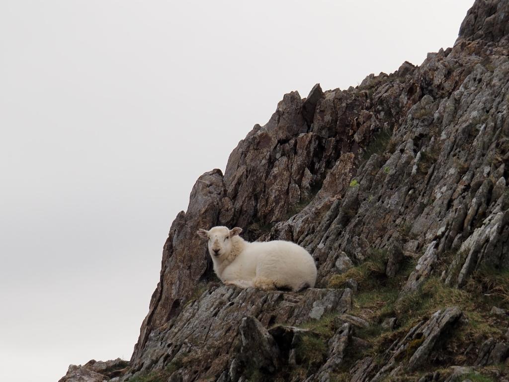
A glorious Sunday was announced. So, I wanted to go on Mount Snowdon. Unfortunately all campsites and other accommodation in the area were fully booked. Thus, I decided to drive there early Sunday and back in the afternoon. I picked up the rental car Saturday afternoon and left Sunday at 0.30am so that I would arrive there at 4.30am when the sun was going to rise. The journey was quite comfortable because the roads were mostly empty. Before getting to Betws-y-Coed it was already dawning. However, the weather was not as good as announced. It was overcast with clouds just above 1000m. When I arrived at Pen-y-Pass the parking was full - I feared that, but didn't quite expect it. So, I drove back down to the S498. The paying parking spaces along the road were also taken. Hence, I drove further down were I found a space in a bay where parking was allowed. It was towards 5am. Since I was on the other side of the valley now, I had to find a way to cross over. It didn't seem to make sense to cross the valley directly via the pasturage. So, I walked back along the road and took the nice footpath below the A4086 with little ups and downs to Pen-y-Pass. It was quite busy there. Hikers were arriving, others were leaving. I took the Pyg track. There's a nice view down the valley to Llanberis and the two lakes. Several hikers were coming down and at least 30 hikers were in front of me on the short stretch that I could oversee - and that at 5am! I wore my light Lowa Innox hiking shoes the second time. I didn't feel quite confident on the smooth rocky surfaces and also for the narrower ledges they were not quite stable enough. I should have taken my heavy boots for this mountain. After an hour I reached Bwich y Moch from where I caught my first view over the large east combe of Snowdon with its three dark blue lakes. The double summit of Y Lliwedd glowed in the morning sun opposite - I would traverse it on the way back down. For the ascent I had decided to take the route via Crib Goch, which was describe as very exposed and challenging, but doable without climbing gear. I took the path towards the rocky east ridge. The scrambling starts slowly. There are many traces. One had to hope that they all continue. Suddenly, I was seemingly blocked in front of a vertical wall without an obvious passage. Maybe I had taken a cul-de-sac. I backtracked and looked for alternatives. There was a possible passage towards the north, but it was quite wet and crumbly. I saw that there was three other hikers just behind me. So, I returned to the original path and waited to ask them whether they know how it continued from here. They said that they had done it several times before and any path is possible. They would usually take the direct one in the middle, which was the one where I turned around the first time. So, I climbed up and engaged into the wall. The holds were good and after 5 or 6 meters it got slightly easier again. The rock continued to be excellent and after a few more steep sections I could see the entirety of the ridge to the summit. The scrambling was easier now. I briefly stopped on the east summit before engaging into the knife edge that connects to the west summit. That one is quite serious: 200m vertical towards the north and 60-70° to the south. In the beginning there's a comfortable 15cm ledge 1m below the edge on the north side and good holds on top of the edge. I moved slowly forward and switched to the south side at the end of the ledge. On all fours I continued on the top of the rugged edge. Sometimes the holds are flat enough to stand up and walk. In one place I had to let a guy pass who was on the way down. Full concentration is required and the ridge is quite long. After the north summit there are several pinnacles. It might be possible to climb over them. However, I followed some traces that lead down into the gullies on the south side and back up again. Finally, I had to climb some steep steps down to a pass. I was quite surprised to see several mother sheep with their lambs high up in the rocks here. The northeast face of Snowdon is quite impressive. From here it is not quite clear how the path from Mount Snowdon to Y Lliwedd would go. The ridge is now grassy. After a small hill there is a steep rocky section again. The path is obvious. The scrambling is engaged, but not exposed. The rocky ridge continues now. It is less exposed on the north side. Finally, it goes a bit up and down with easier scrambling to Crib y Ddysgi, also called Garnedd Ugain, which is only slightly lower than the summit. Masses of walkers were on the way to the summit. The view to the sea was quite attractive on the way to the summit. A mountainbiker was fighting his way up along on the railway track. Two motocross riders filmed there ascent with a drone. I arrived on the summit at 8.30am. There were still clouds moving around in the summit, occluding the view to Y Lliwedd and down into the east combe. The small circular platform on the platform was very busy. The west side was a bit windy, so I looked for a sheltered spot on the east side to have lunch. Suddenly the clouds disappeared and the view down to Llyn Llydaw became clear. Also the sea at Porthmadog was visible. Towards the west the entirety of the isle of Anglesey was visible. In particular, the hills and small lakes around Llyn Cwellyn were very beautiful. The train line was closed. Unimaginable how many people would be up here when that one was running too. I looked for a quiet place off the summit to take a nap and I really fell asleep for half an hour in the sun. At 10am I left and took the path down to Bwich Ciliau, which traverses the southeast face, not the very steep east ridge as I initially thought. The sun was heating up that southeast face mercilessly as all these hikers had to suffer that were on their way to the summit at that time. The path is partially paved to fight erosion. Some parts are seriously exposed and some high steps require scrambling. I passed two tents on Bwich Ciliau before starting the hot climb to Y Lliwedd. There are again many traces so that it is not always clear which one is the best. Half an hour later I was on the west summit. The views down to the dark blue lake of Llyn Llydaw are impressive. A guy was climbing up directly from the ruins of a miners' village along the Watkin path to the summit. I ate my second lunch while enjoying the view to the southwest and the green meadows of Nantgwynant. After the close east summit the path follows the sharp edge. There are spectacular views into the vertical north face of Y Lliwedd and the lakes in the combe. After two smaller halls the path falls down the steep face towards Llyn Llydaw, a bit of scrambling included. Opposite of another miners' village I took another nap in the grass. The screaming kids that were apparently bathing on the other side of the lake did not prevent me from sleeping another 30min. It was 12.30pm when I took the Miner's Trail to Pen-y-Pass. At 1.30pm I arrived at the car. I started the last bottle of the 5 litres that I had brought along. At 2pm I returned along the same way to Oxford. The roads were quite busy. In particular in Betwys-y-Coed there was quite a traffic jam due to the massive influx of tourists. At 6.30pm I arrived in Oxford.
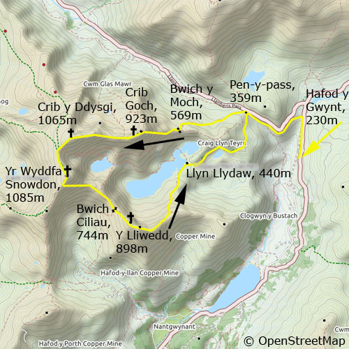
Pen-y-pass
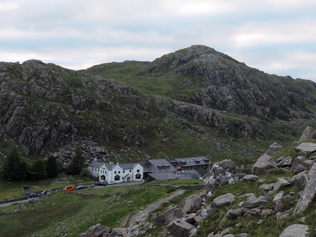
Llyn Peris and Llyn Padarn
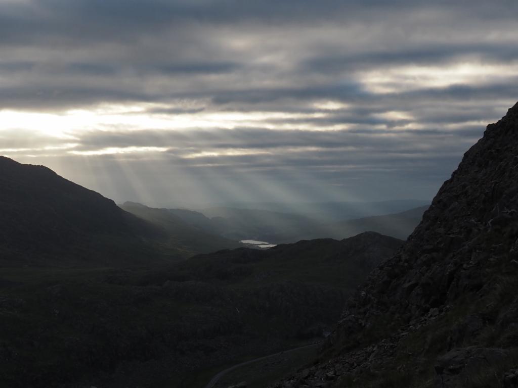
Llynau Mymbyr in the morning light breaking throught the clouds
Approach to Bwich y Moch and Crib Goch
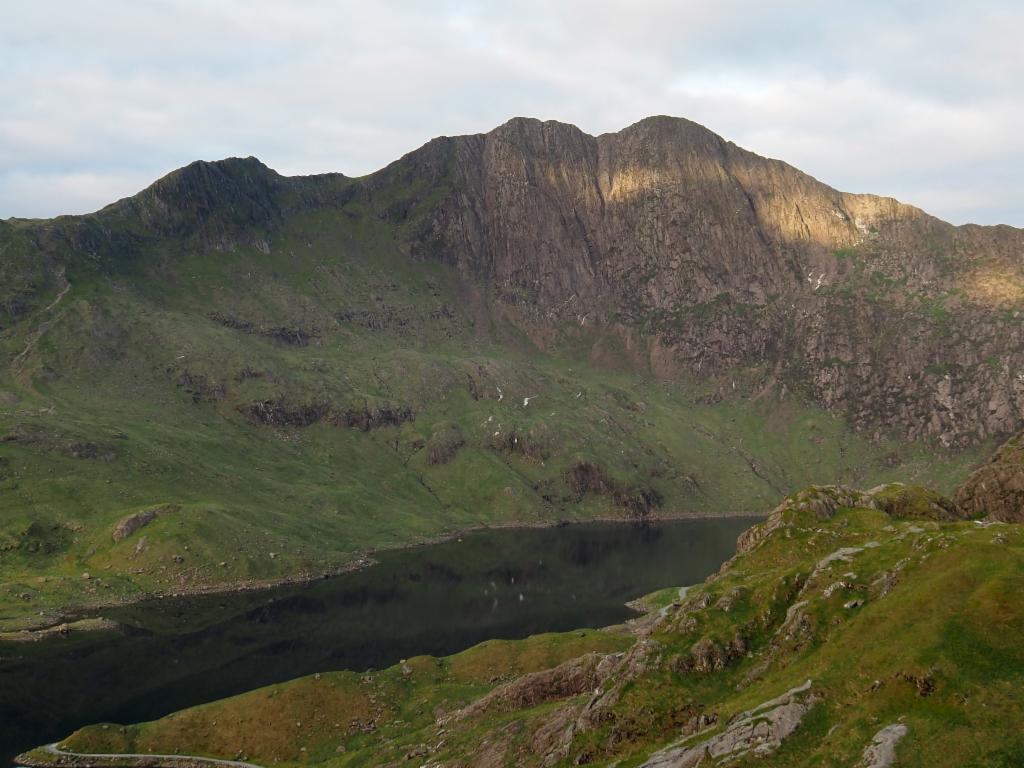
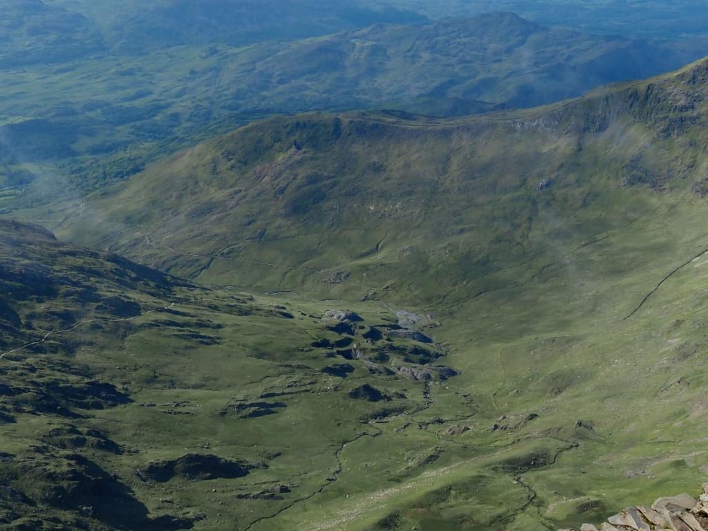
View from Bwich y Moch across Llyn Llydaw to Y Llywedd
Climb from Bwich y Moch up to Crib Goch
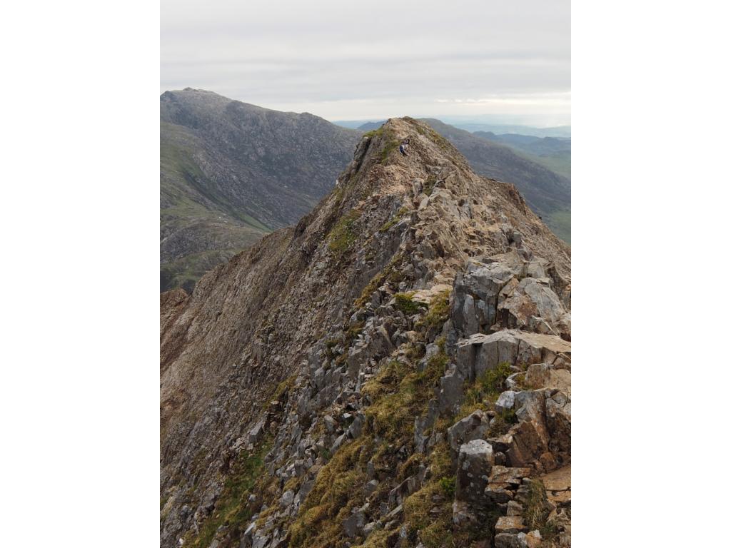
The knife edge: it's tougher and it looks..
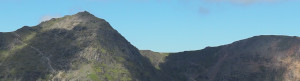
View from Crib Goch to Yr Wyddfa / Mount Snowdon and Crib y Ddysgi / Garnedd Ugain
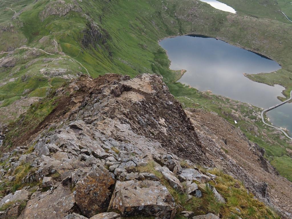
Glaslyn from the Crib Goch ridge
How did it get there?
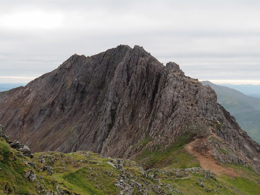
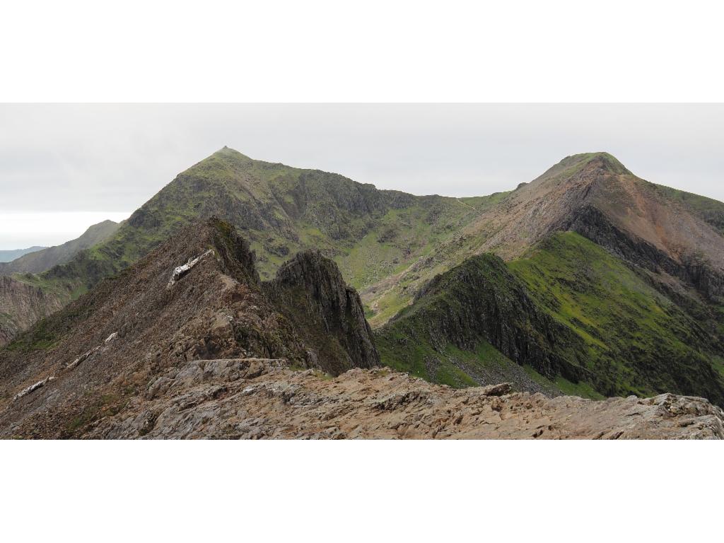
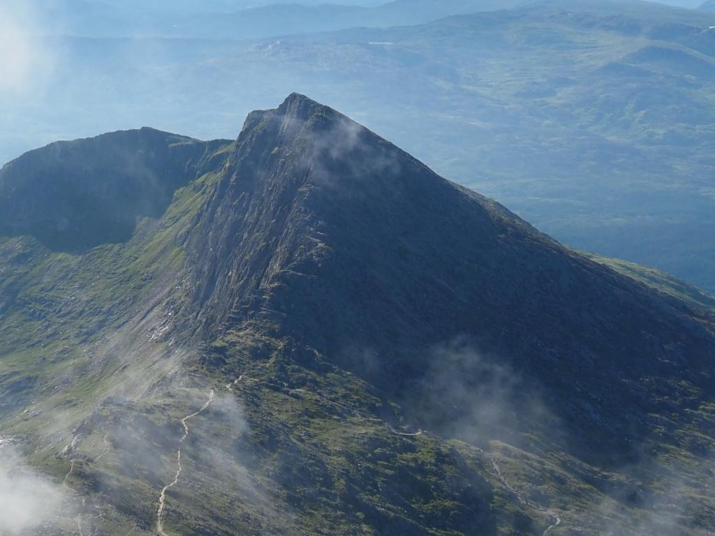
Looking back at Crib Goch from Bwich Coch
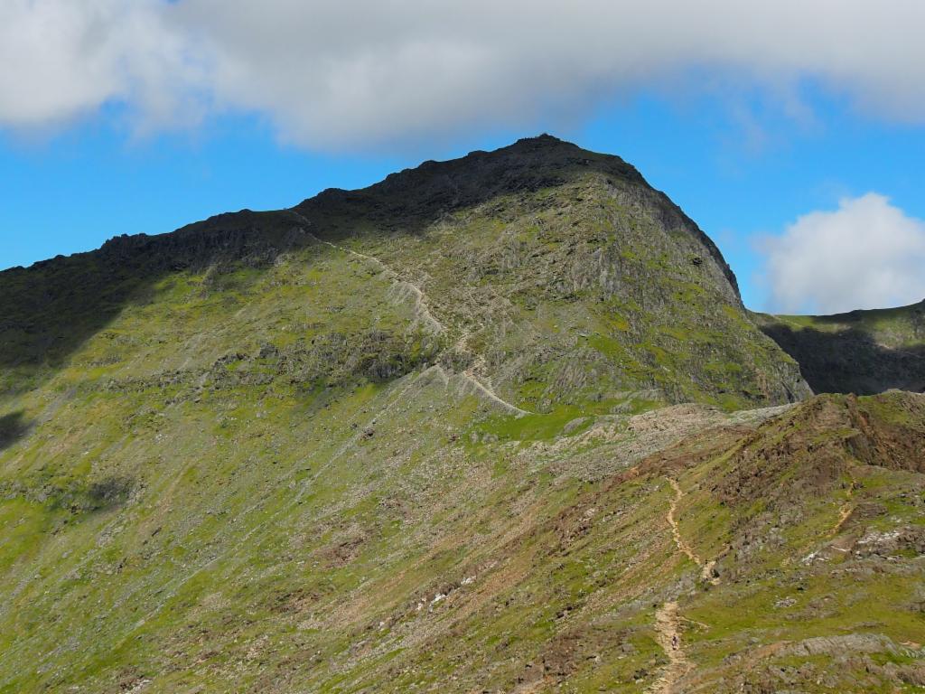
Ridge from Bwich Coch up to Crib y Ddysgi
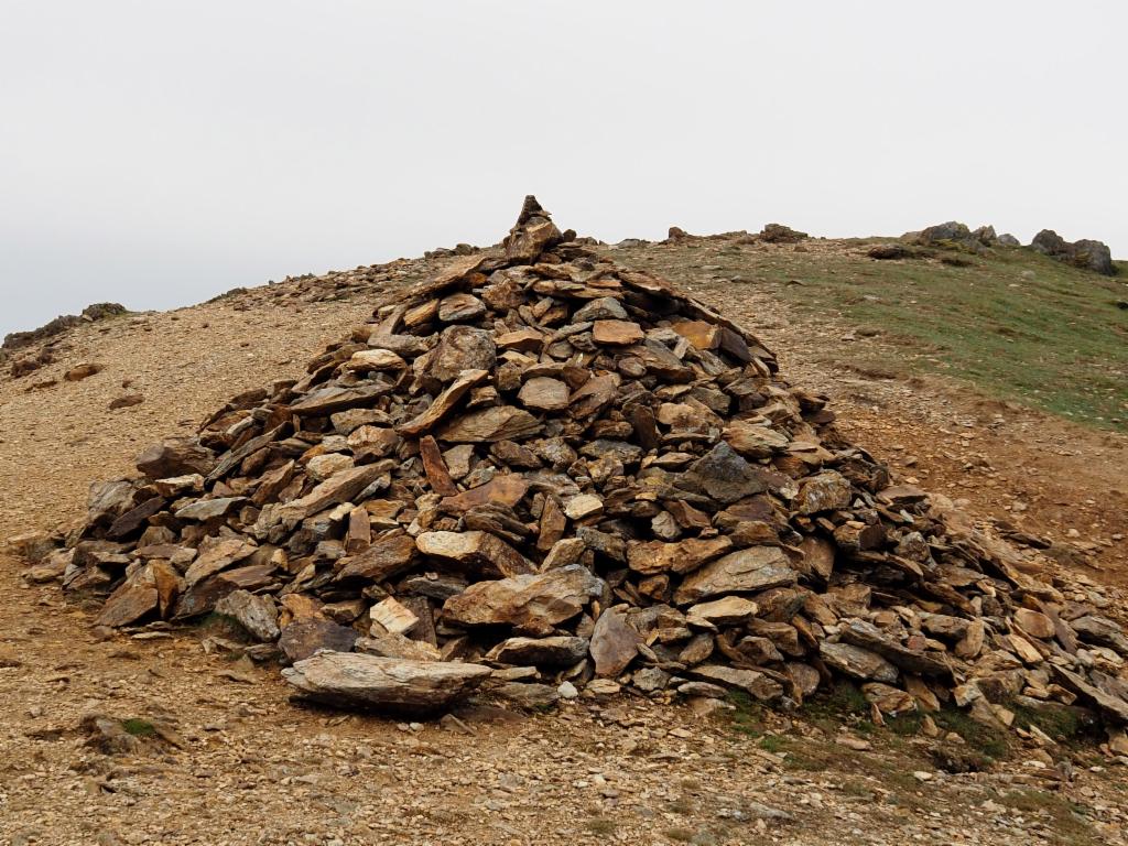
Huge cairn on Crib y Ddysgi
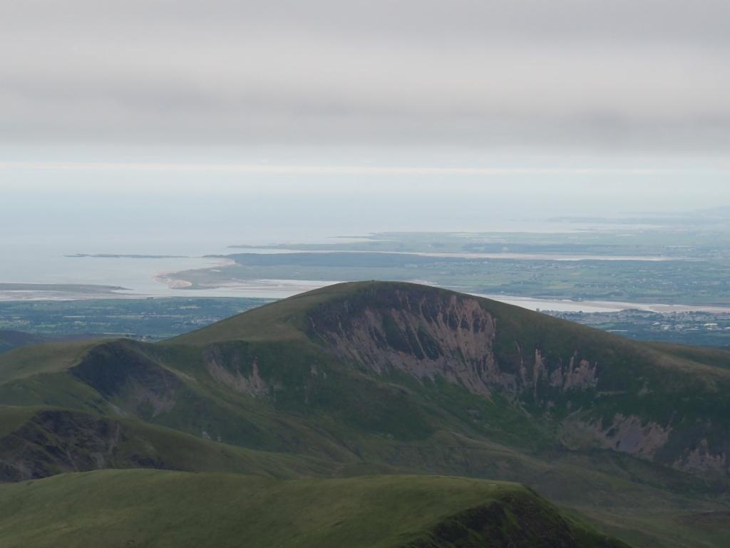
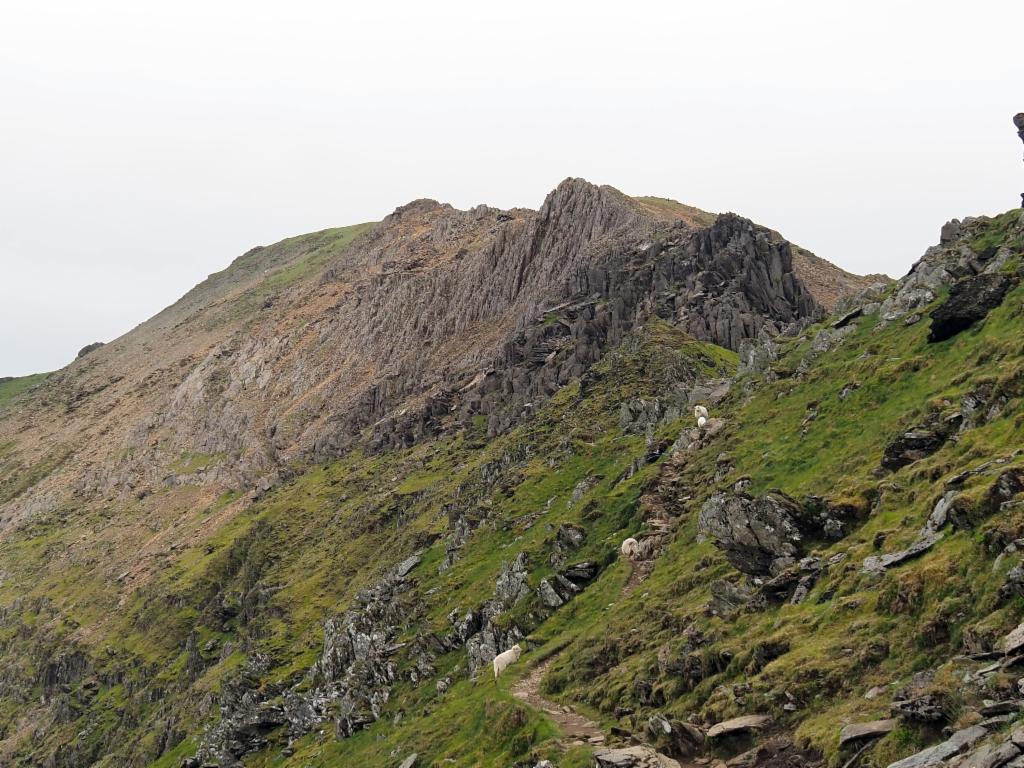
Moel Cynghorion from Crib y Ddysgi
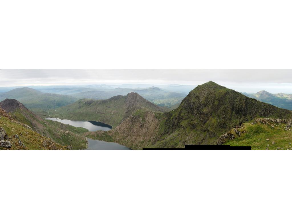
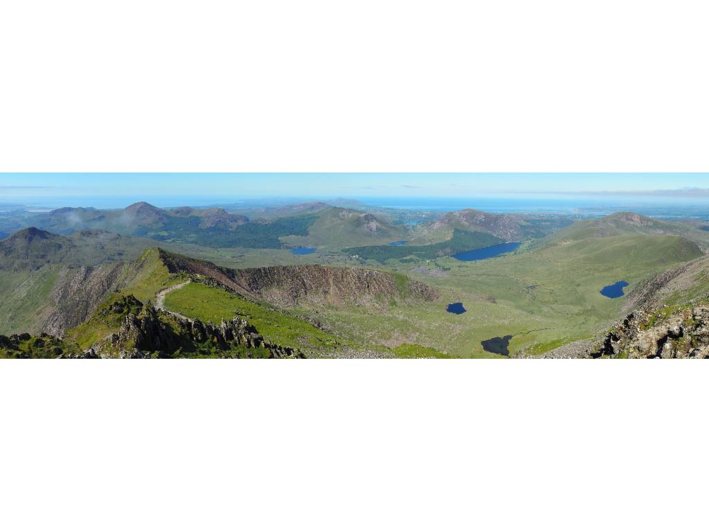
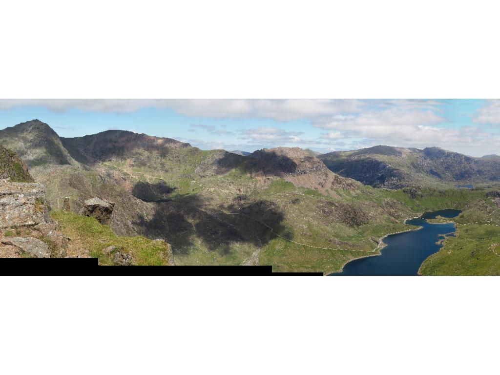
Panorama from Crib y Ddysgi towards the southeast
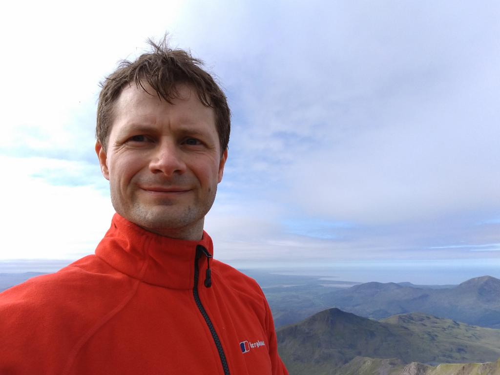
On the summit
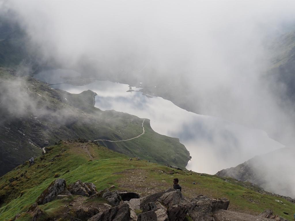
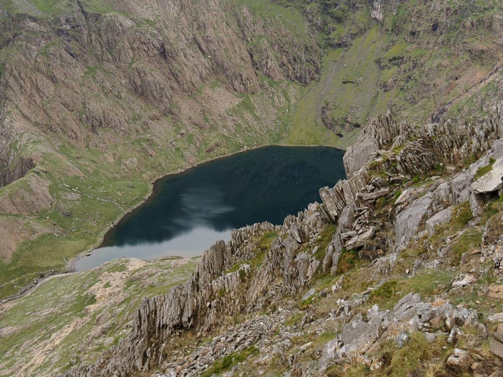
Llyn Llydaw appears through the clouds
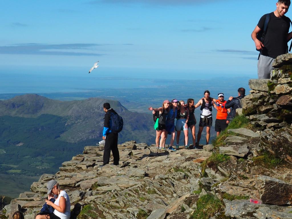
Busy summit
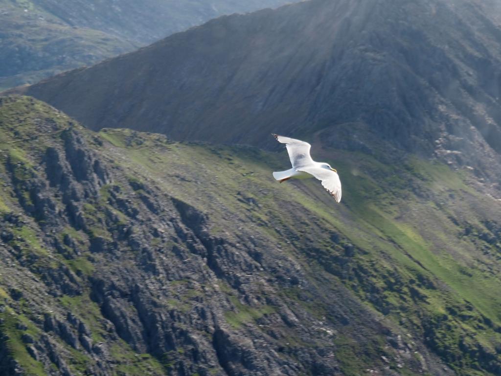
Seagull
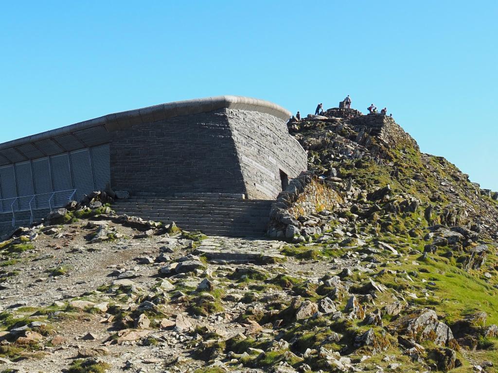
Railway station
Panorama towards the west
Carnedd Llywelyn and Glyder Fawr
Mines of Plascwmllan
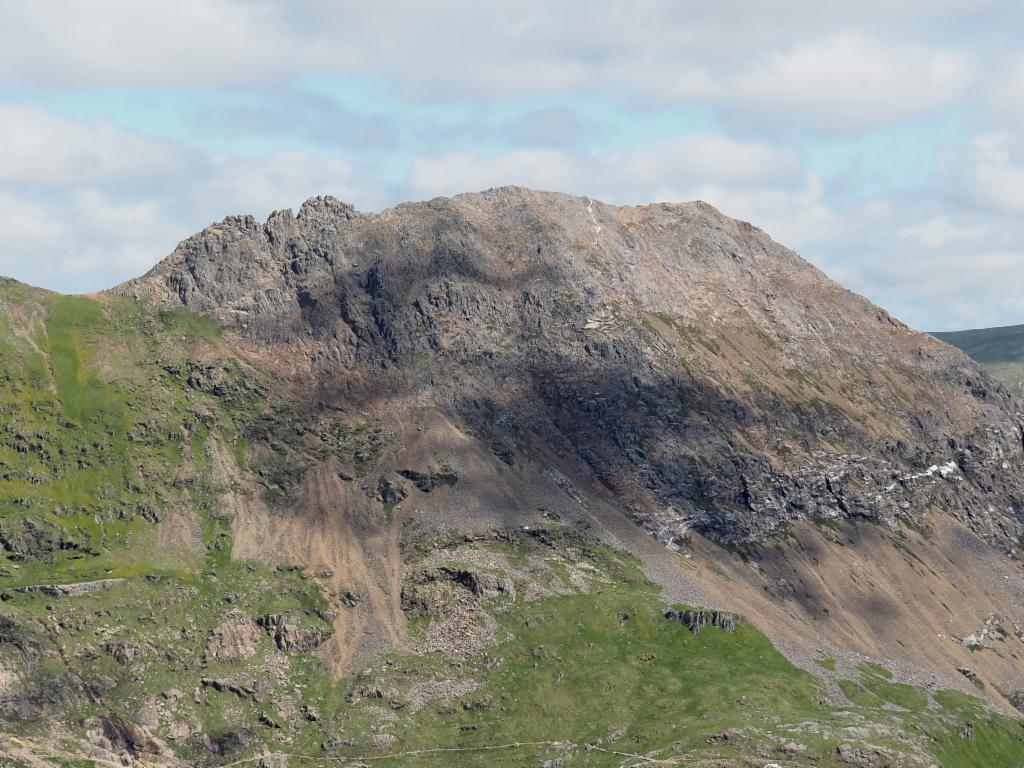
Y Lliwedd
Path descending from Yr Wyddfa to Bwich Ciliau
Crib Goch from Y Lliwedd
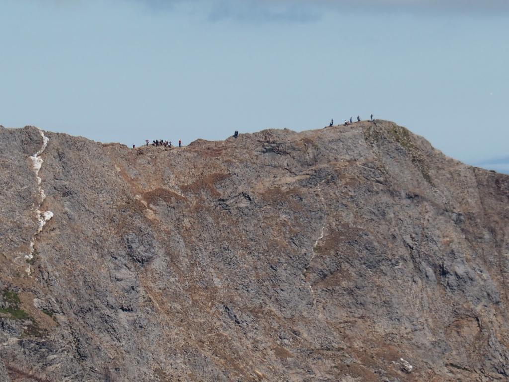
Hikers on the knife edge of Crib Goch
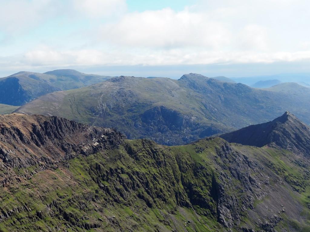
Panorama from Y Lliwedd towards the northwest
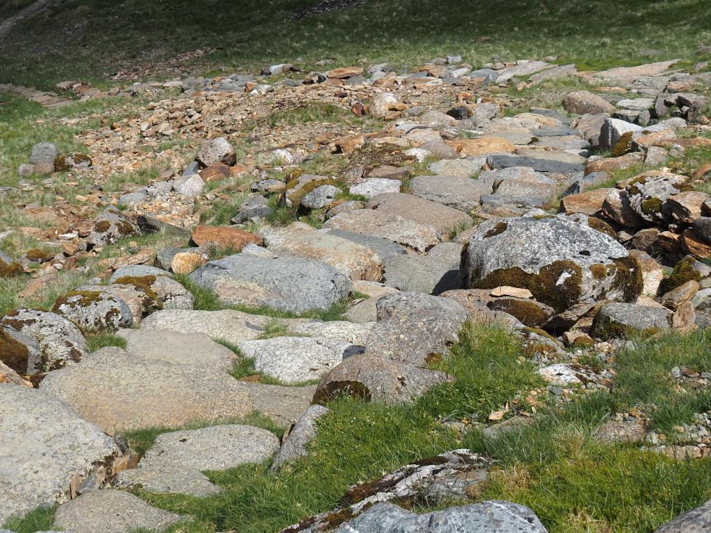
Paved path down to Llyn Llydaw
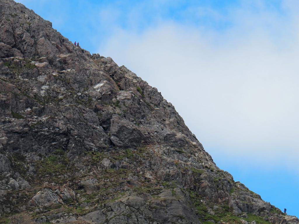
Most difficult section of the climb to the summit of Crib Goch
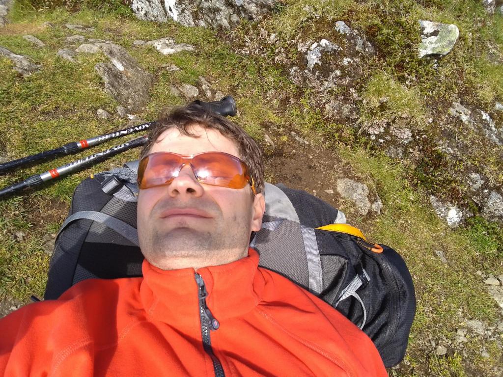
Afternoon nap at the shores of Llyn Llydaw
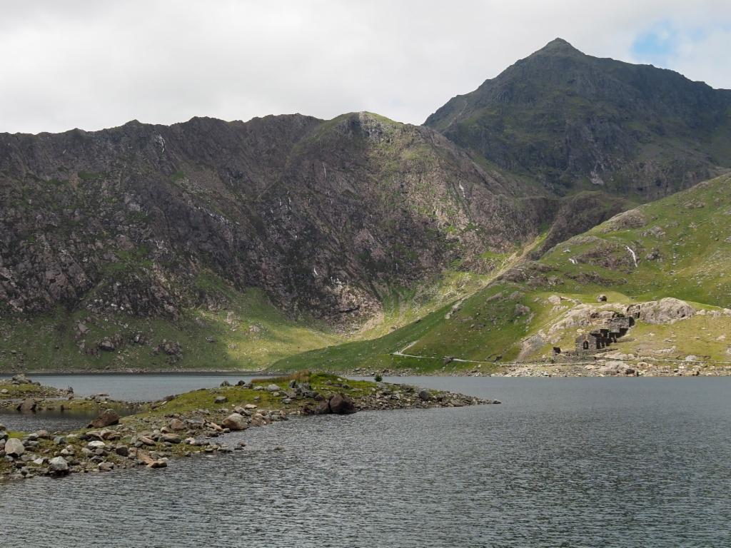
View from Llyn Llydaw to the summit of Mount Snowdon