
Oxford - Wallingford - West Wycombe
8. 5. 2020
Peter Schrammel
Weather
sunny, a few clouds in the afternoon
Interest 
***: Long tour from the Thames valley via the steep Chiltern hills to the Thame valley
Route
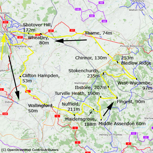
Oxford, 60m - Clifton Hampden, 53m - Wallingford, 50m - Nuffield, 211m - Maidensgrove, 188m - Middle Assendon 60m - Turville Heath, 190m - Fingest, 90m - Ibstone, 207m - Stokenchurch, 235m - Radnage, 130m - West-Wycombe, 97m - Bledlow Ridge, 200m - 253m - Chinnor, 130m - Thame, 74m - Wheatley, 80m - Shotover Hill, 172m - Oxford
Elevation gain
1063m
Distance
113km
Timing
6 3/4h (1 + 2/3 + 1/3 + 1/3 + 1/4 + 1/2 + 1/6 + 1/3 + 1/2 + 1/6 + 1/4 + 1/3 + 1/6 + 1/6 + 1/3 + 2/3 + 1/3 + 1/4)
Stamina
F
Difficulty
0: several steep hills with slopes of up to 16%, but never more than 150m at once
Danger
0: car traffic on unavoidable A roads
Visitor frequency
d: many, many cyclists in all directions
Report
On a nice sunny early May weekend with more than 20 degrees I wanted to escape the Corona lockdown for a couple of hours. I left Oxford at 10am and cycled along the ring road to Blackbird Leys in order to avoid the heavy traffic on the more direct A roads. The cyclepath was quite busy. It wasn't just me who just wanted to get out and enjoy the sun. I continued on Watlington Road and via Toot Baldon to Clifton Hampden, which I reached at 11am. I stopped briefly to take a sip from my water bottle while several cyclists on race bikes were rushing by. I crossed the Thames to Long Wittenham, climbed up the short steep hill and then via Brightwell-cum-Sotwell down to Wallingford. There was quite a lot of traffic on the main road. I stopped at the bridge to take some pictures. I continued first on the A road towards Henley before I turned right on the wonderfully quiet single-track road to Nuffield. A red kite was gliding above the fields searching for prey. Later towards Swyncombe I observed another three at least. I took the small side road to Maidensgrove where I ate something on the enormous commons meadow. I rolled down the steep road to Stonor where I saw another red kite very closely and a couple of partridges. I wasn't quite sure which direction to take from there. My phone seemed defect I had no network reception and I hadn't downloaded the map. So, I first turned left, but then tought was wrong and cycled down the valley to Middle Assendon. Now I was pretty sure that I was wrong. I saw a road sign to Fawley, but didn't remember that village name, so I asked an elderly man in his garden. First he said that it was possible to go via Fawley, but quite complicated. Then he gave me the advice to go back to Stonor and take the road to Turnville. That's what I did. Before Stonor there was suddenly a terrible smell that I hadn't noticed on the way down; the origin of the small was identified after the next turn: a dead roe deer in the ditch, apparently hit by a car. After the Stonor Deer Park I climbed quite a steep hill up to the ridge and down on the other side to Turnville and Finest. I took the first road to the left to Ibstone. The hill was very, very steep and when I arrived on top I was pretty sure that this was not quite right, but in the worst case I would have to cycle all the way up to the main ridge of the Chiltern hills. This is what happened. Finally, I crossed the M40 at Stokeschurch and then followed the Chilterns Cyclepath steep down to Radnage. I stopped to eat an apple and enjoy the nice view towards the different greens of the hills and the church peeking out from the forest. I also observed a pheasant couple hiding behind the high grass of the pasture. When I arrived at the bottom of the valley, I saw a sign 3 miles to West-Wycombe - that's where I wanted to go initially. My thighs were already quite heavy, but 3 miles is not terrible after 70km, and I had still time; it was 3.30pm. After some ups and downs I approached West-Wycombe with views towards Lawrence Church on top of the hill. There was not enough time to go there this time because I still had to cycle more than 40km. I pedalled up Beldow Ridge, which is very, very steep at the beginning. The road climbs slowly through the very long stretched village to the highest point of the circuit before falling down very fast to Chinnor. Thame was just 4 miles away. That's not that far actually. In addition I had a tail wind - that was motivating! I stopped on the impressive high street of the town and then continued on the A road towards Wheathley. The traffic was not too terrible and I advanced reasonably fast. On the flat climb into the centre of Wheathley I slowed down more and more. I was quite exhausted. Thus I stopped once more to empty my bottle. I decided to go back to Oxford via Shotover Hill - it's a steeper climb than via Horspath, but the downhill into the centre of Oxford is more direct. I slowly pedalled up the hill, which seemed rather easy in comparison to the hills I had already climbed today. Then I rolled back home via Old Road and High Street arriving towards 5.30pm.
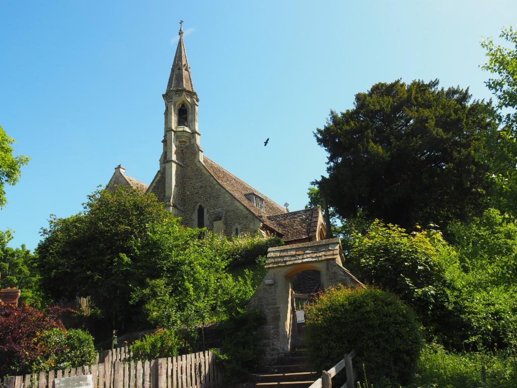
Church in Clifton Hampden
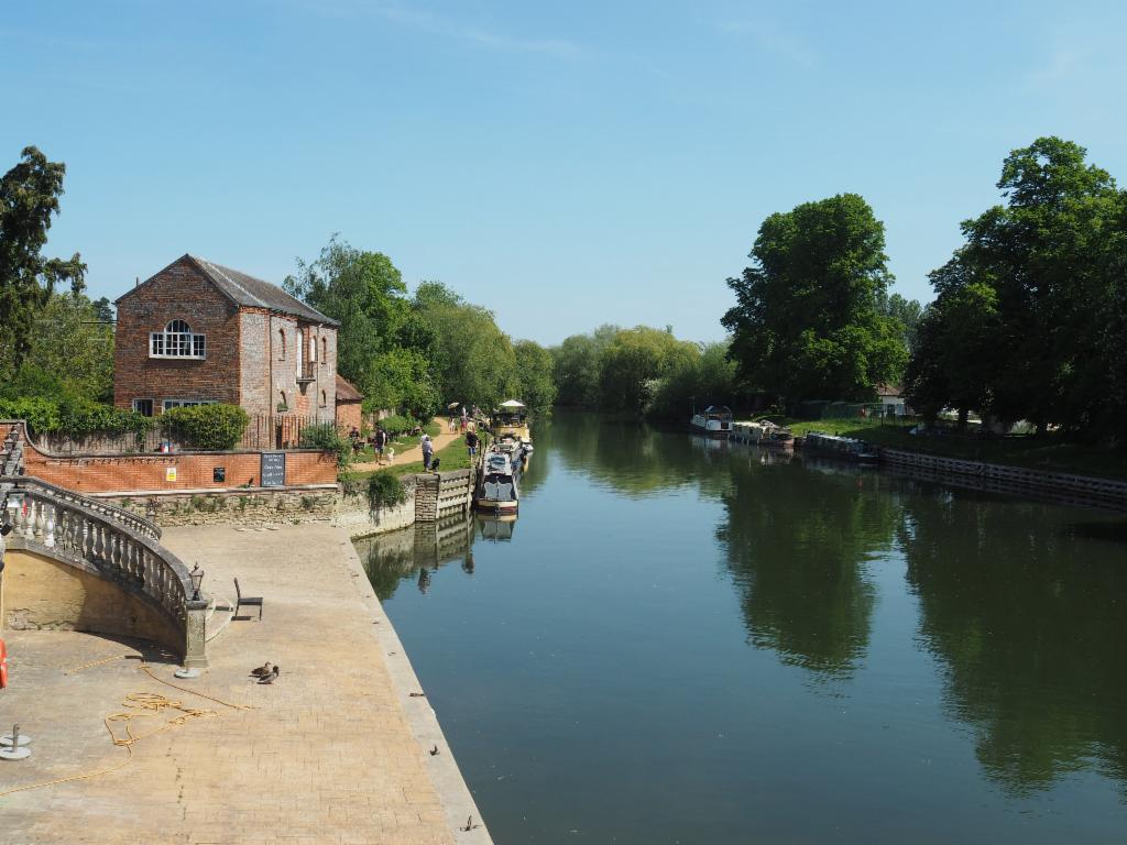
Thames at Wallingford
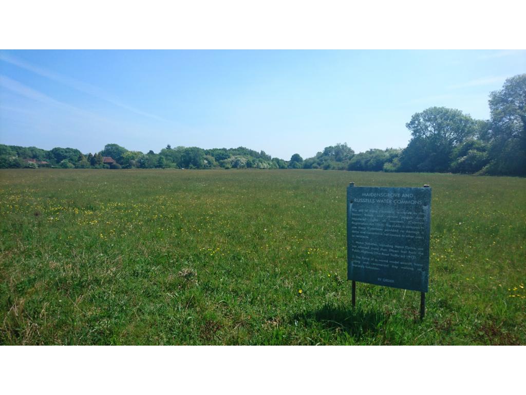
Maidensgrove Common
Stonor
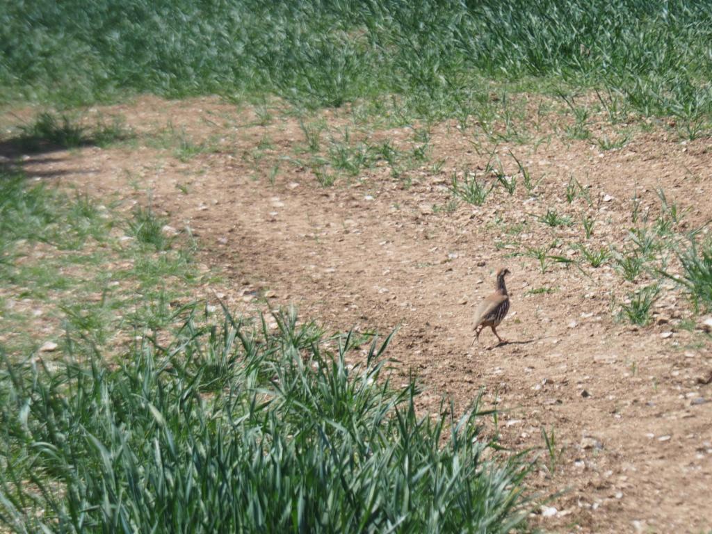
Partridge
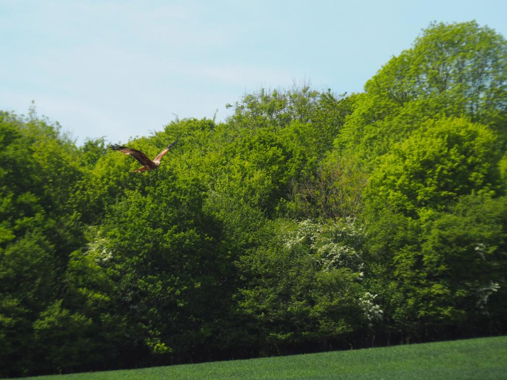
Red kite
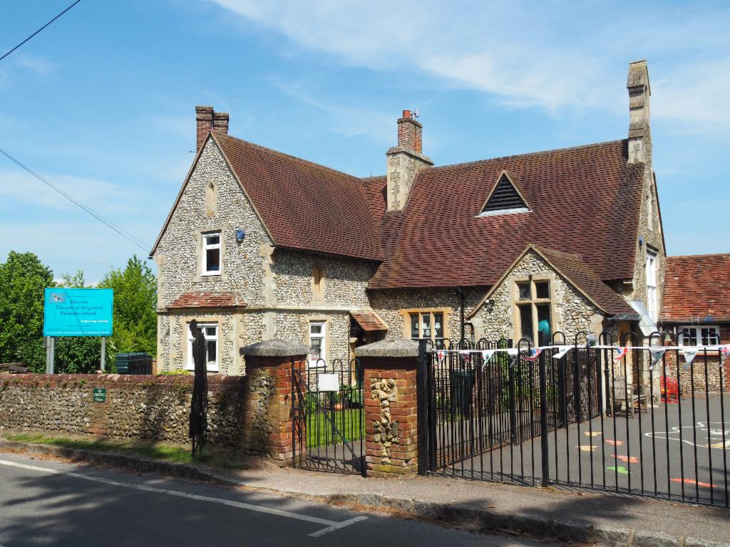
School in Ibstone
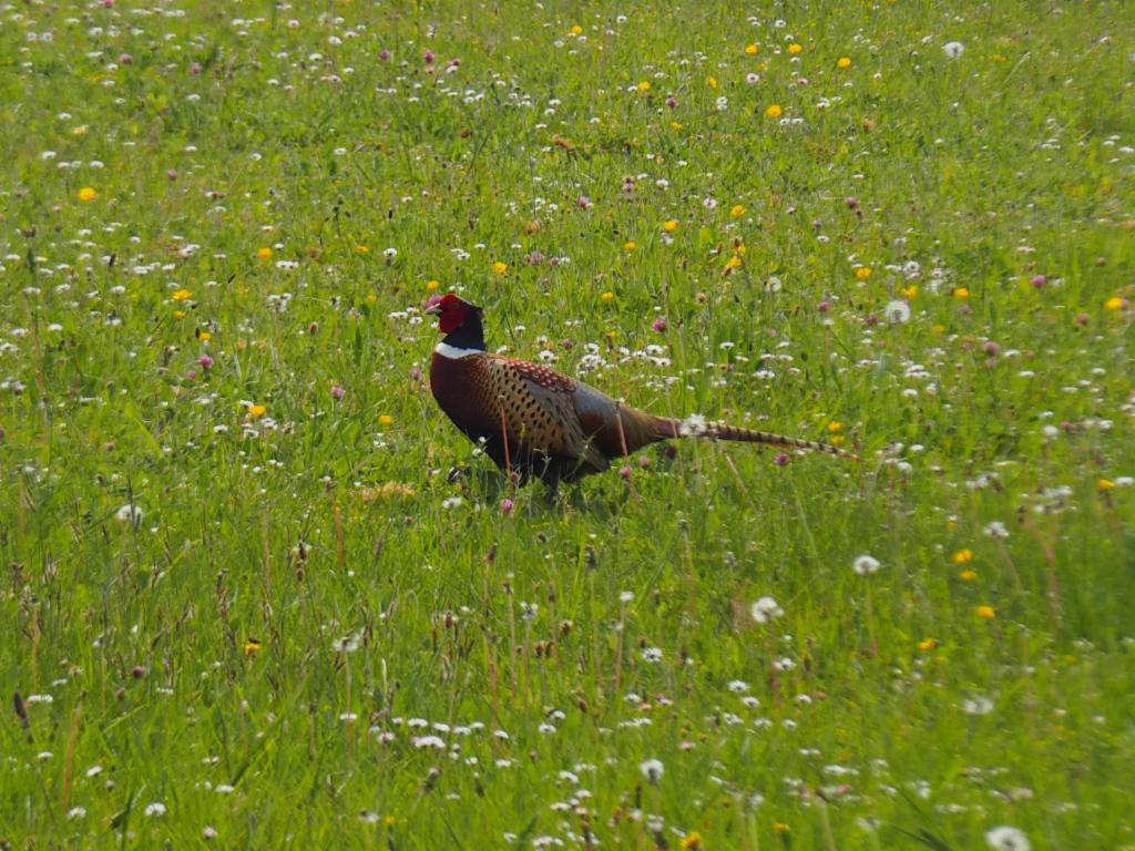
Phaesant
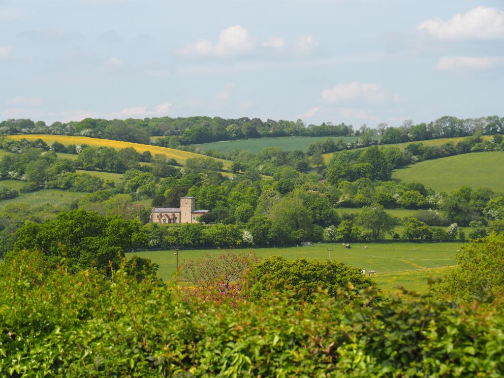
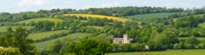
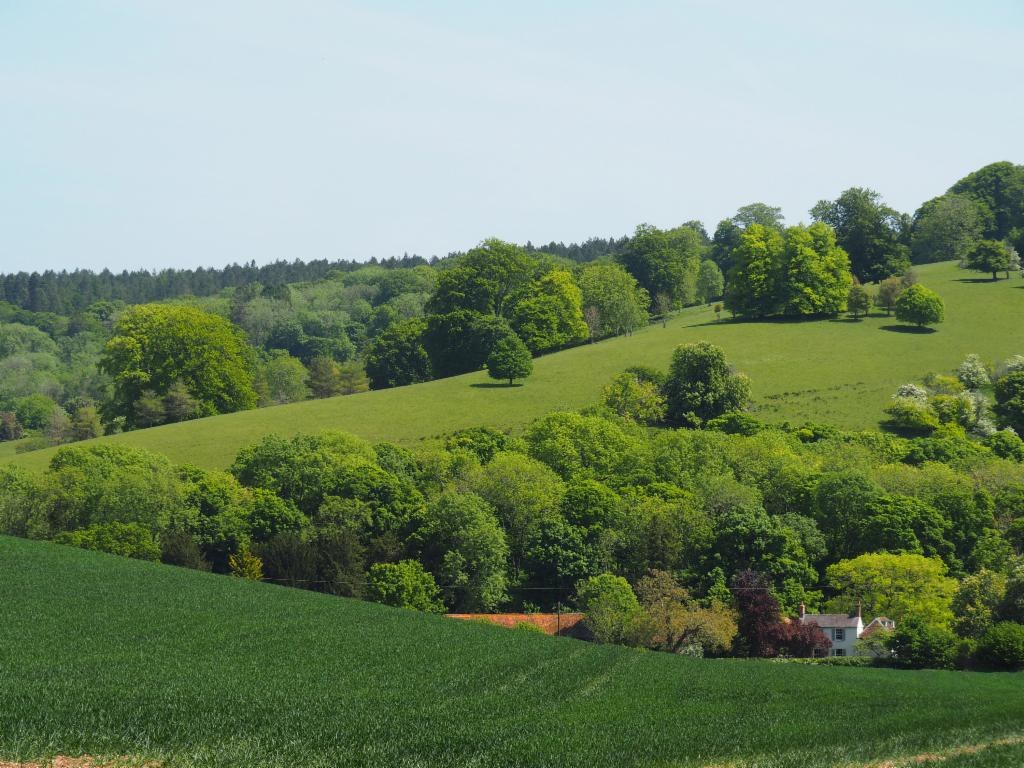
Radnage
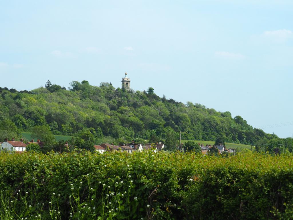
St Lawrence above West Wycombe
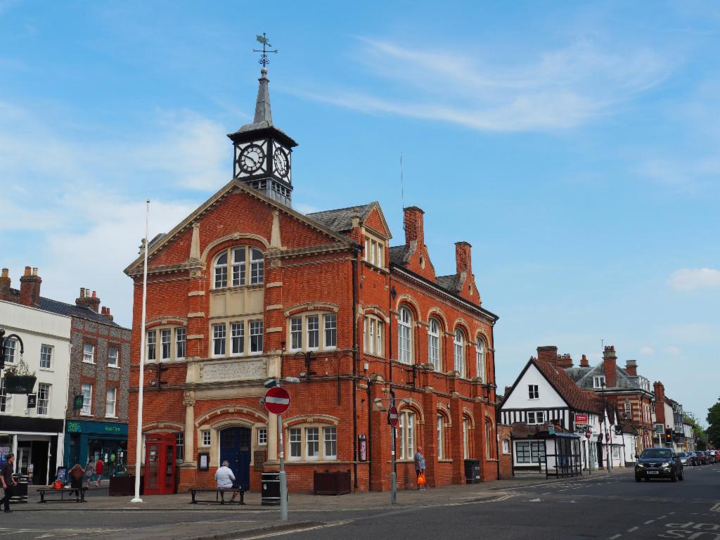
Thame Town Hall