
Rajgad Fort
6. 10. 2017
Peter Schrammel
Weather
sunny, rain, sunny, 33°
Interest 
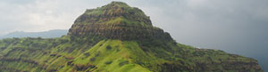
****: former fortress on top of beautifully green, rocky ridges
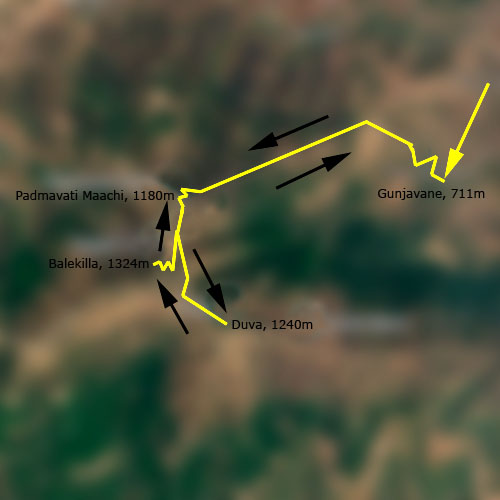
Route
Gunjavane, 711m - Padmavati Maachi, 1180m - Duva, 1240m - Balekilla, 1324m - Padmavati Maachi - Gunjavane
Elevation gain
723m
Distance
10km
Timing
3 3/4h (1 1/2 + 1/2 + 1/2 + 1/4 + 1)
Stamina
C
Difficulty
A: very steep, high steps; very slippery when wet; metal bars as handholds along difficult sections
Danger
5: very steep, slippery, grassy slopes
Visitor frequency
e: very popular
Comments
R 10.- entry fee at booth near parking in Gunjavane, R 40.- for parking
Report
During my business and conference trip to India, I had a free weekend in Pune. Since I had already explored the city, I wanted to explore the mountainous surroundings too. I had up a bit about Rajgad Fort and decided to hire a taxi to get me to Gunjavane, a tiny village at the foot of the mountain. The driver, a retired army officer, knew the area well and understood what I intended to do. We took the motorway NH48 to the south which climbs steep up on a ramp blasted into the slope before it crosses a mountain range through a tunnel. On the other side there were wide relatively flat valleys. We left the highway at Nasrapur and continued on a less maintained road through several villages. Cattle were wrangled by women on the roads. The men washed and brushed them in the river surrounded by rice fields. The weather was quite cloudy and muggy. The last two kilometres to Gunjavane there was a narrow dirt road. We parked the car on a parking in front of a colourful temple. We exchanged telephone numbers and I told the driver that I would be back in four hours. I walked through the quiet village following the route that I had on my phone. After a few turns the path got steeper and I overtook a group of students. Some of them had just flip-flops, which was not quite adequate on the muddy path. I didn't have proper hiking boots either, but only sneakers. After a small plateau with booths where drinks would be sold at busier times, the path got even muddier and I was also struggling a bit. Fortunately, it was only a short section. The path led in the forest over a broad ridge. I was a bit afraid of snakes that might jump from the trees. Suddenly, I reached a bald spot with a clear view to the mountain. The fortifications reminded me a bit of the Bastille of Grenoble. It was not quite believable that there would be a passage through the steep rocky and grassy mountain face. Finally the path started climbing seriously over high rock steps between rusty metal guardrails. The carved steps were extremely slippery, but I made fast progress. A group of six students asked me to take a picture them before I overtook them. A tunnel leads through the fortifications to a terrace with a beautiful view over the valley with its thousand shades of green. The visibility was quite hazy, though, and the early afternoon rain was certainly around the next corner. After a few further photos with the students, I continued past a pond to the next level of the fortifications. On the terrace of a hut there were dozens of young people. I took the path to the eastern ridge which was crowned by spectacularly winding walls on either side. I climbed the first peak on that ridge. The path was a bit crooked, but the view all around was fantastic: the near eastern ridge and the enormous Bhatgar reservoir in the valley, the main fort, and the western ridge. The southern face, as the whole mountain, was horizontally subdivided by three vertical rock layers connected by steep grassy slopes. The main fort looked like a huge block of granite, which seemed inaccessible. Mist was coming from behind it and was afraid of getting into a thunderstorm. So I wanted to reach the hut as quickly as possible. But the rain was faster and found minimal shelter under the remains of a porch. The shower was short, but the paths were now even muddier. When I arrived at the hut, I had still one and a half hour. Enough time to attempt the top of the mountain and return to the valley. There was telephone network coverage; so, I could text the driver if I would be delayed. I assumed that the upper path would lead to the top. After a few meter I encountered soaked hikers who I asked whether this is the right path. They confirmed; so, I continued. The path is quite spectacular and necessarily exposed. The carved steps were slippery and the guardrails were not very trustworthy. I slowed down for safety. At the oriental porch I was greeted by a monkey. Stepping inside, I was surrounded by dozens of monkeys who were messing around. The remains of the fort were scattered over the flattened top of the mountain. There were several ponds. Some looked like cellars carved into the rock that were now filled with water. I took pictures and cautiously climbed down the slippery staircase. There was no need to hurry. I had plenty of time to return to the village in time, which I did. On the way down I saw a shrew on the middle of the path that was coughing strangely. Apparently it was injured. In the village, the driver was chatting with a guy in a booth next to the parking. Apparently, I should have registered and payed an entrance fee, which I caught up on now. I also paid the driver the parking fee. On the way out of the village, the driver suddenly stopped. An oncoming truck was stuck in the mud. A guy was attempting to put a rubber mat under the wheels while the truck driver tried to roll back and forth to find sufficient grip. My driver got a bit worried because if they didn't manage to get the truck unstuck then this could take several hours until they found another vehicle that could tow it out. Until then we would be stuck here too because this was the only road down into the valley. After 15 minutes they finally got one wheel onto the rubber mat and the truck got out of the muddy section. Now, there was sufficient space for us to pass. The sun had set for quite some time already when I arrived at the hotel.
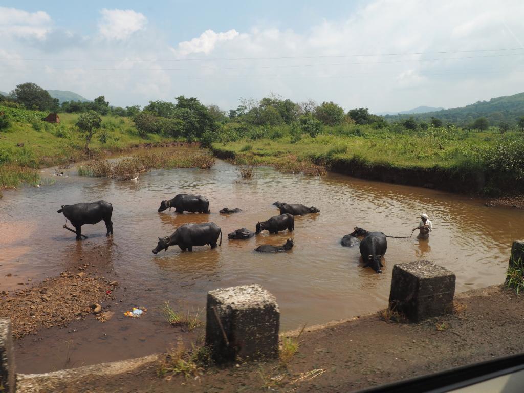
Washing the cattle in the river on the way to Gunjavane
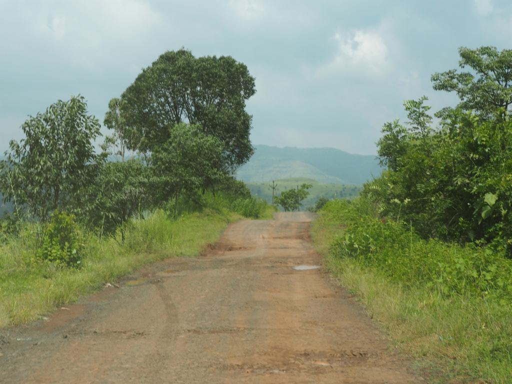
Road to Gunjavane
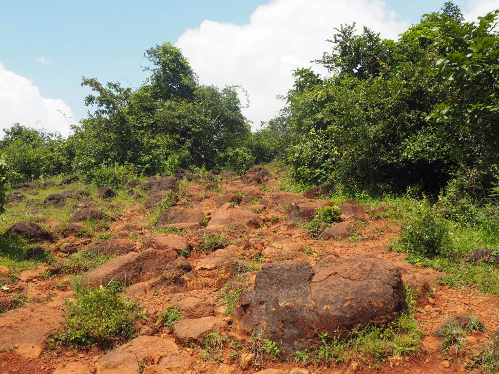
Rocky path up to the ridge of ascent
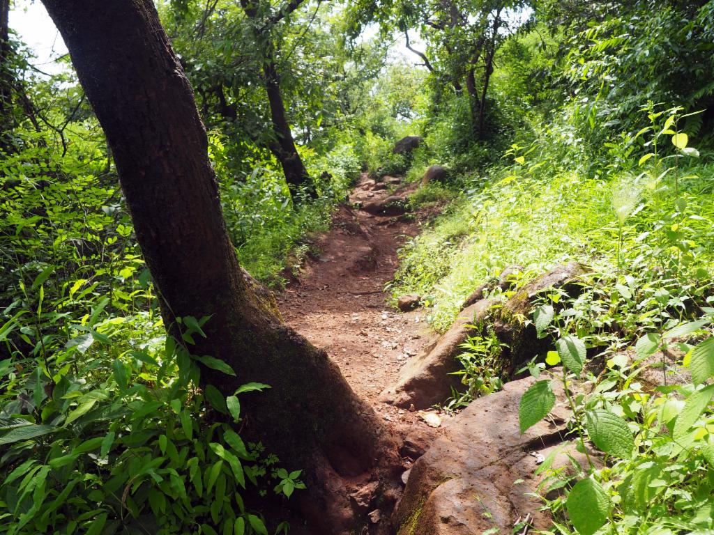
Path on the broad ridge
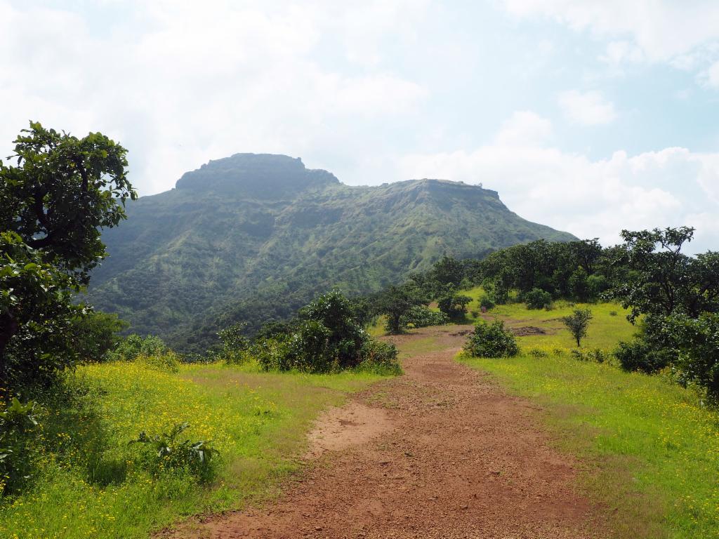
How will the path pass through the rocky barrier?
Ridge of ascent from Gunjavane to Padmavati Maachi
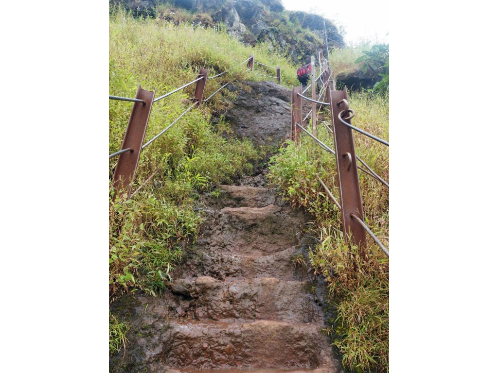
Slippery stairs leading up to Padmavati Maachi
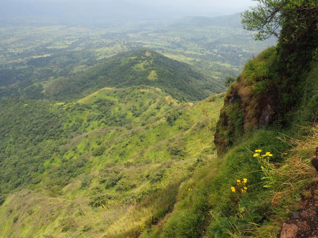
View from Padmavati Maachi towards southeast
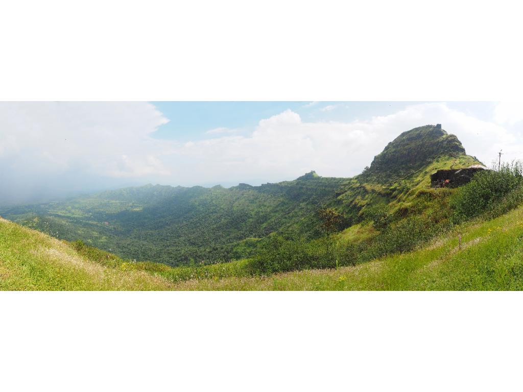
Sanjivani Maachi and Bhatgar reservoir from Duva
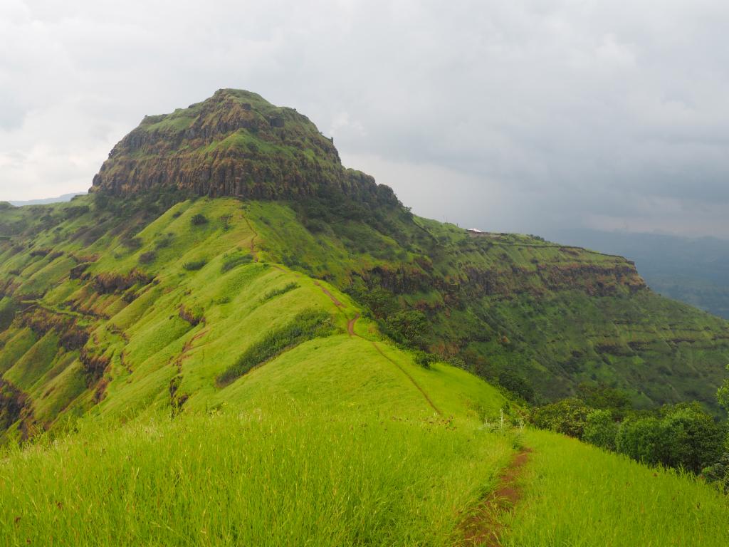
Balekilla and Padmavati Maachi from the path to Duva
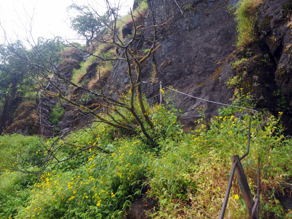
Exposed, rocky and slippery path to Balekilla
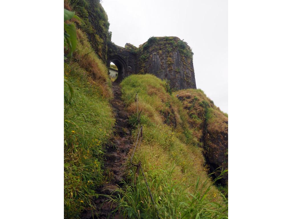
Approaching the entrance of Balekilla
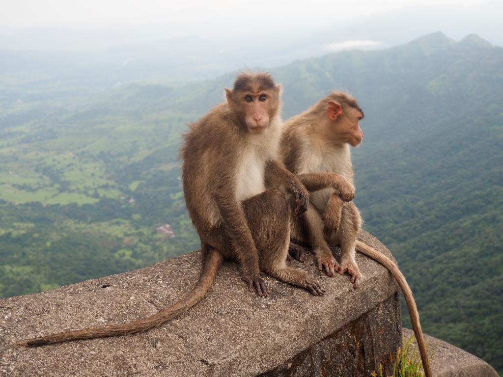
Monkeys in Balekilla
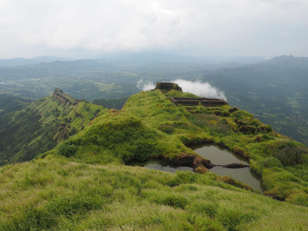
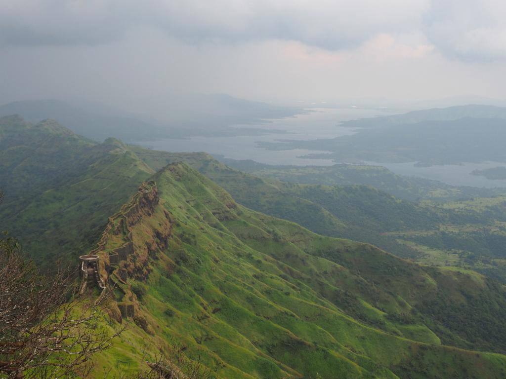
On Balekilla, view towards the west
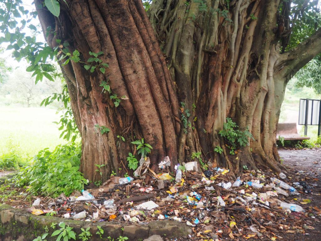
Village tree and garbage dump in Gunjavane
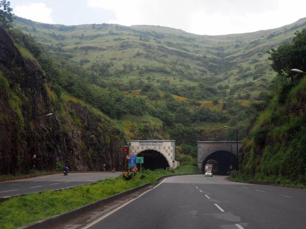
Past the tunnels on the way back to Pune