
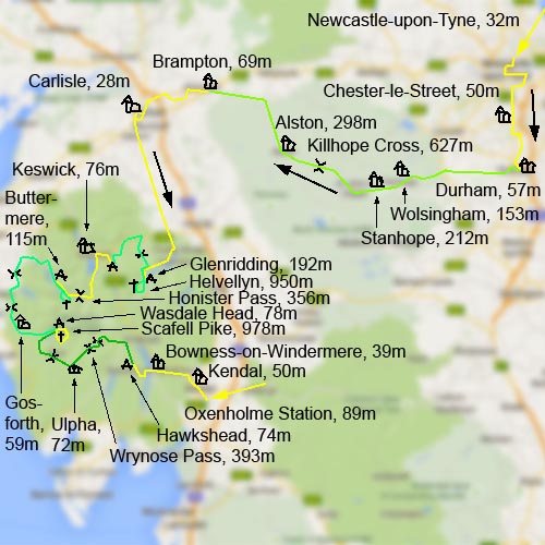
Newcastle - Lake District
31. 7. 2014 - 9. 8. 2014
Bertrand Jeannet and Peter Schrammel
Weather
D1: cloudy, rain in the afternoon;
D2: overcast, then rainy;
D3: rain in the morning then sunny;
D4: cloudy, sunny and rain in the afternoon;
D5: rain, then sunny in the afternoon;
D6: cloudy in the morning then sunny, rain during the night;
D7: cloudy in the morning then heavy rain the afternoon and during night;
D8: rainy, then sunnier, some rain in the evening, rain during the night;
D9: light rain throughout the day
Interest 
D1: * suburbs and heavy road traffic;
D2: **** impressive way east-west over Killhope Cross;
D3: **** flat and quiet approach to Lake District;
D4: ***** the most beautiful summit in Lake District and a stone circle;
D5: ***** through the heart of Lake District via Honister Pass to Buttermere;
D6: ***** interesting hike above Buttermere and long ride between sea and hills;
D7: **** conquest of England's highest mountain;
D8: ***** tough, but wonderful route over three steep passes;
D9: *** shortest way to the train station
Route
D1: Newcastle-upon-Tyne, 32m - Chester-le-Street, 50m - Durham, 57m;
\nD2: Durham - Wolsingham, 153m - Stanhope, 212m - Killhope Cross, 627m - Alston, 298m - Brampton, 69m;
\nD3: Brampton - Carlisle, 28m - Pooley Bridge, 145m - Gillside Farm / Glenridding, 192m;
\nD4: Gillside Farm - Red Tarn, 718m - Helvellyn, 950m - Gillside Farm; Gillside Farm - Mell Fell, 343m - Threlkeld, 147m - Castlerigg Stone Circle, 215m - Castlerigg Farm, 215m;
\nD5: Castlerigg Farm - Keswick, 76m - Rosthwaite, 97m - Honister Pass, 356m - Syke Farm / Buttermere, 115m;
\nD6: Syke Farm - Gatesgarth, 115m - Haystacks, 597m - Gatesgarth - Syke Farm; Syke Farm - Loweswater, 128m - Lamplugh, 190m - Keltonfell, 255m - Ennerdale Bridge, 100m - Cold Fell, 310m - Gosforth, 59m - Wasdale Head, 78m;
\nD7: Wasdale Head - Mickledore, 825m - Scafell Pike, 978m - Esk House, 759m - Sprinkling Tarn, 598m - Sty Head, 425m - Wasdale Head;
D8: Wasdale Head - Eskdale Green, 57m - Birkerfell, 271m - Ulpha, 72m - Seathwaite, 105m - Cockley Beck, 218m - Wrynose Pass, 393m - Little Langdale, 105m - Blea Tarn, 265m - Great Langdale, 97m - Skelwith Bridge, 48m - High Crag, 143m - Hawkshead Camping, 74m;
\nD9: Hawkshead Camping - Bowness-on-Windermere, 39m - Crook, 162m - Kendal, 50m - Oxenholme Station, 89m
Accommodations
D1: Chad's College, Durham;
D2: Howard Arms, Brampton;
D3: Gillside Farm, Glenridding;
D4: Castlerigg Farm, Keswick;
D5: Syke Farm, Buttermere;
D6+7: Wasdale Head Camping;
D8: Hawkshead Camping
Elevation gain
+8316/-8259 (cycle: +5686/-5629, hiking: 2530)
D1: +313/-288;
D2: +1343/-1331;
D3: +600/-477;
D4: 857 +478/-501;
D5: +442/-542;
D6: 636+80 +850/-813;
D7: 1037;
D8: +1317/-1321;
D9: +367/-356
Distance
435km (cycle: 403, hiking: 32)
D1: 33km;
D2: 98km;
D3: 73km;
D4: 12 + 27km;
D5: 24km;
D6: 7+6 + 53km;
D7: 13km;
D8: 63km;
D9: 26km
Timing
40 3/4h (cycling: 28 1/2, hiking: 12 1/4)
D1: 2 1/4h (1 1/4 + 1);
D2: 6 1/4h (1 3/4 + 1/2 + 1 3/4 + 1/2 + 1 3/4);
D3: 4 1/4h (1 + 2 1/4 + 1);
D4: 4 3/4h (2 + 3/4 + 2) + 2 1/4h (1 + 1/2 + 1/2 + 1/4);
D5: 2 1/2h (1/4 + 3/4 + 3/4 + 3/4);
D6: 3h (1/4 + 1 1/2 + 1 + 1/4) + 3 1/2h (1/2 + 1/2 + 1/4 + 1/4 + 1/2 + 1/2 + 1);
D7: 4 1/2h (1 3/4 + 1/2 + 3/4 + 1/4 + 1/4 + 1);
D8: 5 1/2h (3/4 + 1/2 + 3/4 + 1/2 + 1/4 + 1/2 + 1/2 + 1/4 + 1/4 + 1/4 + 1/4 + 1/2 + 1/4);
D9: 2h (3/4 + 1/2 + 1/2 + 1/4)
Stamina
D1: B;
D2: G;
D3: E;
D4: F (D+C);
D5: C;
D6: G (C+D);
D7: E;
D8: F;
D9: C
Difficulty
D2: 13% for 150m to Killhope Cross (15-18% downhill);
\nD4: Swirral Edge I- for 100m, Striding Edge 0+ down to the ridge, then a 10m chimney I+;
\nD5: >15% for 2km (twice 25% for 100m) to Honister Pass (20% downhill);
\nD6: some steps 0+ down from Haystacks to Scarth gap; some sections up to 15% to Lamplugh and Cold Fell;
\nD7: final gorge to Mickledore 0+ to I- with loose stones;
\nD8: many short sections >15% to Eskdale Green, longer sections 15-20% up to Birker Fell, 25% downhill, 20-25% for 300m up to Wrynose Pass, very long 25% downhill, 25% for 200m up to Blea Tarn, 25% downhill
Danger
D4: Swirral Edge 5, Striding Edge down to ridge 5, then 4;
D6: to Haystacks via the waterfall <3, down from Haystacks short sections 4, summit!;
D7: <3, cliffs not far away from path
Visitor frequency
D1: e (cars);
D2: c-d (still lots of cars);
D3: d (dense traffic along Ullswater);
D4: d (high traffic on Striding Edge and also lots of cars on the roads);
D5: c-d (traffic but not too annoying);
D6: c (lonely via the waterfall, dense traffic on the other side; rather calm on the roads);
D7: c-d (despite bad weather);
D8: c (quite lonely over Birker Fell, much traffic on Wrynose Pass);
D9: d (quite some traffic)
Report
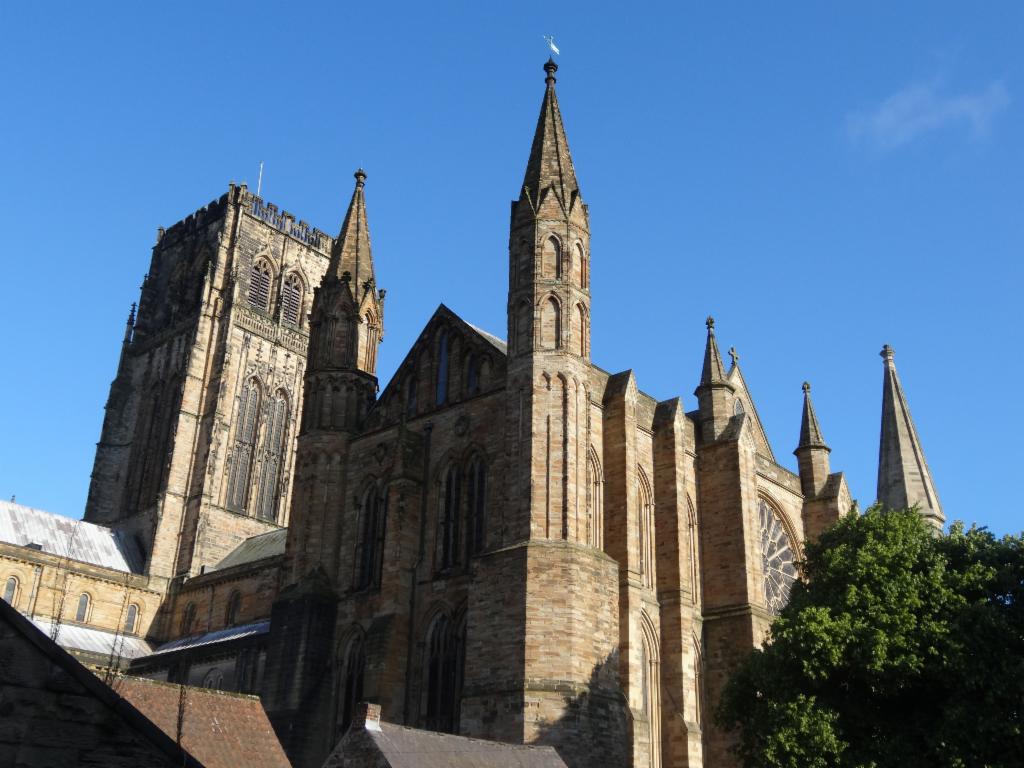
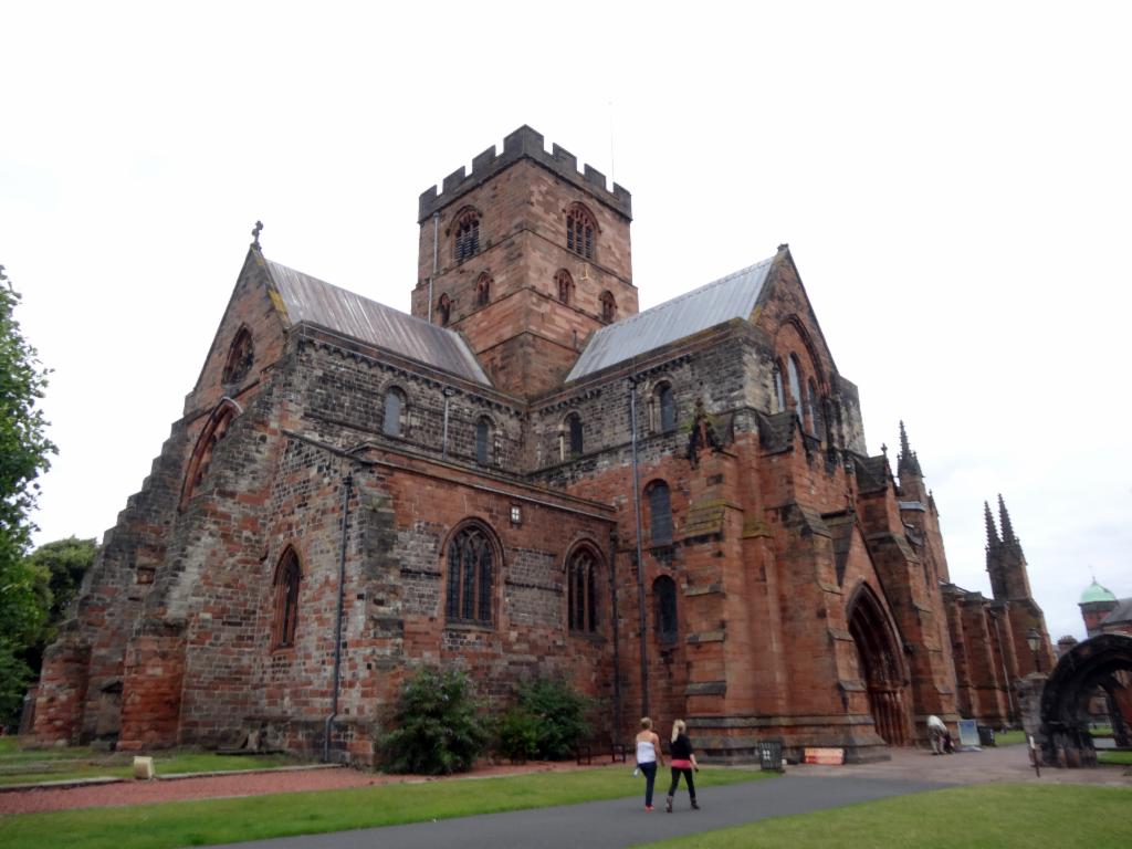
Day 1: I took the train to Newcastle where I arrived at 10.30pm. Bertrand picked me up from the train station. I followed him to Bertrand's au-pair nanny's house, an elderly styled lady with whom I was watching Jaws until 2am while Bertrand was mounting his super-light mudguards and trailer. Next day we left after 10am riding down to the river Tyne. Parts of the city were blocked because of a cycling event. We were allowed to pass and crossed the river over Millennium Bridge, a bent suspended bridge. We followed the river downstream and climbed then via Heworth Leam Lane. It started drizzling. So, we quickly bought some stuff in a grocery. Bertrand noticed that a screw of his mudguards was missing, but we couldn't find it. We rode down the hill to B1288 from where we wanted to follow the bike track on a former railway track. Since it was not tarmacked, Bertrand refused to take it with the trailer. We pedlled a bit uphill to Wrekenton. It was already noon. We asked in two pubs, but they did not have any food. We enjoyed the nice view from the long downhill on the B1296. We then continued along the A167 through Birtley. Finally we stopped at the Lambton Worm pub, where we had a good lunch. We continued. Suddenly after a roundabout, the A167 turns into a dual-carriage way. We stopped immediately because this road was very dangerous and crossed back to the road through Chester-le-Street. Afterwards there was a cycle path alongside A167. Later we rode on a country road through suburbs a bit up and down to Durham. We stopped on a bridge with impressive view of the cathedral perched on the rock in a narrow loop of river Wear. We climbed the steep road up to the market place and further up to the cathedral. The square was full of tourists and there was a huge black cloud behind the cathedral tower. We quickly attached the bicycles and entered cathedral where there was a rehearsal for concert taking place. We waited inside for the rain to stop. Then we went down to tourist office to ask for the closest camping site because we wanted to make use of our camping gear that Bertrand was pulling in his trailer. They phoned for us, but said that everything was flooded. So, we took a room in St Chad's College, primitive students' rooms with bunk beds. We locked the bicycles in a shabby, dirty shed behind the building. After the next heavy rain, we went for a walk, had steak dinner near Elvet bridge and ended the day in a bar near Framwellgate bridge.
Day 2: Next morning the bells of the cathedral woke us up. There were no clouds. At 9am we went to the dining hall which was full of people, but there was still plenty of stuff on the huge breakfast buffet. After 10am we were ready to leave. We rolled down through the city, climbed up again on the A690 and turned into the B6302 via Ushaw Moor on small country roads through tiny villages to East Hedleyhope. From there we climbed a very steep hill to B6301. The sky had become dangerously cloudy again. From Tow Low we had a nice view into the valley of the river Wear. We stopped several times so that Bertrand could take photos with his medium format camera. We rode the steep ups and downs of the B6297 until we reached Woisingham. It was almost noon. So we bought some food in grocery. I was not hungry yet, so we continued on the A689 to Stanhope. Fortunately, there was not much traffic. There was a bit of sun now that we enjoyed together with the lunch on a bench on the town square. After an espresso in the nearby café we felt again some raindrop. After 1pm we continued on an idyllic, narrow road on the opposite riverside. It was a bit up and down and also the drizzle intensified so that we did not know whether we wet from the inside or outside. Finally it turned into real rain. We were glad that we were not on the main road. It took forever to reach St John's Chapel. The rain faded away as the road climbed up in an almost alpine landscape. We rode past the Killhope lead mine where the landscape feels like climbing towards Col du Lautaret, but only at 600m above sealevel. Finally we fought hard to climb the steep 16% section up to the pass. It was 3pm. We had a view over the bleak round hills of the Pennines touching the dark clouds. Bertrand continued because he did not want to put on his jacket despite the cold winds. I took some pictures before I rolled down the steep straight downhill with a 18% gradient. Suddenly there was a loud bang: I had lost my U-lock that was attached to my frame. I climbed back up 100m and put it into the backbag. Bertrand waited for me further down. We rolled down the valley. It started raining again when we reached Alston with its steeply inclined market square. We locked up our bikes and fled into a small café. There we held out at tea and cake until the rain would fade away, but it did not really seem to stop. It was already after 4pm and it was still a long way to Carlisle. Partly in heavy showers, we rolled down the valley of river South Tyne. Bertrand was much faster with the weight of the trailer. Finally, the rain stopped and even some sunny spells appeared. Slowly, we realised that we would not reach Carlisle that day. The next bigger town Brampton. So we went there. Everything was wet, thus we looked again for a B&B. We took the first one on the market square, Howard Arms, not cheap, but Bertrand was seduced by the charme of the Spanish waitress. We locked up our bikes in the beer cellar, changed our clothes and had an excellent dinner.
Day 3: After breakfast we fetched our stuff from the cellar. Suddenly someone turned off the lights and locked me in. In the dark I found way back up and hammered against the door. I was freed shortly after. Outside it looked rainy again. Bertrand noticed that another part of his mudguards went missing. Finally, he accepted that they are crap. We left after 10am, but took the wrong way out of town. So, we had to follow the A689 longer than we wanted. There was quite a lot of traffic. Only after a hill we were able to take side road to Newby East with nice country mansions. Then we were again on the unavoidable A689 which led us straight into the city. Later there was a cycle lane which made it feel slightly less dangerous. We stopped at a view down to river Eden and the bridge and skyline of Carlisle. We walked out bicycles through the pedestrian zones, looked into the strangely architectured cathedral of dark red stone and a blue ceiling inside. Bertrand was already hungry; I continued strolling through the town and bought waterproof trousers. Towards 1pm we met again and left the city towards the south. After having crossed many railway bridges we reached soon a country road with quite some traffic, but almost flat, which allowed us to make fast progress. The weather nice and cool. There was no real village for miles, only fields and some farmhouses. At some point we stopped to watch a buzzard on straw bales. Via Blencow and Greystoke we rolled down to the A592, where suddenly had a view down to Ullswater. It was 3.30pm. The road along Ullswater is quite narrow and constantly goes up and down, and there is heavy traffic in both directions, which makes it particularly quite dangerous. We stopped now and then when it was possible to take pictures of the wonderful lake. We looked for camping site. There were two on the map, but we did not find the one directly in Glenridding. So we looked for the other one on the opposite side of the lake, but did not find the way that would lead us there. It was already 5.30pm. So, we went to tourist office and asked. After having bought some stuff for the next day at the grocery, we climbed quite a steep road to Gillside farm. We rang at the door, paid our fee to an old lady, and chose our camping site at the far end. It was nice and sunny and the first time we were actually able to use the tent. When rolling over a concrete slab I got a flat tyre. I quickly fixed it because for dinner we had to ride down to the village again. We enjoyed burger and beer in the garden of a pub. Since it was quite chilly outside, we moved inside for the second pint. Back on the campsite we locked out bicycles to the fence and took a shower. The night was clear and cold.
Day 4: We left before 8am. Bertrand's stomach did not feel well. We followed the footpath, crossed the brook and continued on a dirt road to a former mine. Now we hiked up on a steeper road next to huge terraces of rubble extracted in the mine. We followed the left branch of the valley. After Bertrand had done something for his metabolism, we reached Red Tarn at 10am, a small lake at the foot of the craggy east face of Helvellyn. After a short break watching people on Striding Edge, we scrambled the 45° steep, rocky Swirrel Edge. Concentration was necessary because sometimes it was quite slippery. We reached the top before 11am. It was extremely windy and already quite cloudy again. The view gave us a good impression about the whole Lake District. We had lunch under protection of stone walls in the form of a cross. We climbed down via Striding Edge. After the first steep section, we met a group rebuilding the path with material lifted by helicopter. Afterwards there was some scrambling with nice views down Grisedale on the one side and Red Tarn on the other. We could have followed the whole ridge but we did not want to lose too much time. So we followed the good path just below the ridge alongside a wonderfully built, Great Chinese Wall-like high stone wall. At one point we were able to pass over it via wooden ladders. Now the path led down very steeply, first on dirt then on a very exhausting paved path directly to Gillside farm. At 1.30pm we started removing the tent and we left an hour later. Now we cycled back up and down along the lake before we turned left to climb up A5091. This was very exhausting for Bertrand who insisted on taking the trailer. We stopped at the little church of Matterdale End. Someone was playing organ inside, but the church was locked. Gradually, the road became flatter and finally there was a fast downhill to the A66. We took the totally straight old road before we chose to cycle on the A66. Bertrand was afraid of too many ups and downs if we left the A66. We rode on the strip between the lane and the edge of the road while cars were passing at 60mph. Finally we used a quiet cycle path through Threlkeld, crossed the A66 and continued with quite some uphill sections to the Castlerigg stone circle, a very nice one. Bertrand did not want to leave his bicycle. It was already towards 6pm. Then we missed to turn left and had to climb up again a bit. Bertrand was so exhausted that we had to take a short break. It started to rain quite heavily, but I assured him that it was only 2 miles to the camp site. What I did not know, howeer, was that there was yet another very short but very steep road that we had to climb. Totally wet, we arrived at the reception. We put the tent in a rain break and took a luxurious shower. Afterwards we went to the restaurant nearby. People were waiting outside, because it had not opened yet. The restaurant was very small. We all had to share a few tables The British-Vietnamese couple with young children was serving Vietnamese food with British ale. It was a very funny and comfortable atmosphere.
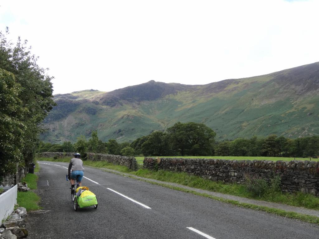
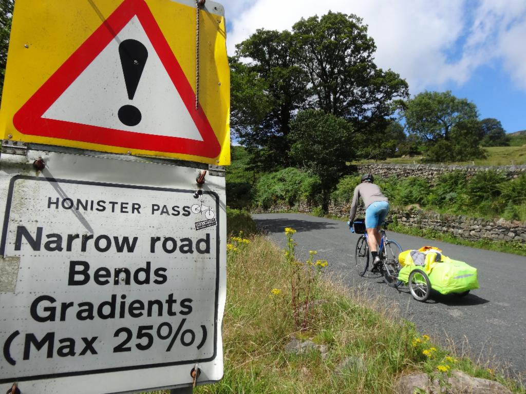
Day 5: It was a rainy night and morning. We slept long. After breakfast the rain seemed lighter. I folded the tent and we rode down to Keswick. We locked up the bikes, had a short stroll in the town and coffee with some sunrays. Bertrand was texting to his girlfriend non-stop. After 12.30pm we left and followed the almost flat road alongside Derwentwater. There was little traffic. There were a coupld of ups and downs only at the narrow section of Borrowdale valley before it opens up again. We had lunch at the pub in Rosthwaite. We had very good food and Bertrand could recharge his phone. At 14.15pm we continued. It stayed dry and we enjoyed even some sunny spells. The road was still flat, but suddenly there was a roadsign announcing 25%. Bertrand was excited and needed to take a picture because in the French Alps 12% is considered 'extremely steep' by cyclists. The steep section was quite long, so Bertrand had to give up and push his bike after a while. Even I, without trailer, had to fight hard. Finally the road became a bit flatter before the final turn up to Honister Pass, where an old mine serves as tourist attraction. It was 3pm when we rolled down on the other side, which seemed even steeper. The road meanders down a beautiful alpine valley between rocky faces. We stopped several times to take photos. At Gatesgarth we reached the south end of Buttermere lake. We had to climb up a bit again before a small stony village chapel announced Buttermere village. It was 4.30pm when we put our tent on the uneven camping site on other side of the brook. The grass was kept short by a few sheep. There were even more sheep next door who made quite some noise, but at least the views down to Crummockwater were nice. The tent could dry in the sun while we went to the small farm shop to ask how to pay, but they said the farmer will come next morning and collect the fees. After taking a shower we had dinner in the Bridge Hotel, which was completely full. We got the last table in the garden where felt a couple of rain drops.
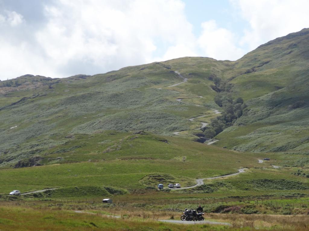
Day 6: The plan for the day was to hike up the Haystacks in the morning and then continue to Wasdale Head in the afternoon. I woke up Bertrand early. There were no clouds. We had quick breakfast and left after 7.30am by bicycle along the lake back to Gatesgarth. We had several photo stops for the nice views of High Stile reflected in Buttermere. We locked up our bikes and followed the small track to the end of the flat valley. Then we took the leftmost path. The path was quite devastated from waters flowing down the steep faces. We quickly gained altitude. At 9am we had already reached the plateau. There were some dark clouds around, but otherwise mostly sunny. We followed the path along the craggy north face of the Haystacks. After a photo stop at BlackTarn, we finally climbed the rocky summit. Even there were some pools. It was 10.15am. We enjoyed the nice panorama to Ennerdale, Buttermere and Crummockwater. After some scrambling, we encountered quite some people hiking up while we walked down the long traverse. Here the path was better maintained: the waters crossed the path in stony casings. We reached Buttermere after 11am. It was so nice and sunny that we stopped at the lake and I swam a bit with the ducklings. Back in the village at noon, we had coffee, cake and icecream at the farm café. There was still nobody there to pay so we finally gave the money to ladies at farm shop. While removing tent, the farmer came and asked for money. We sent him back to the café to collect it there. At 2.15pm we left and cycled along Crummockwater. After a short hill we took a shortcut to the road to Loweswater village. After a further hill we rolled steep down to cross river Cocker. After a stretch alongside Loweswater the landscape became more open. There were more isolated hills rather than long ridges. Soon later we turned left and climbed steep uphill to Lamplugh. From there we had our first view to the Irish Sea. After a pass we had a view down to Ennerdale. The weather was now really beautiful and sunny with only a few small clouds. Via Croasdale we reached Ennerdale bridge. It was 4.15pm and we continued right away steep uphill onto the next grassy plateau. There were thousands of sheep and planted trees on the Dent hill. There was quite a lot of traffic. Finally we had a view to the nuclear power plant at Sellafield and far behind in the sea the mountainous Isle of Man. A long steep downhill led us to Calder Brigdge. It was unavoidable to ride on the A595 with lots of heavy traffic. After many ups and downs we arrived at Gosforth. It was almost 5.30pm. We bought some stuff for the next two days in the grocery before we followed a small, quiet road with steep uphill sections to Nether Wasdale. Suddenly we left the woods and arrived at Wastwater, probably the most alpine lake of the Lake District with its steep, cragged south shore. There were lots of sheep around and quite a lot of shit on the road. Finally the road went more down. So, we arrived at 7pm at Wasdale Head. There were two campsites. We took the small one at Wasdale Inn for two nights and put the tent next to blackberries. We immediately headed to the garden of the pub for burger and beer after this wonderful day. We had long conversations due to the lack of telephone network coverage.
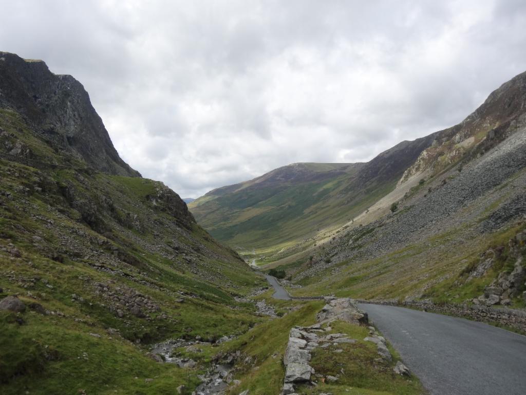
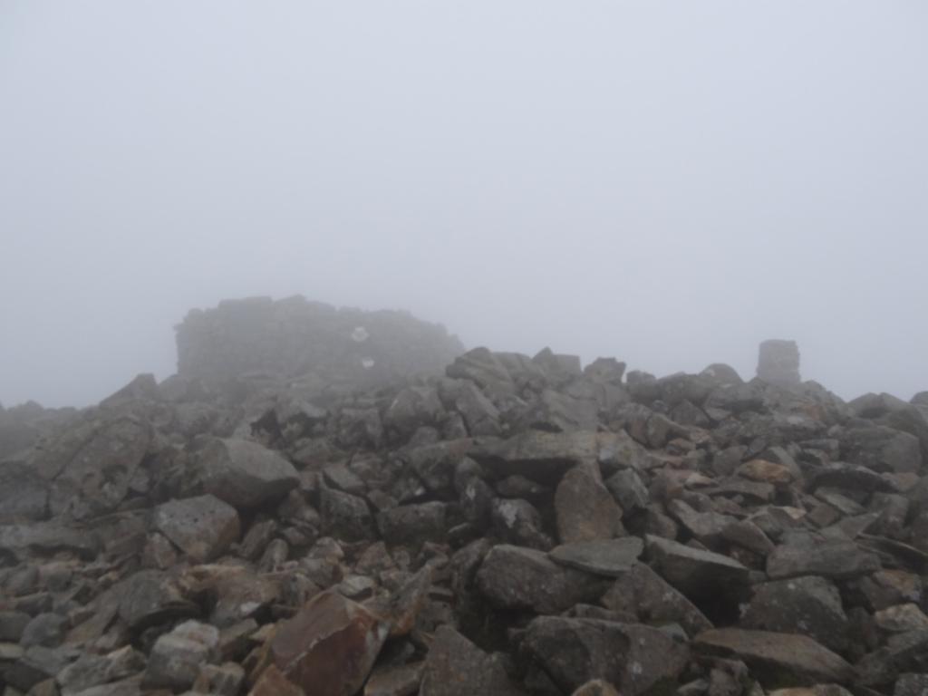
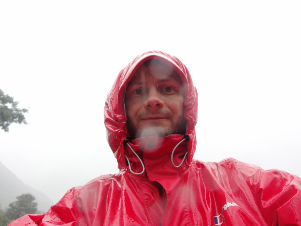
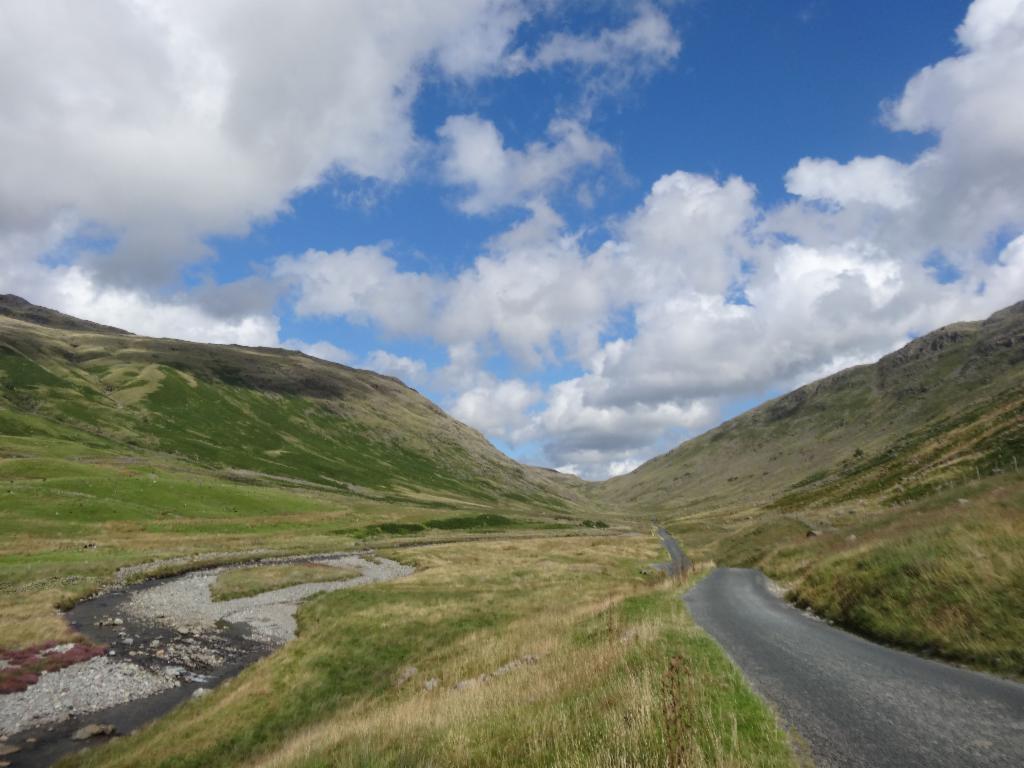
Day 7: As a third hiking trip we planned to climb Scafelle Pike, the highest summit of England. In the morning the sky was covered. We had quick breakfast and left at 8.15m. We took the path that traverses the west face of Lingmell and joins the paved main path to Scafell Pike that starts at the National Trust campsite. The path was steep and efficient following the Lingmell Gill brook. It led straight up to Mickledore pass between the craggy north faces of Scafell Pike on the left and Scafell and the right. There were quite some people in front of us. Over rubble we reached a chimney thorugh which we scrambled up to the pass. It was 10am. We had a view down into Eskdale valley, towards the impressive rocky east face of Scafell, and Lord's rake, a slippery, stony scramble that allows to climb Scafell from Mickledore pass. The clouds looked increasingly threatening and slowly engulfed the summits. We continued to the summit following cairns through endless stone fields. Unfortunately, the summit was already in the clouds at 11am. There was a huge stone cylinder on summit. It was quite cold and windy. Quite some people were sitting around and waiting for better weather. We found a less windy spot for lunch, but the weather become more and more foggy. I convinced Bertrand that it would be better to take the other way on the east face down. We left towards 11.30am hiking from cairn to cairn because there was no visibility at all. After the first steep section we met a couple who were searching for the right way. After having climbed over another summit we followed a long traverse where the visibility became gradually better. But now we felt some raindrops as we lost altitude down to Esk House. The view down into Borrowdale was open now. We hiked down along deeply cut brooks to Sprinkling Tarn. There was no rain and no wind, almost some sunrays. So we decided to take a short nap, but after a few minutes raindrops hit us again. So we continued to Sty Head pass, when a huge black cloud came across Lingmell with its impressive canyon of Piers Gill. The raindrops intensified until it could clearly be called rain and soon thereafter it was raining cats and dogs. Bertrand was a bit slower. I continued fast down the paved path, but all my clothes were nonetheless wet within seconds. Down in the valley, water was flowing on the dirt road and in the meadows. It was difficult to avoid that water ran into the shoes from above. I waited at a wooden church. When the rain became less torrential, Bertrand arrived. We went directly into the pub at 2pm for tea and cake to warm up again and to dry our clothes. Later in the afternoon it stopped raining. I took a warm shower while Bertrand went on a short bike trip towards Nether Wasdale to send some text messages.
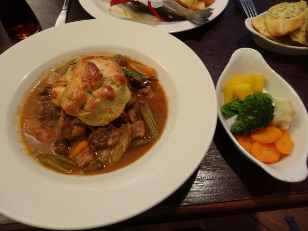
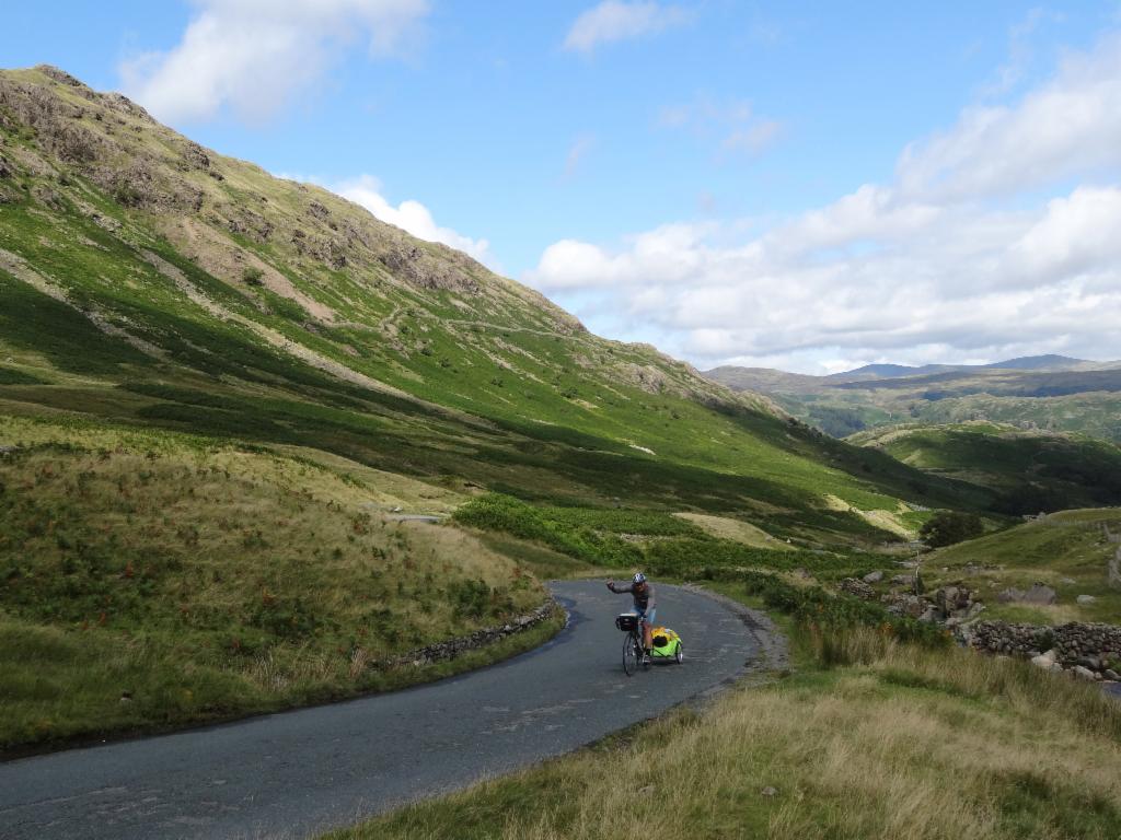
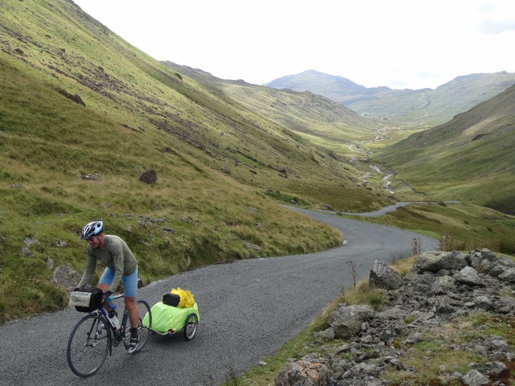
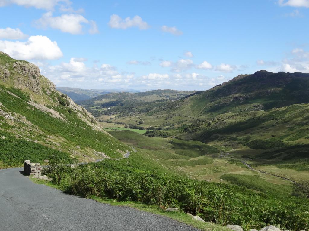
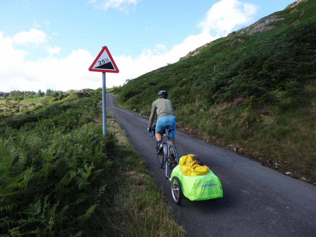
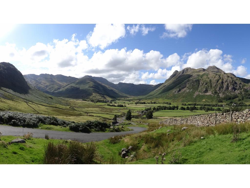
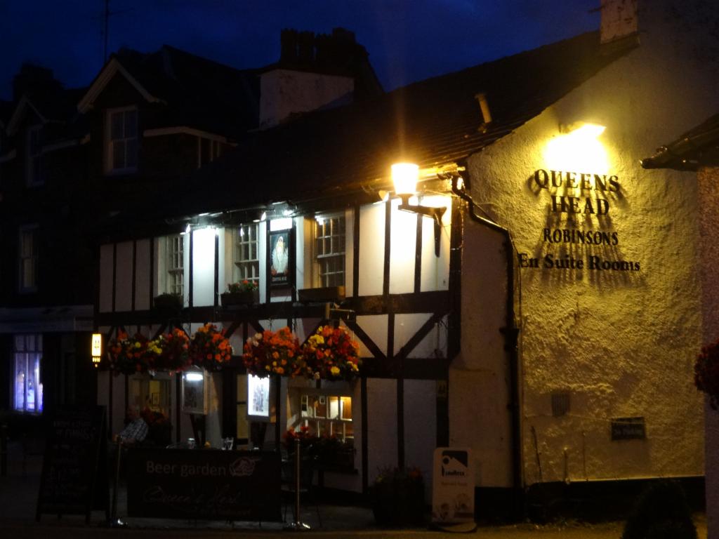
Day 8: The morning clouds were hanging deep in the valley, but it looked brighter in general. After breakfast we packed our wet stuff and left towards 10am up and down with some raindrops to Santon Bridge. From there we climbed over a small pass to Eskdale Bridge. There we found a grocery where we bought some food for lunch. We continued towards 11.30am. The 30% gradient road over Hardknott Pass was considered too tough for Bertrand's trailer, so we opted for the longer tour via Ulpha. It was a bit sunny now. The climb onto the plateau was also not easy, but we had nice views to the Scafell mountains again surrounded by threatening dark clouds. The road continued climbing further up before we could relax on the downhill getting steeper and steeper down to Ulpha. After 12.30am we cycled upstream in this beautiful valley with almost no traffic. It was really sunny now. We stopped after a narrow section of the valley to eat something. Shortly afterwards we reached Seathwaite where we got coffee. From there the road started climbing slightly more. After an old stone bridge, we had finally a free view to the end of the valley that one could describe as a nice alpine landscape. The Hardknott Pass road was coming down on the left and the road to Wrynose Pass was climbing up on the far right. Some cars and motorbikes were coming down Hardknott pass. The climb up to Wrynose pass was almost tougher than Honister Pass. It was at the very limit for Bertrand. It was 3pm when we rolled down the steep hill into Little Langdale. We stopped in the middle to cool down the brakes. There were also many nice photo spots. Since we hadn't had enough passes yet, we climbed up over the next 25% gradient road to Blea Tarn, from where we enjoyed a beautiful view down Great Langdale with its nice green fields enclosed by craggy summits. It would have been nice to go hiking here, but there wouldn't be enough time on the next day when we would have to cycle all the way to Kendal. Hence we changed plans and continued down the valley via Elterwater. This was clearly the more touristic part of the Lake District. After Skelwith Bridge we climbed gently uphill via Barngates and Outgate and further down to the huge Hawkshead Hall campsite that we reached towards 5.30pm. It was quite full, but we found a spot on the fields nearby. We quickly rode to the village to buy some stuff for breakfast. After a luxurious shower we cycled back into the village at 7pm for an even more luxurious dinner at Queen's Head with huge steaks and a bottle of St-Emilion. We sat in the garden - a couple of raindrops could not disturb the excellent food there.
Day 9: After a rainy night, there morning was also rainy. The clouds were low-hanging and there was no sun. We packed our stuff and left before 9am. We rode quite fast alongside Esthwaite Water. The rain discouraged any photo stops. After a little pass we took the ferry to Bowness-on-Windermere. We were looking for a place to get some tea or coffee, but there was nothing sufficiently inviting. Hence we continued a steep hill upwards on the B5284. The rain was getting heavier and heavier. Finally, we rescued ourselves into the Wild Boar Inn at 11am, a luxury inn with leather armchairs and fake old-style wooden interior. We asked for a little thing to eat. They hesitated a bit, but then we got some sandwiches with salad and crisps, and a pot of tea. We warmed up again. At noon it was still raining, but a bit less. So, we decided to continue. The road led straight up and down over wavy hills. Dense traffic made this a less uplifting experience. Finally we rolled down into Kendal. It was not easy to find our way out of the town. Faster than expected we reached the train station of Oxenholme on the west coast mainline at 12.30pm. There was enough time. So we continued a bit further uphill to the Station Inn. We had to wait some time until they took our order and similarly long until we were allowed to pay, but before 2pm we were back at the train station. We bought tickets: Bertrand via Carlisle to Newcastle and me via Lancaster and Wolverhampton to Oxford. The staff was very friendly. We quickly split our baggage. I had to change trains twice, which was not easy because there were so many people on the platforms. I arrived in Oxford at 7pm.
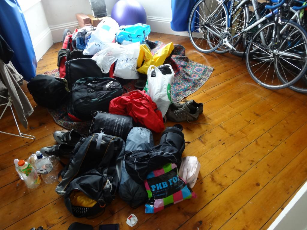
Will all this baggage fit onto our bicycles?
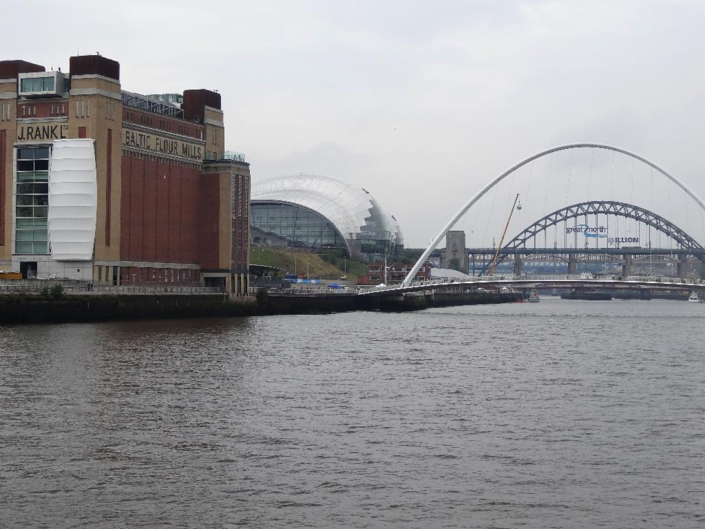
Newcastle upon Tyne
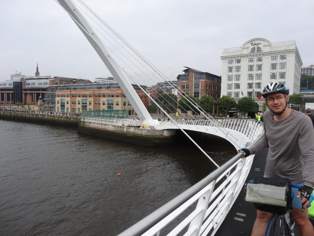
Bertrand on the Millennium Bridge
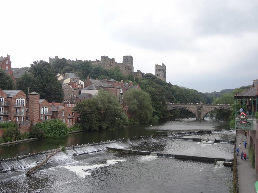
Durham city from the Millburngate Bridge
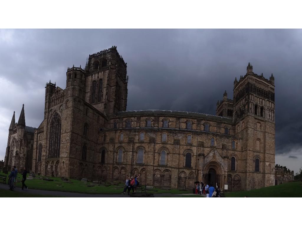
Durham Cathedral before the thunderstorm
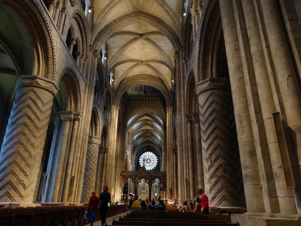
Central nave, Durham Cathedral
Durham Cathedral next morning
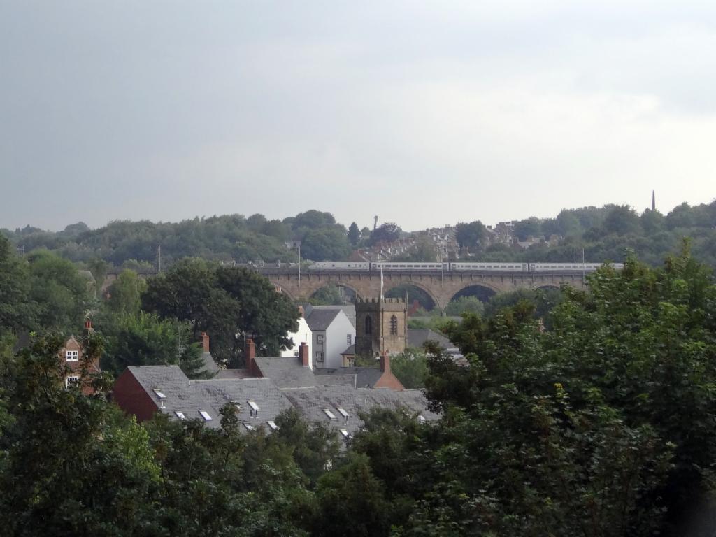
Durham railway viaduct
B6301 at Hedleyhill, view towards the west
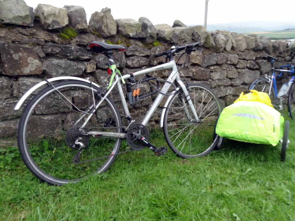
Bicycles and trailer
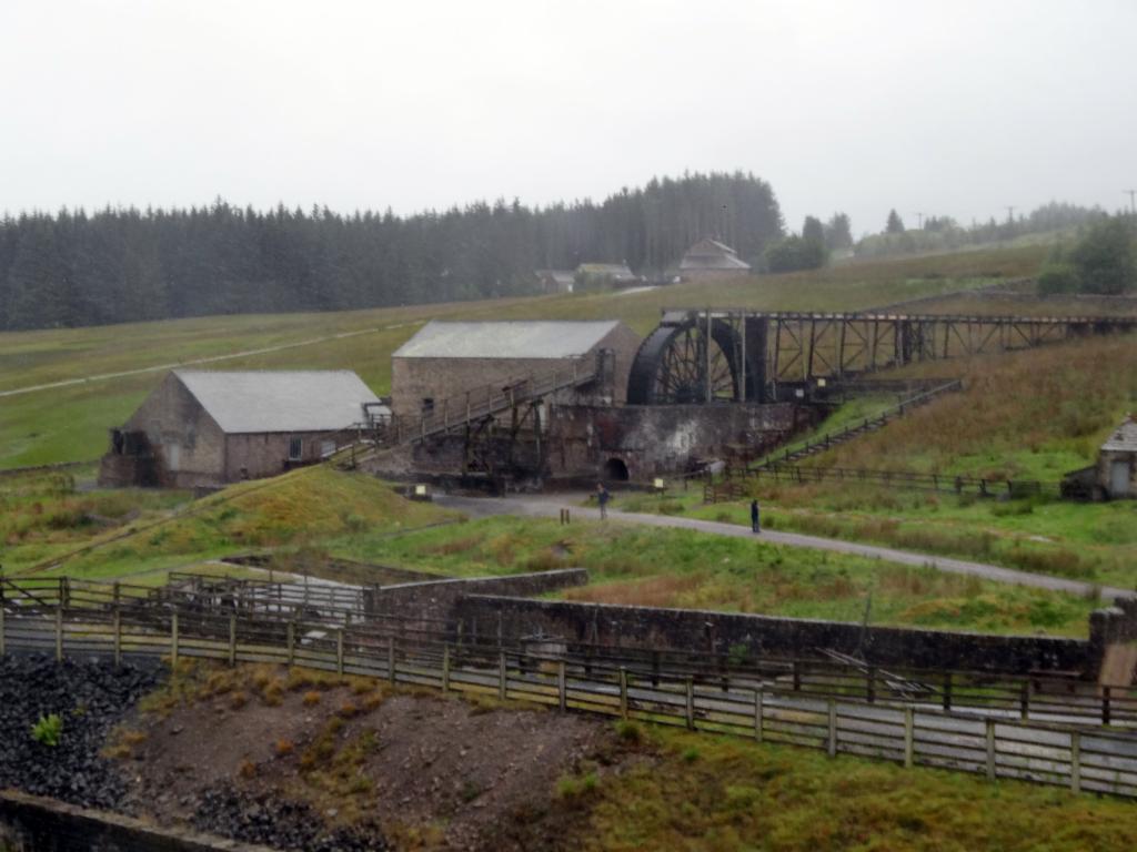
Killhope Lead Mining Museum
View from Killhope Cross eastwards
View from Killhope Cross westwards
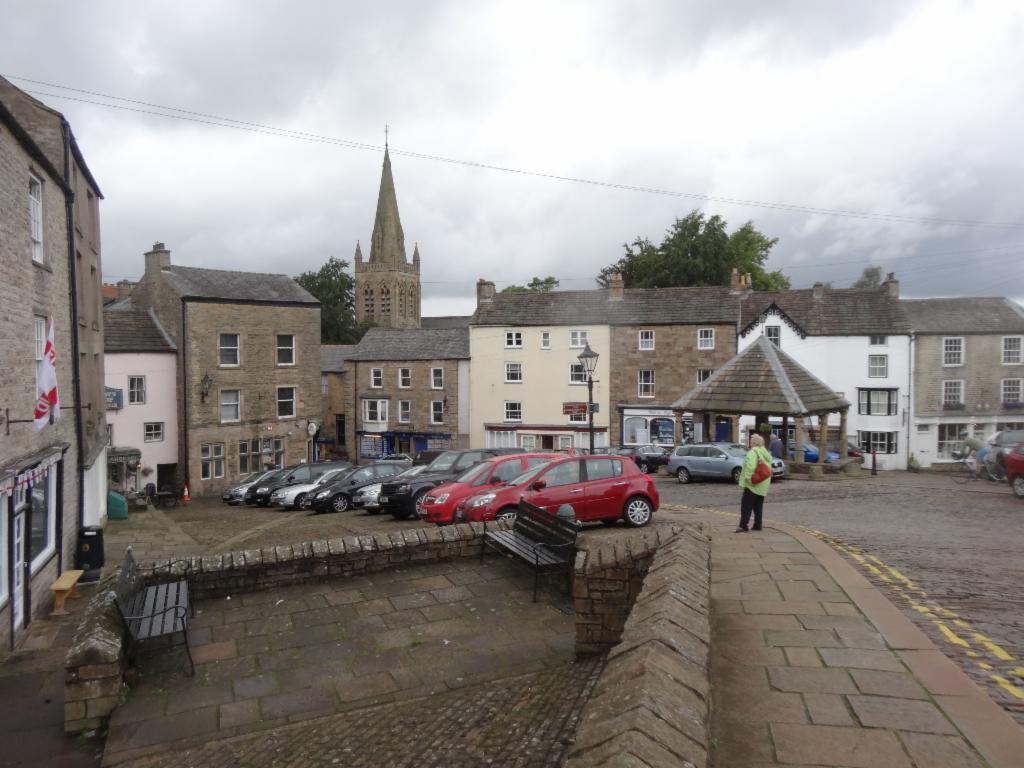
Alston
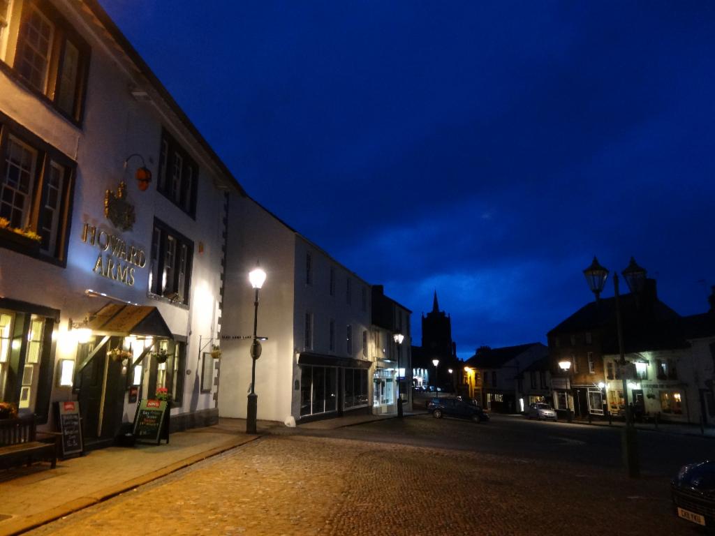
Howard Arms at Front Street, Brampton
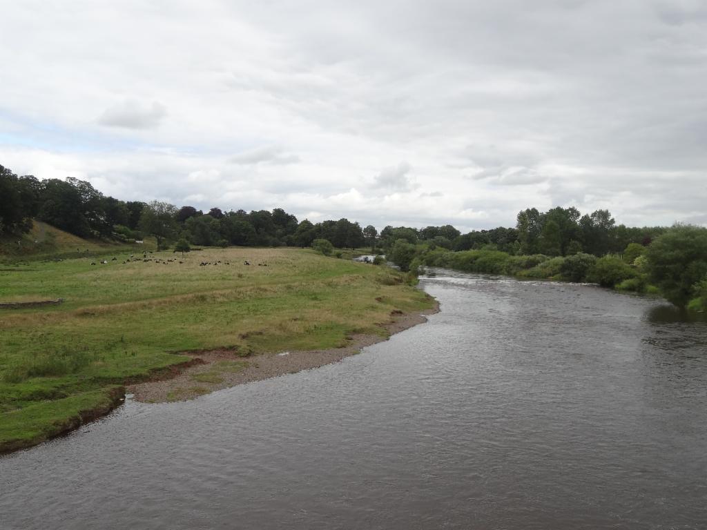
Eden River upstream of Carlisle
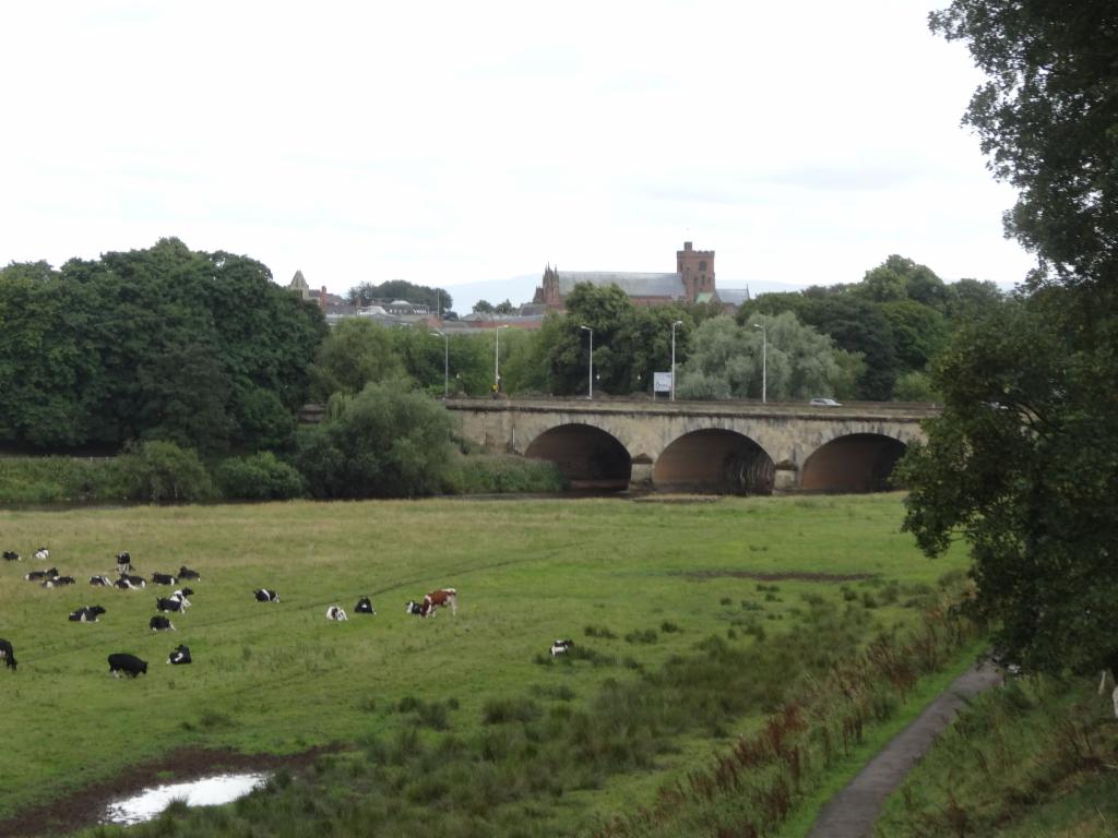
Approaching Carlisle
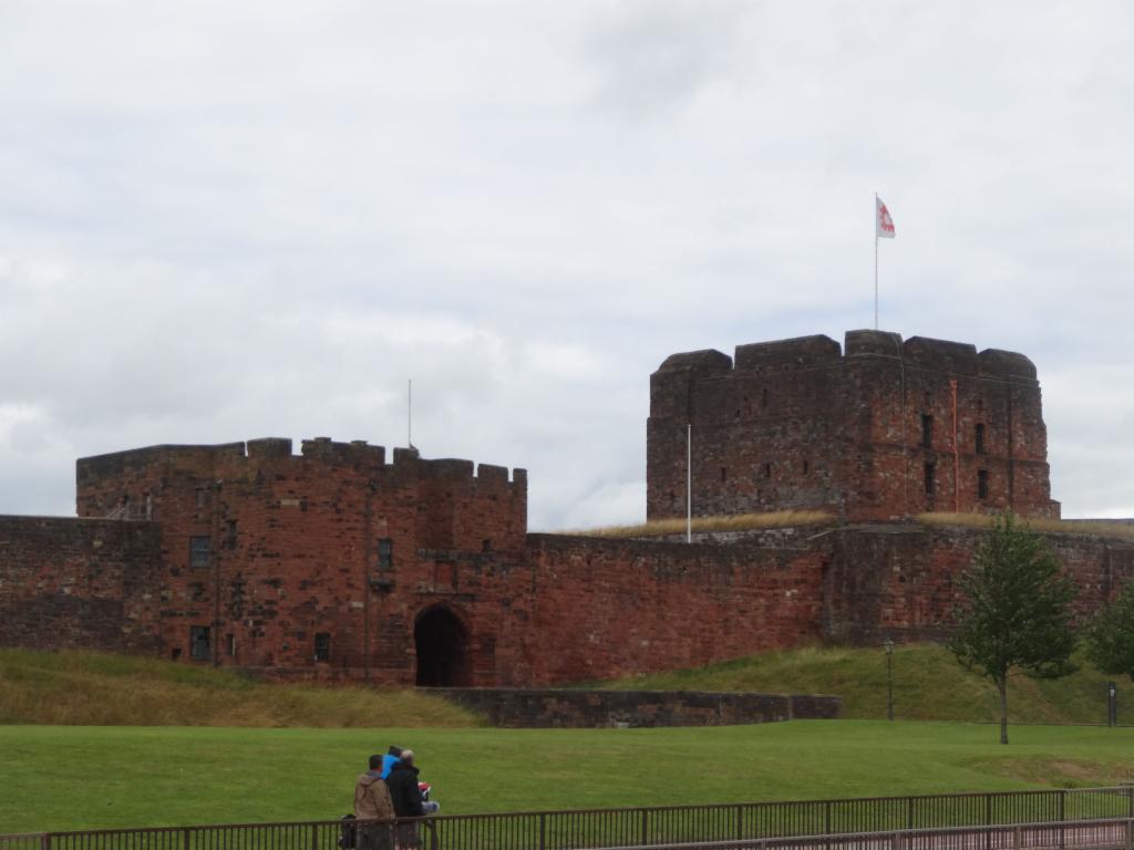
Carlisle Castle
Carlisle Cathedral
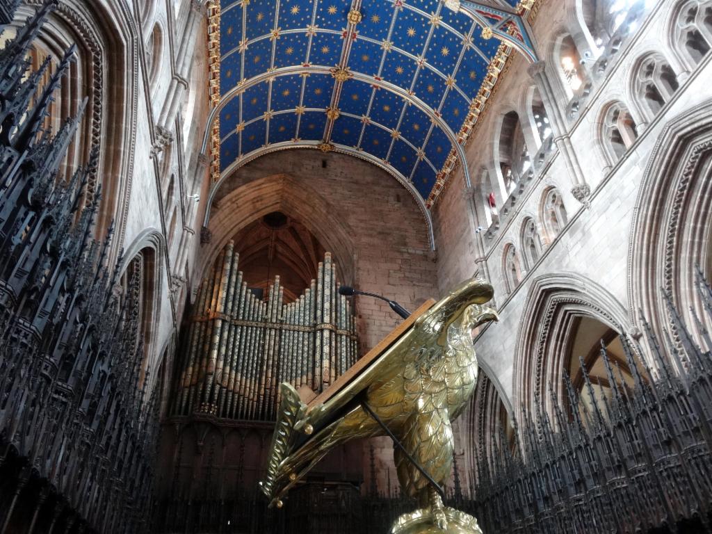
Unusual interior of Carlisle Cathedral
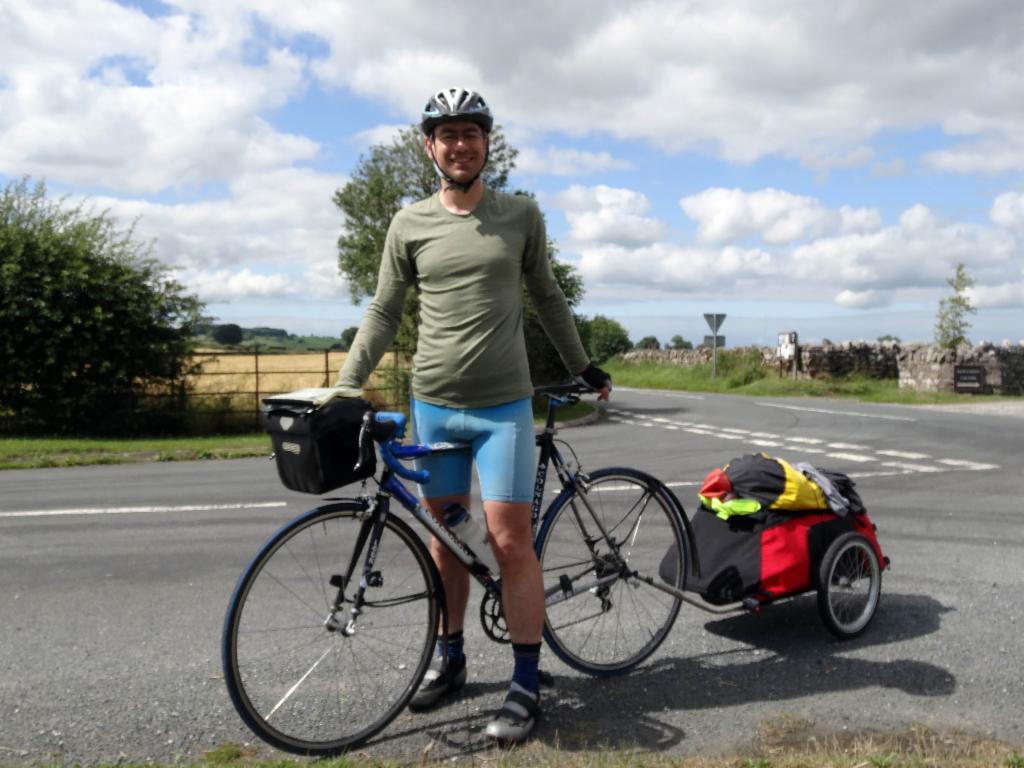
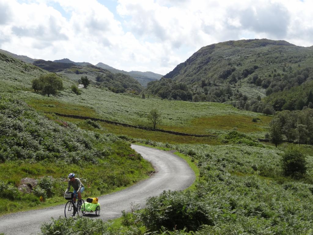
Bertrand pulls the heavy load.
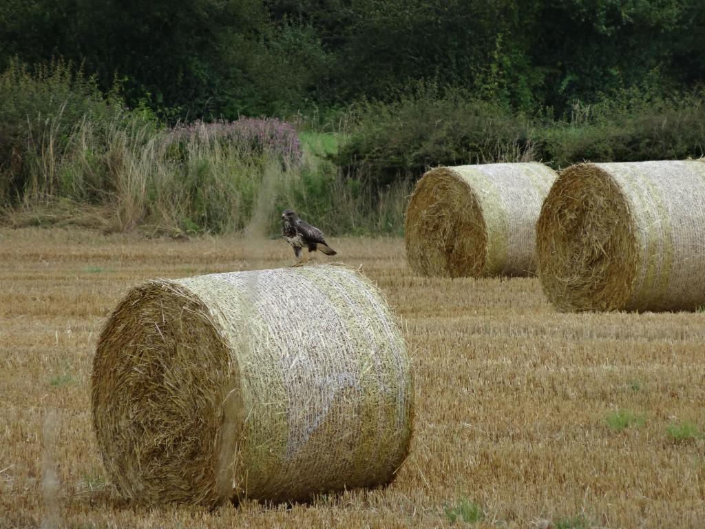
Buzzard near Blencow
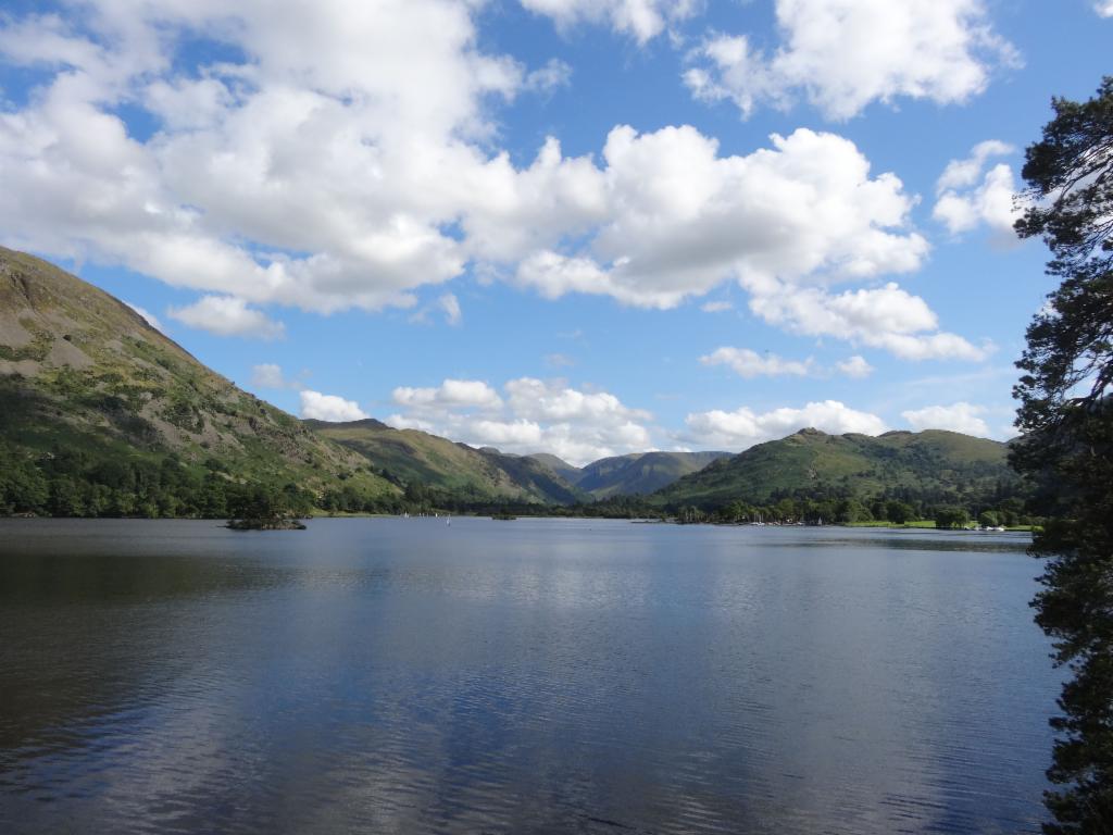
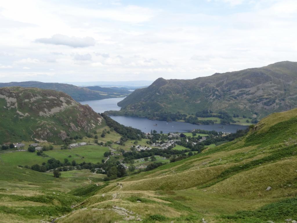
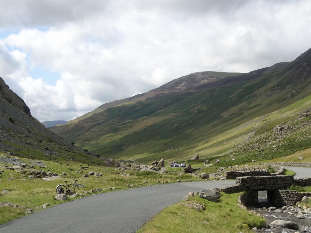
Ullswater, approaching Glenridding
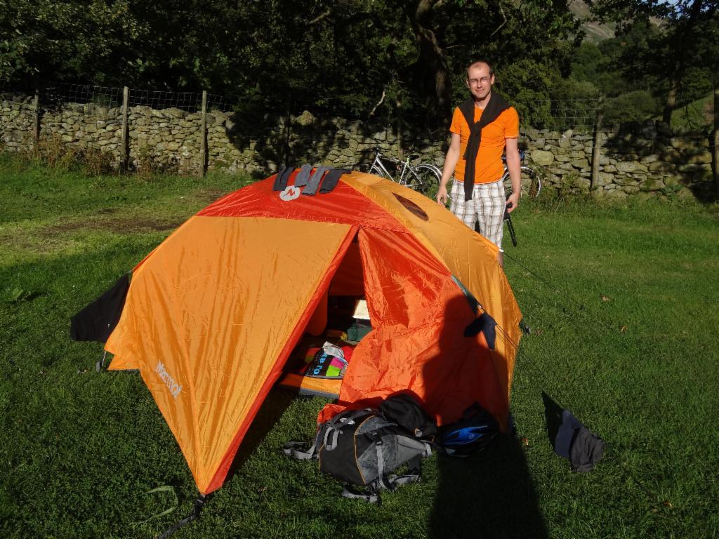
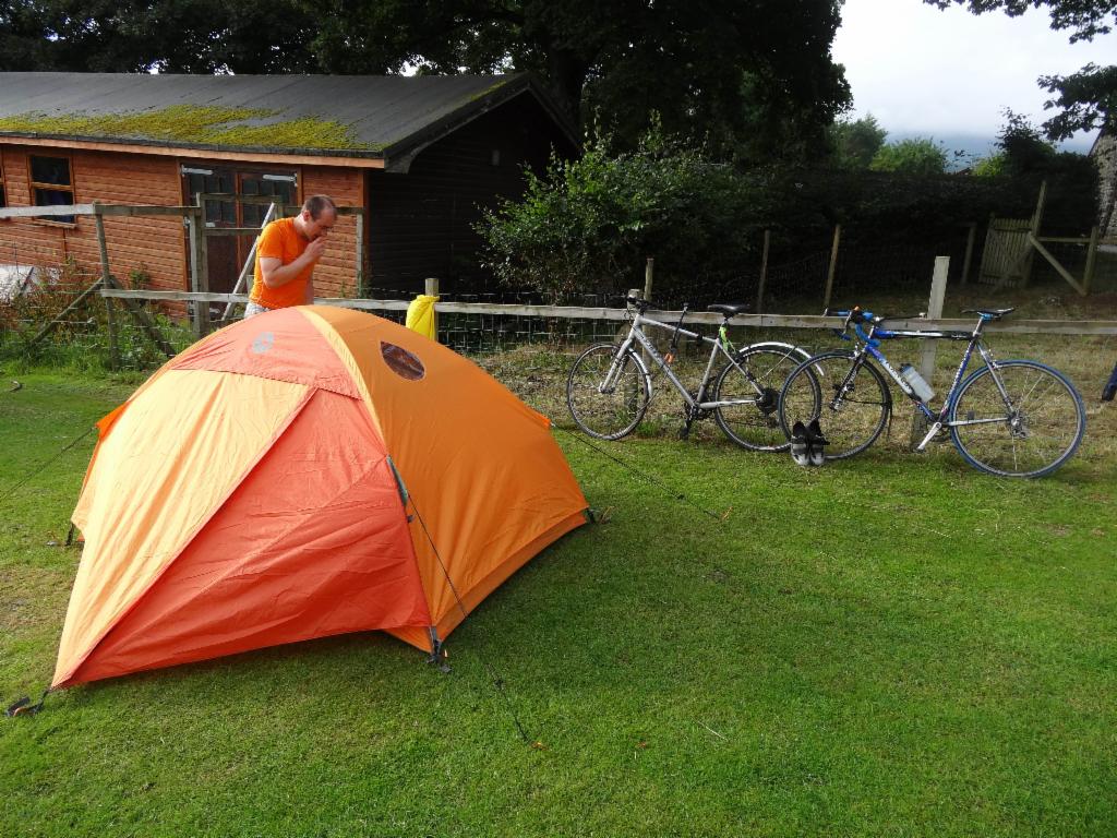
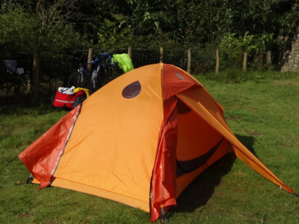
Finally dry conditions: First time we set up the tent at Gillside Camping, Glenridding.
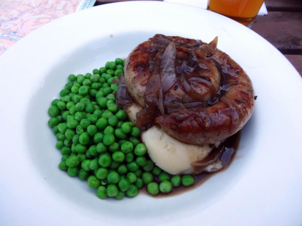
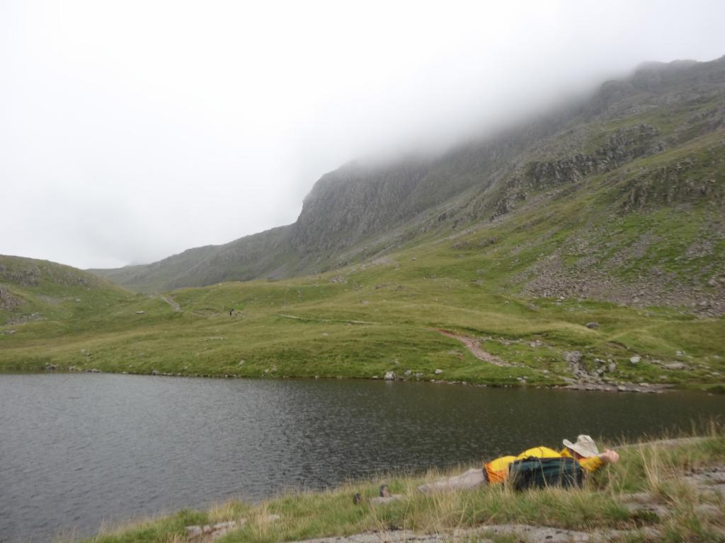
Dinner in Glenridding
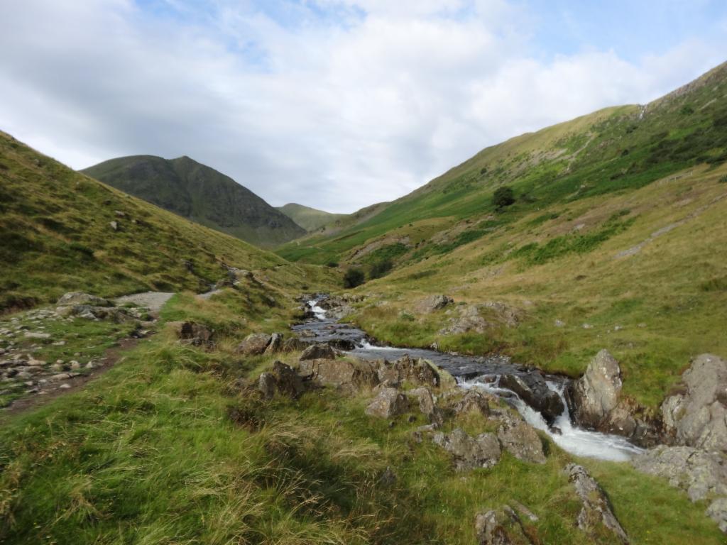
Towards Red Tarn
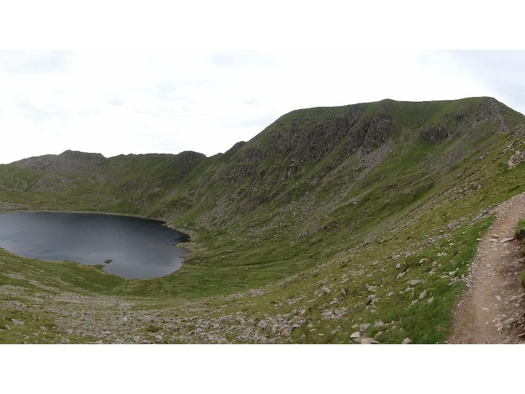
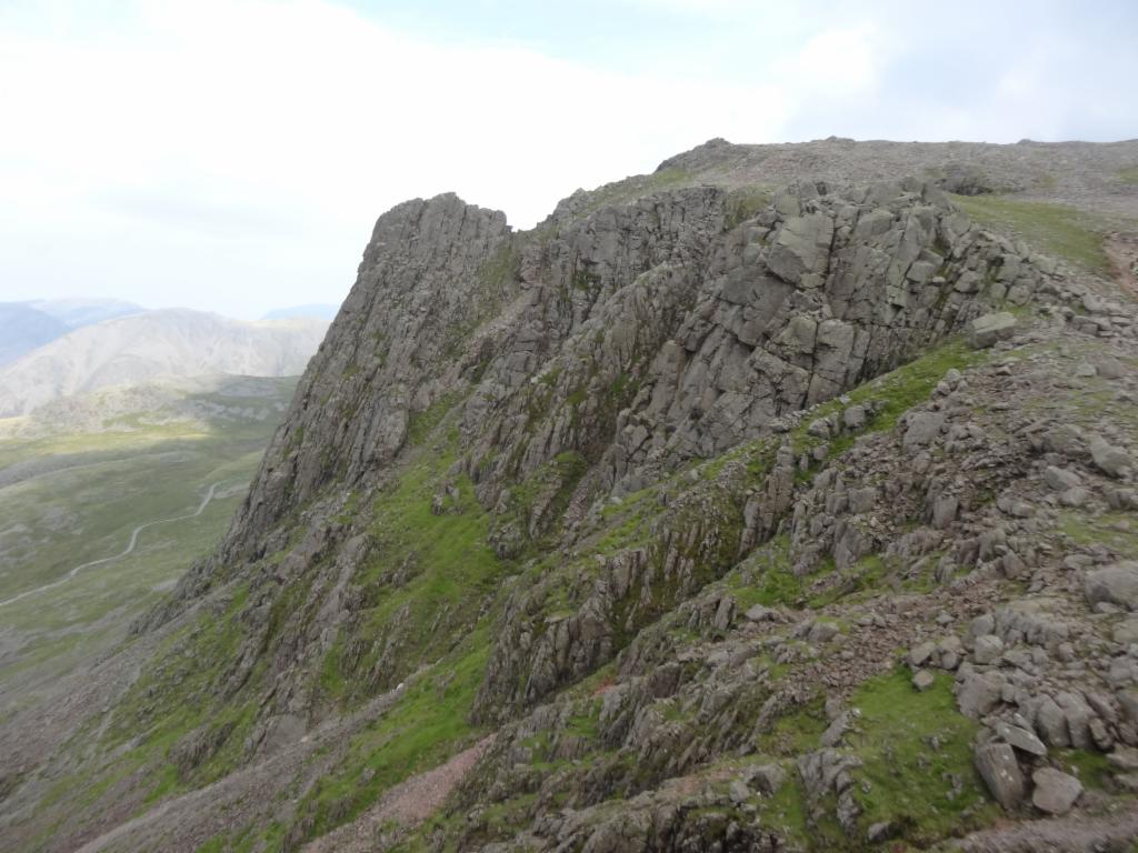
Striding Edge, Red Tarn, Helvellyn and Swirrel Edge
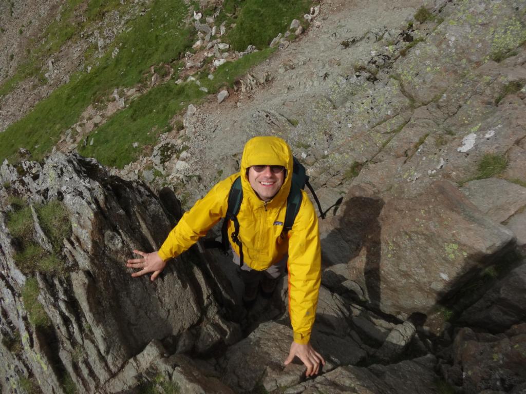
Swirrel Edge
Scrambling on Swirrel Edge
On the summit
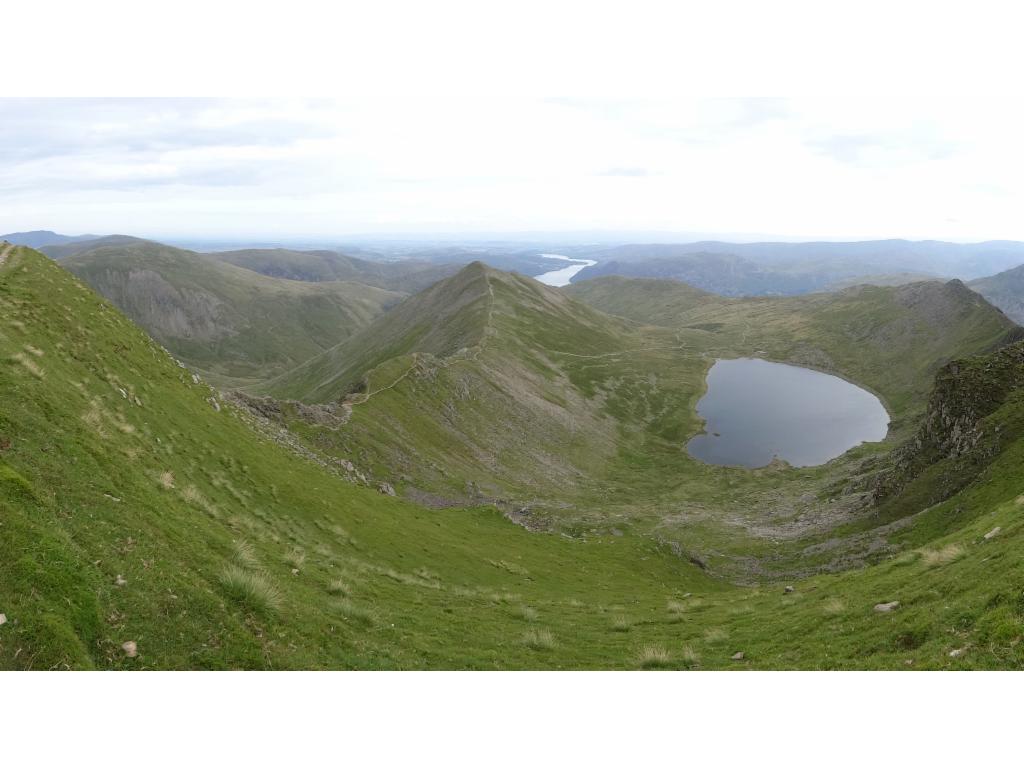
Ullswater and Red Tarn from the summit
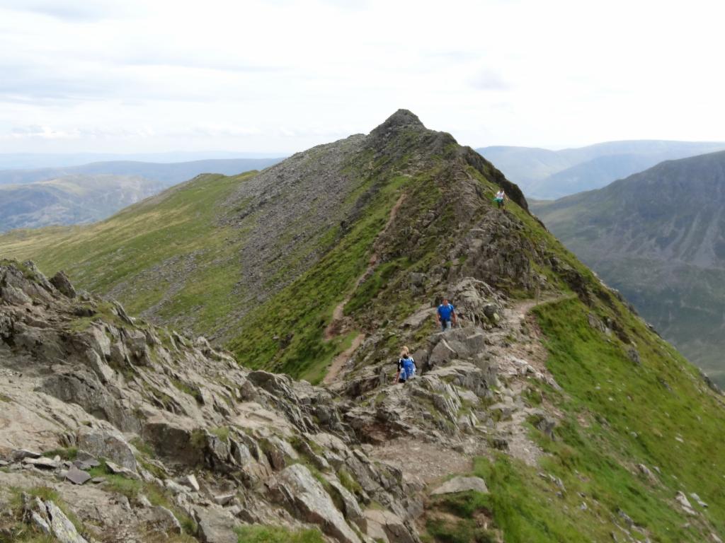
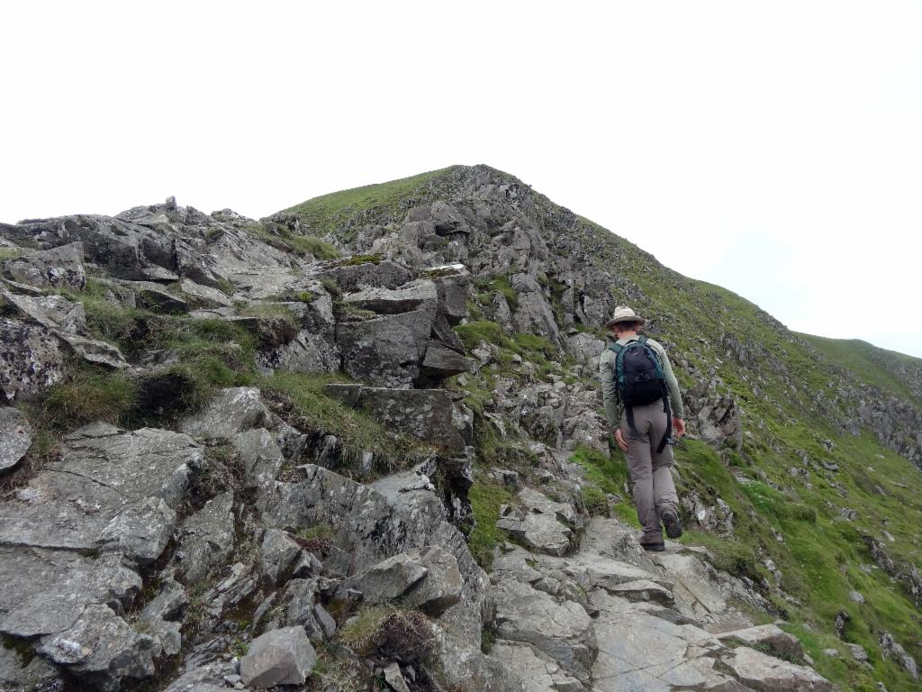
Hikers on Striding Edge
Scrambling on Striding Edge
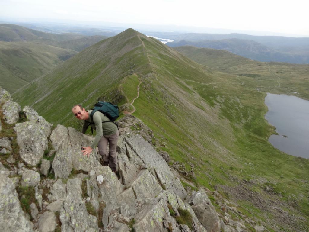
Looking back to Striding Edge
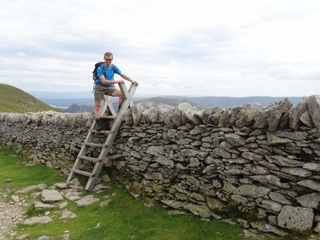
Crossing the stone wall
Descending to Glenridding
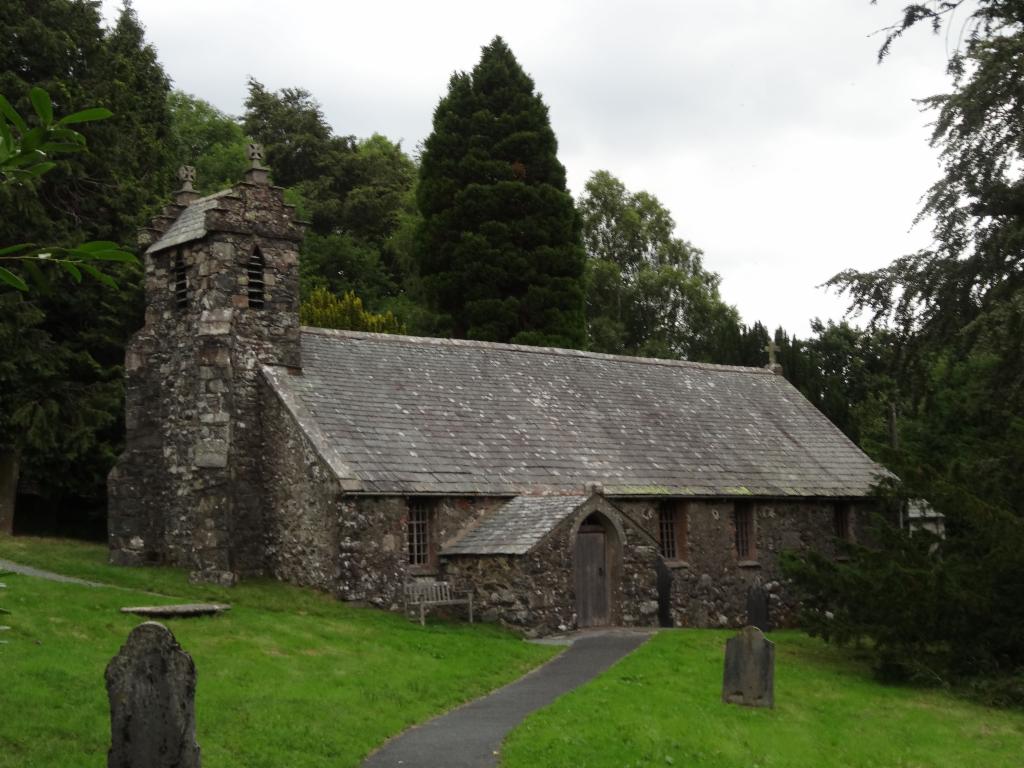
Matterdale Church
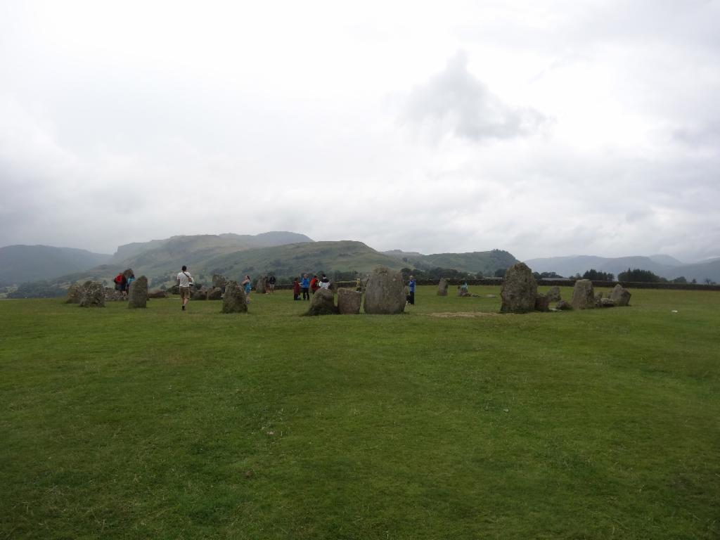
Castlerigg Stone Circle
At Castlerigg Campsite
Derwent Water from Castlerigg
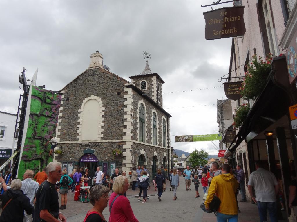
Lake Road, Keswick
Lunch in Rosthwaite
Still flat in Borrowdale
End of the flat section
Bertrand fighting his way up
Descent from Honister Pass
Beautiful valley down to Gatesgarth
At Syke Farm camp site
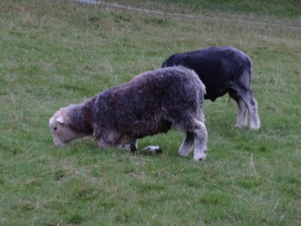
Kneeling sheep on the camp site
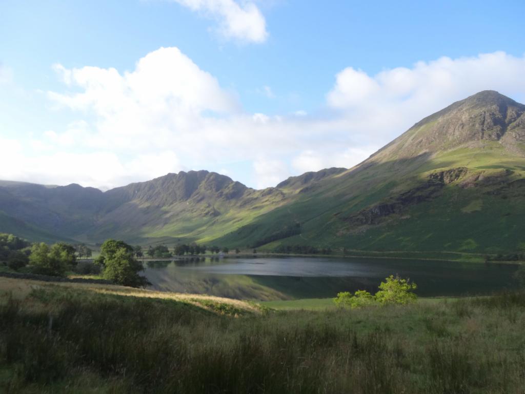
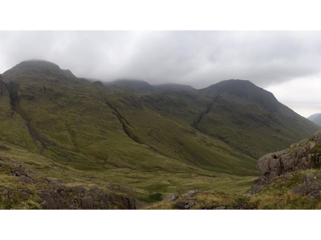
High Crag and High Stile from Gatesgarth
Haystacks and High Crag from the road to Gatesgarth
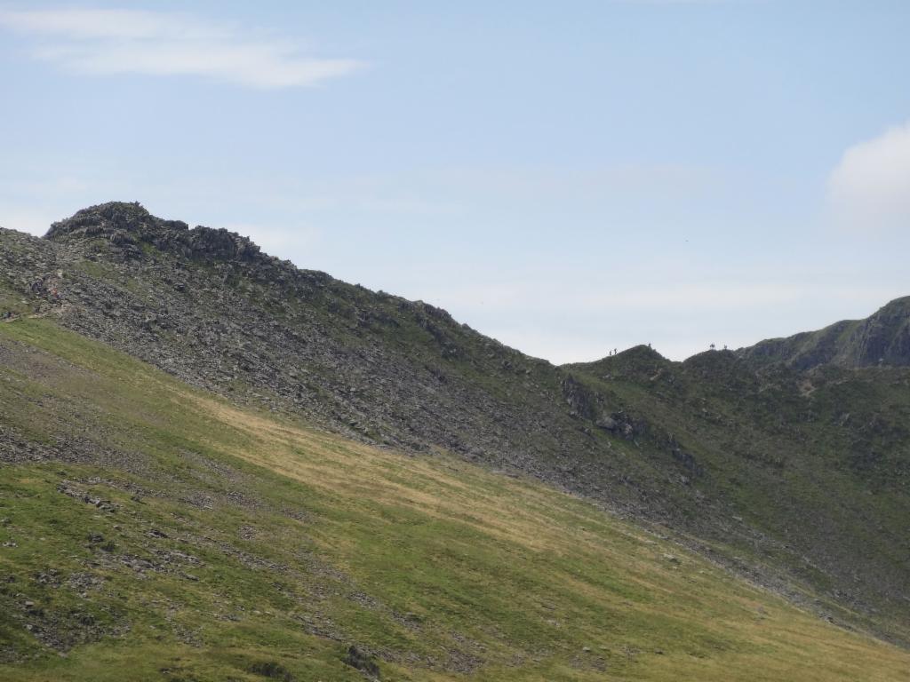
Haystacks from the ascent
Path along the edge of the plateau to the summit
Idyllic tarn on the plateau
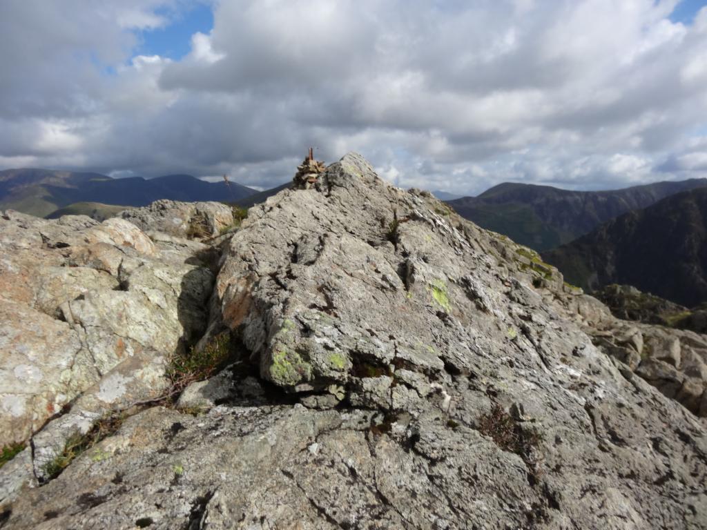
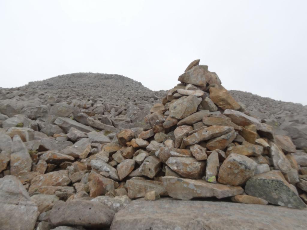
Summit of Haystacks
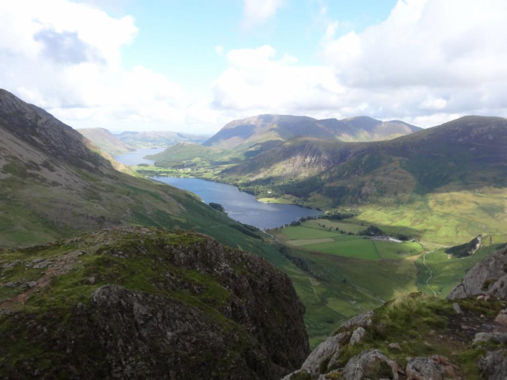
Crummock Water and Buttermere from the summit
Fleetwith Pike, Warnscale Bottom and Haystacks
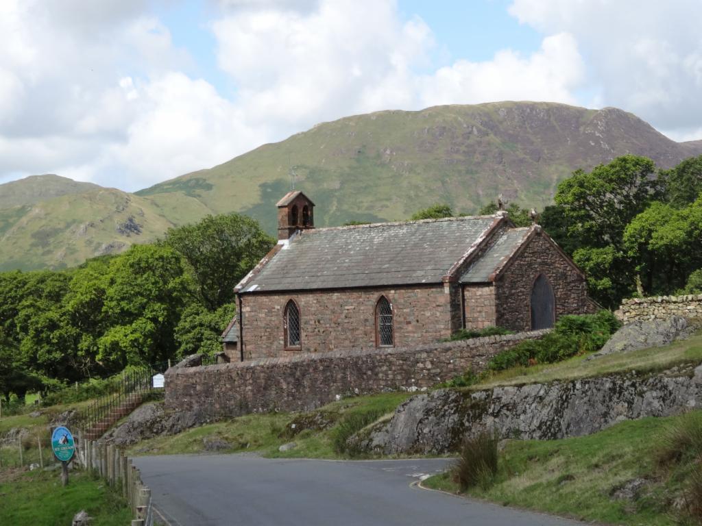
Buttermere Church
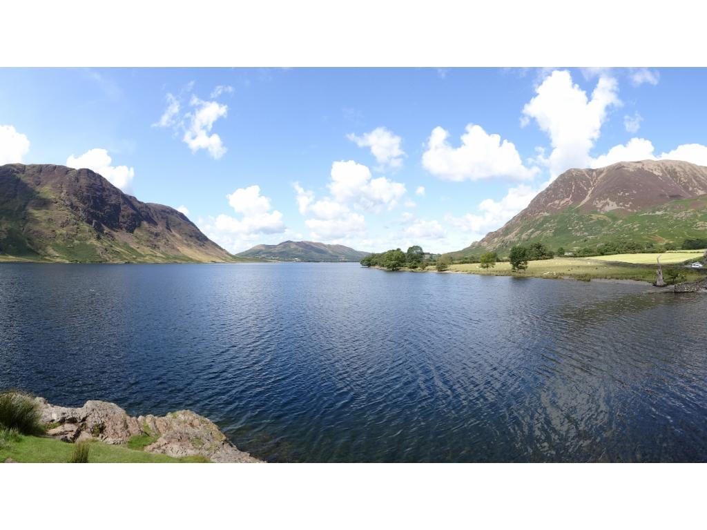
Crummock Water
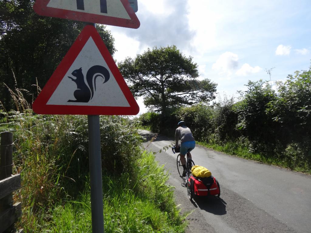
Beware of squirrels on the way towards Loweswater
Loweswater
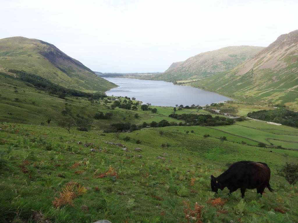
Ennerdale Water
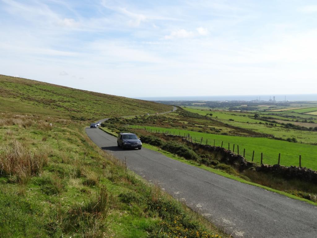
Road across Blakeley Moss
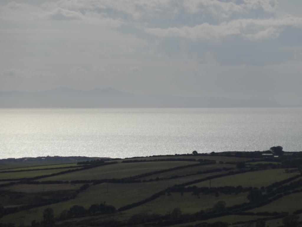
Isle of Man from Blakeley Moss
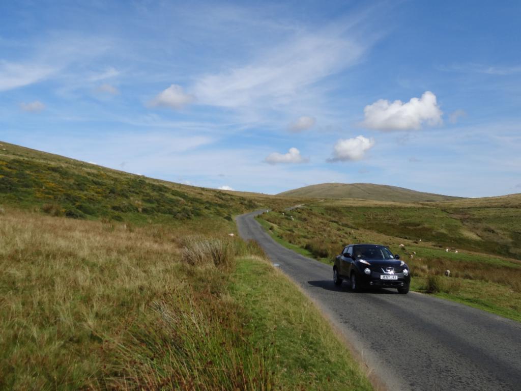
Road down towards Sellafield
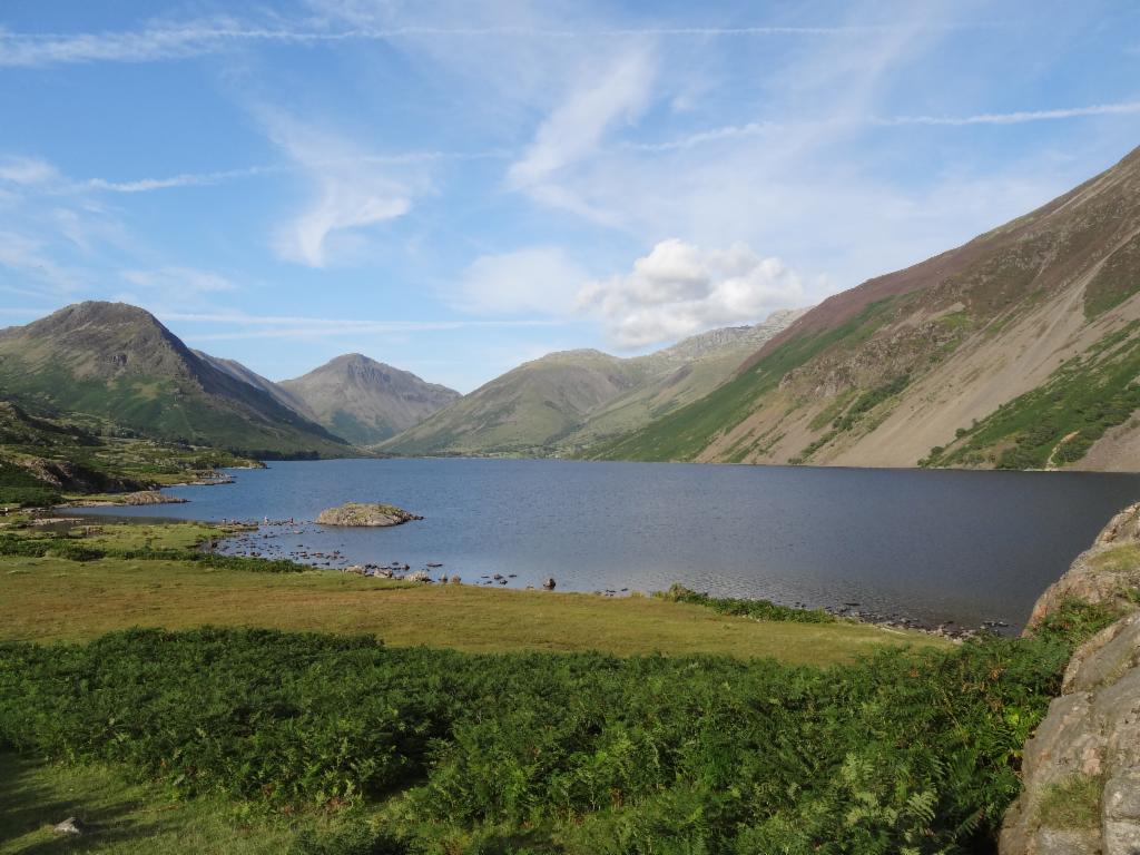
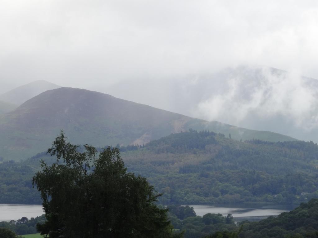
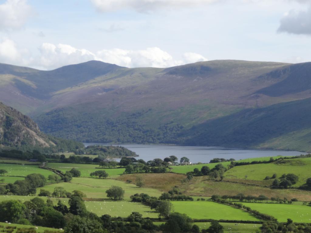
Wast Water towards Wasdale Head
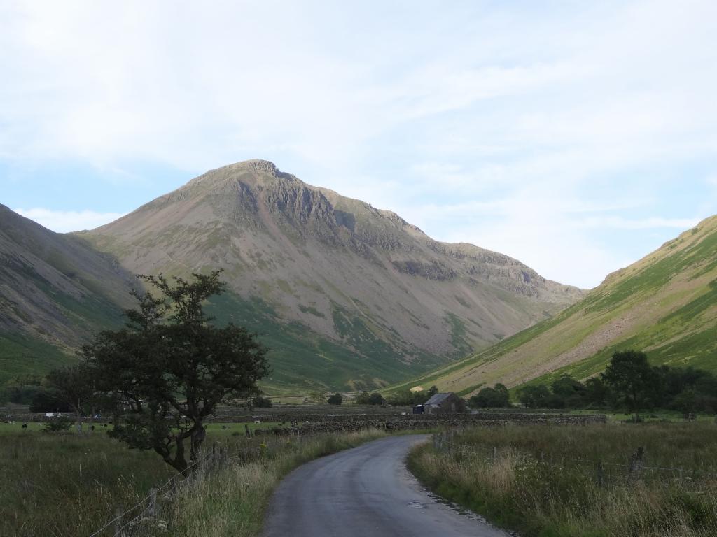
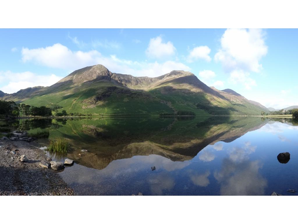
Great Gable from Wasdale Head
Wast Water from the ascent to Scafell Pike
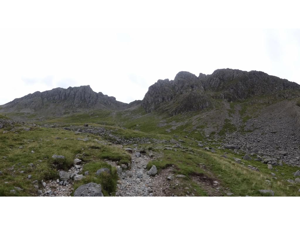
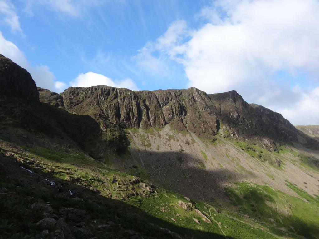
Scafell Pike and Sca Fell
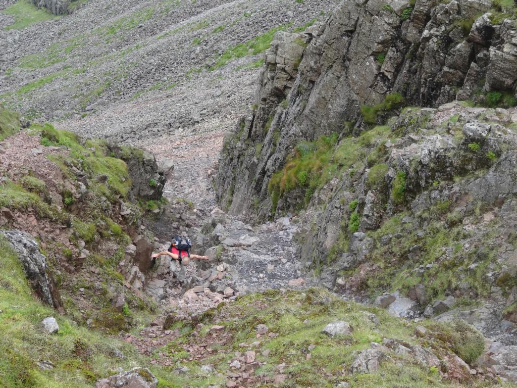
Gully to Mickledore
West face of Scafell Pike from Mickledore
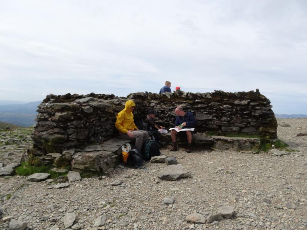
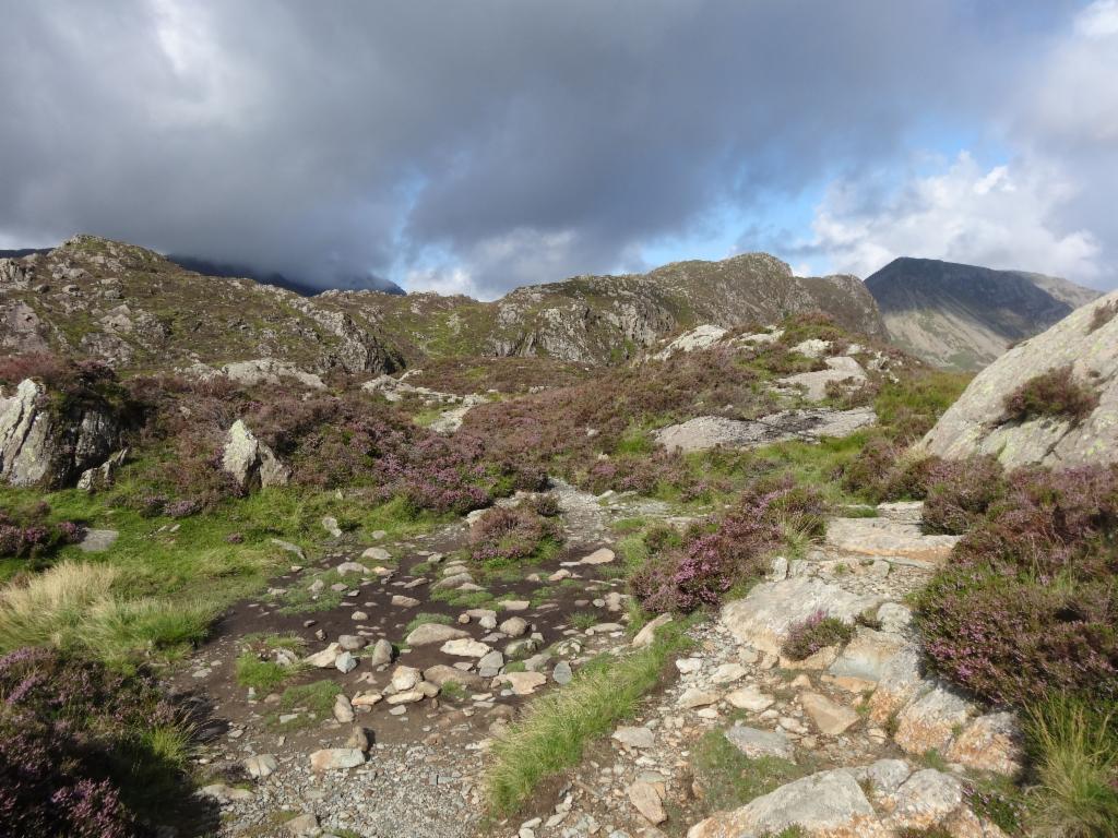
Cairn showing the way across the summit desert
Approaching the summit
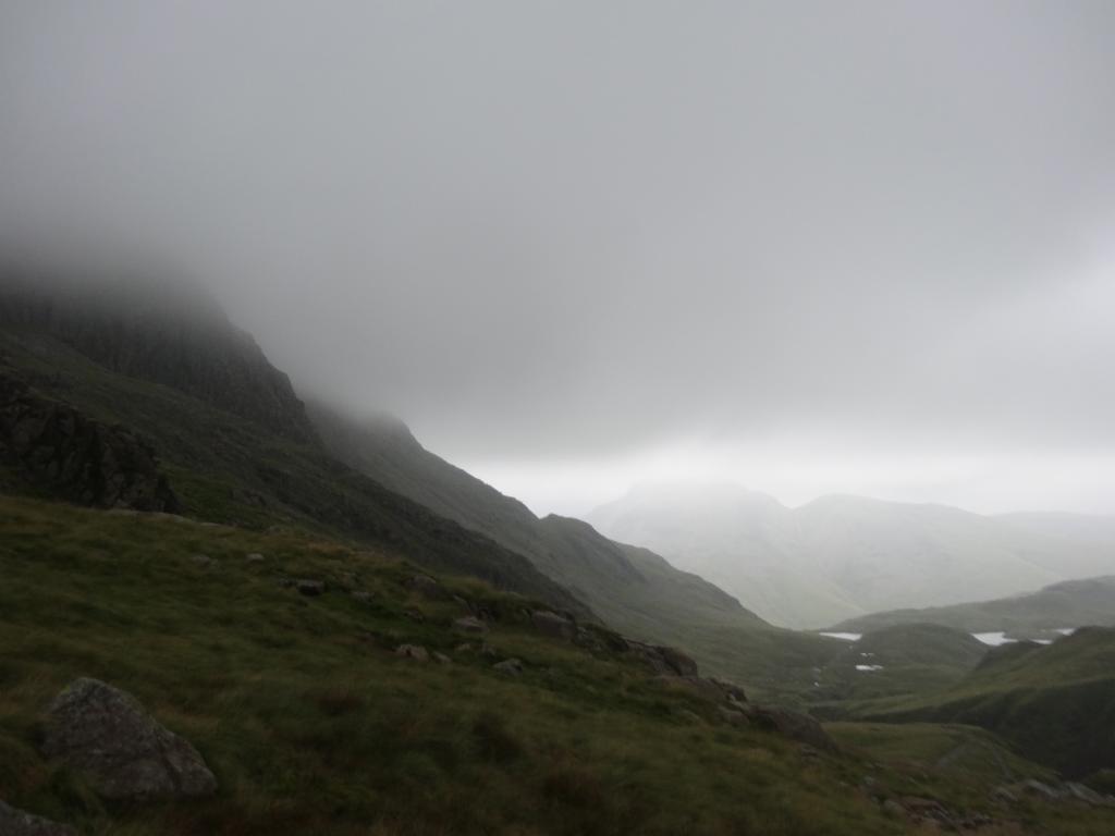
View from Esk Hause towards Great Gable
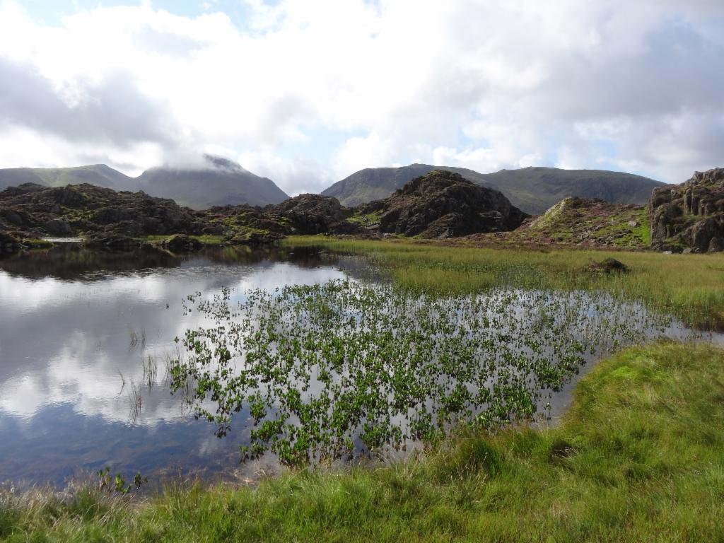
Nap at Sprinkling Tarn
Broad Crag from Sty Head
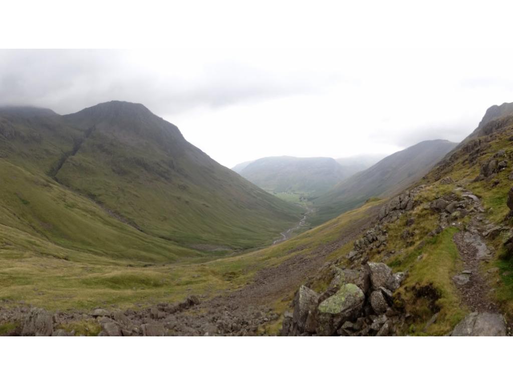
Descent to Wasdale
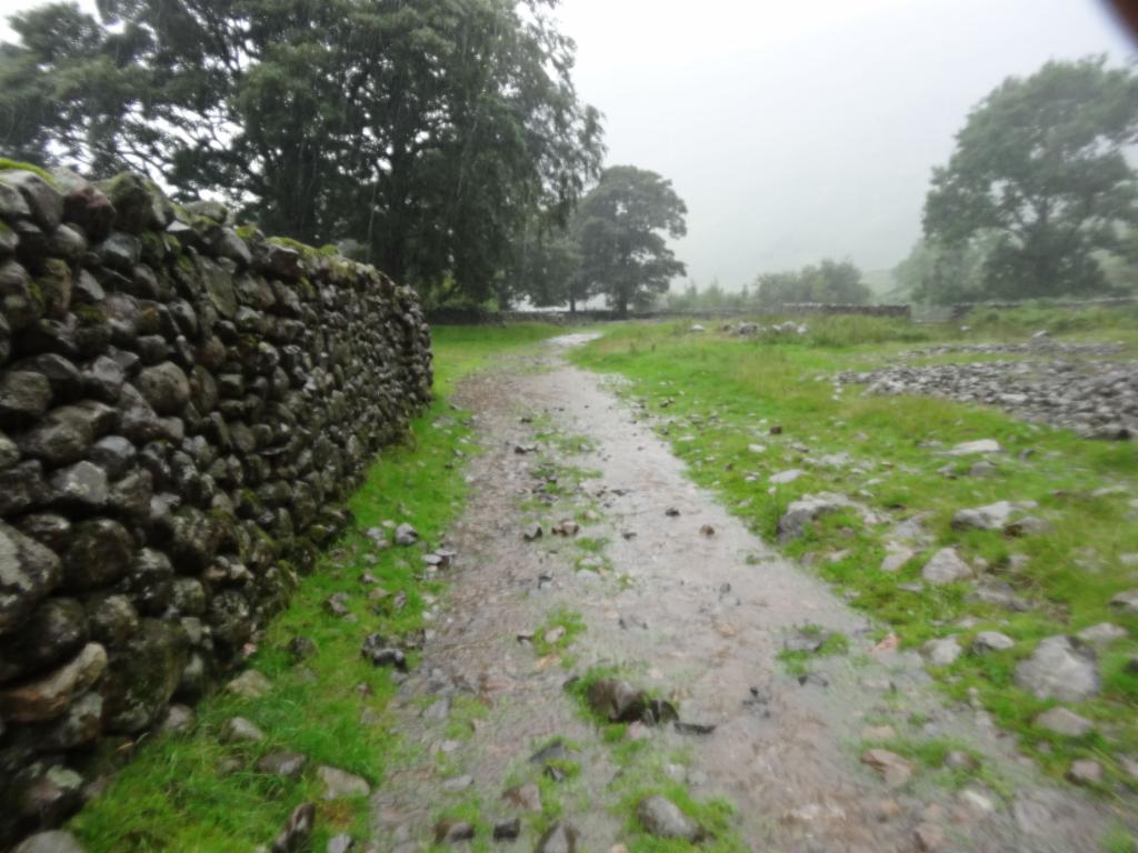
The path turned into a torrent.
Soaked...
Ascent to Birkerfell
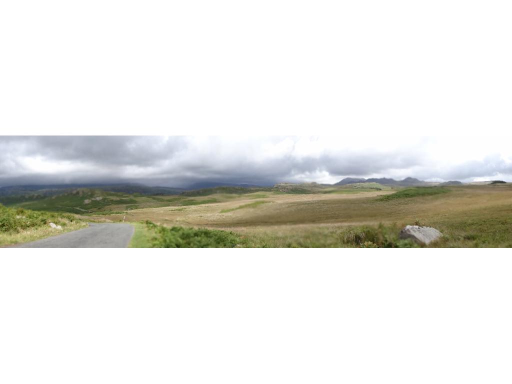
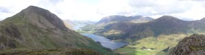
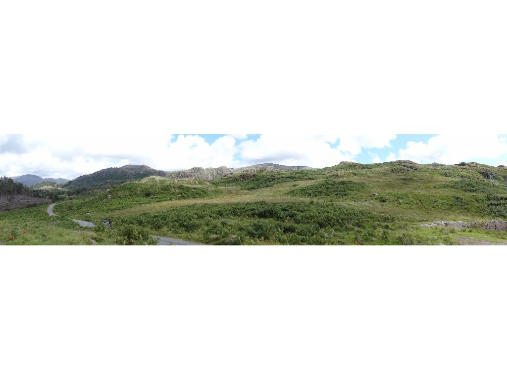
Panorama of Birkerfell
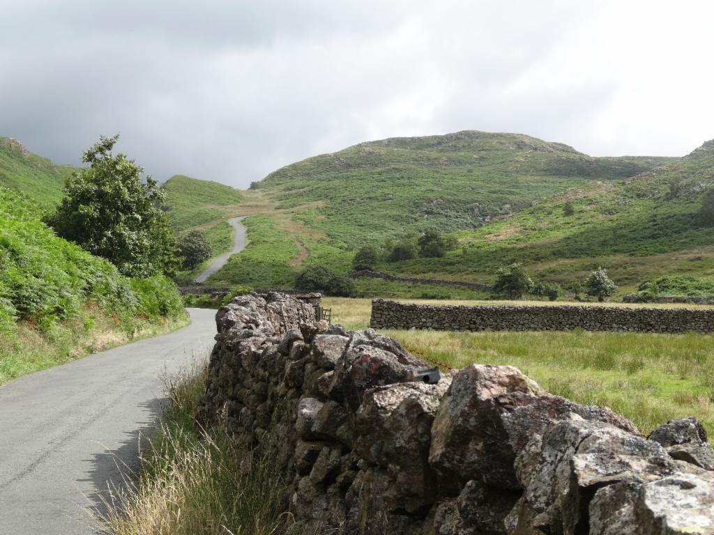
Descent to Ulpha
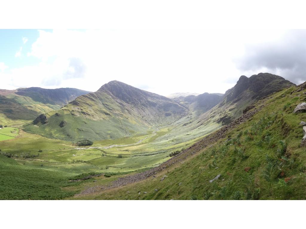
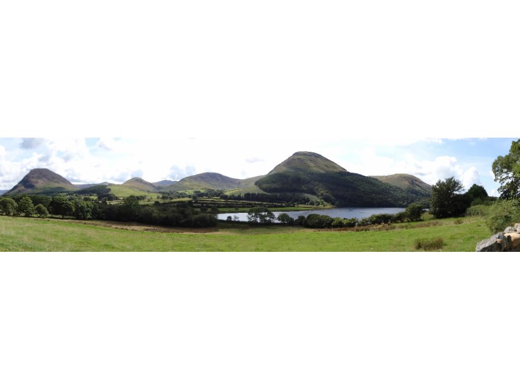
Panorama of Duddon Valley
In Duddon Valley
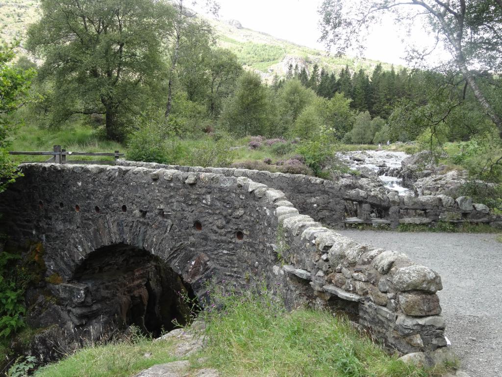
Birks Bridge
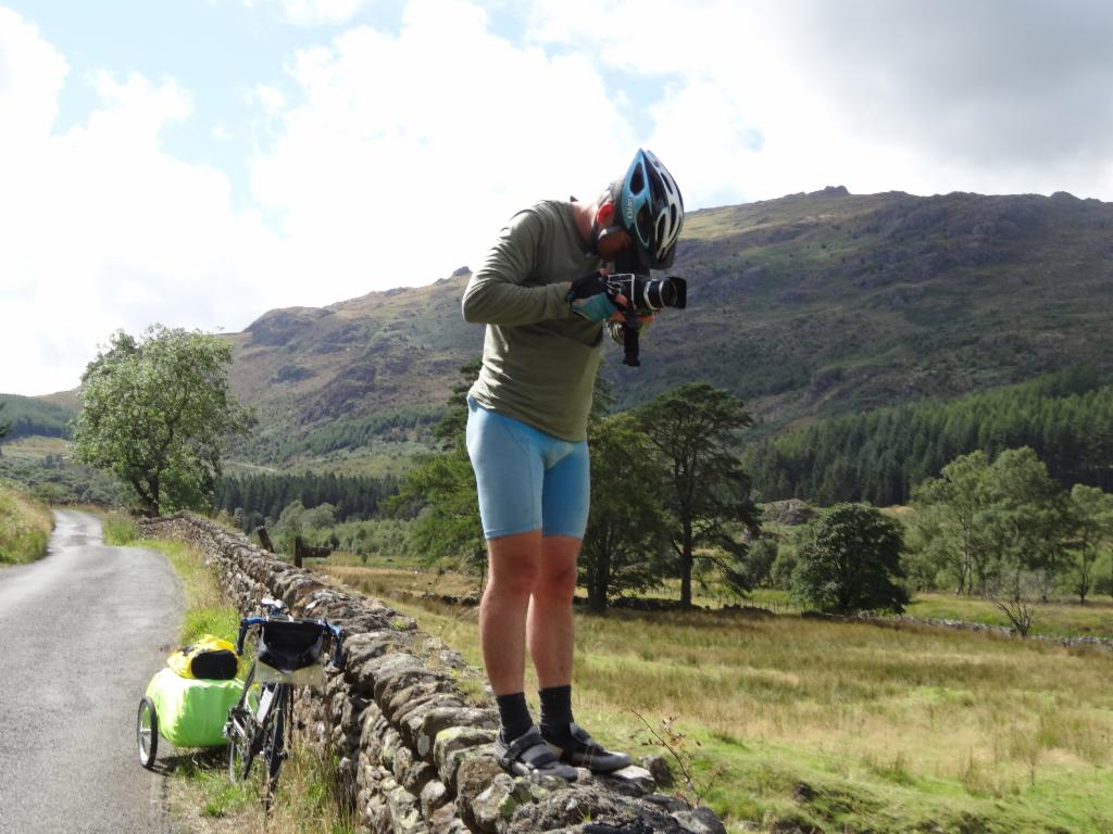
Bertrand and his camera...
Hardknott Pass
Upper Duddon Valley towards Wrynose Pass
Tough climb to Wrynose Pass
Descent from Wrynose Pass into Little Langdale
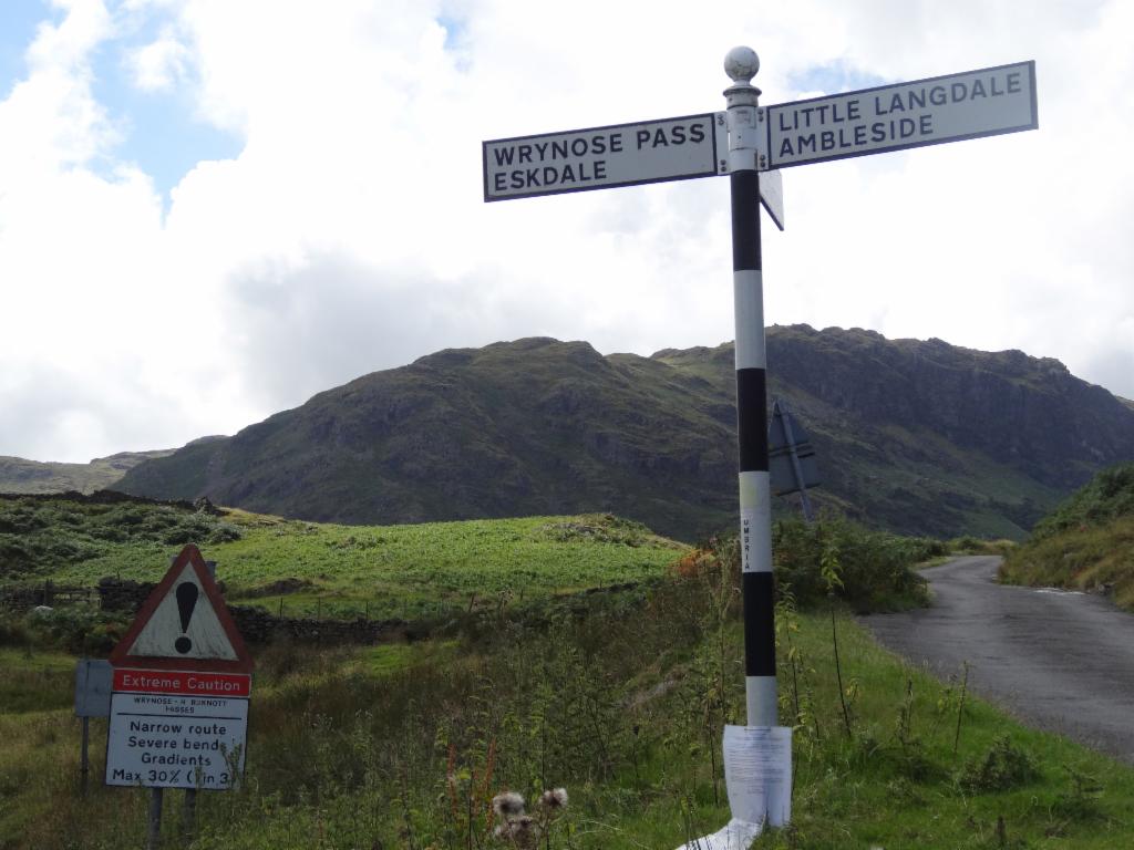
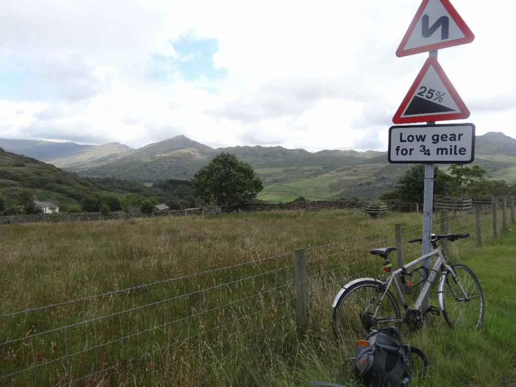
Roadsigns at Little Langdale
Steep ascent to Blea Tarn
Great Langdale from Side Gates Road
Last supper at Queens Head Pub in Hawskhead
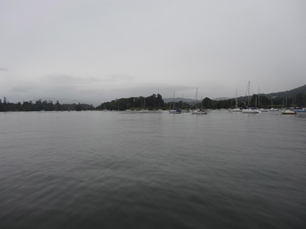
Windermere
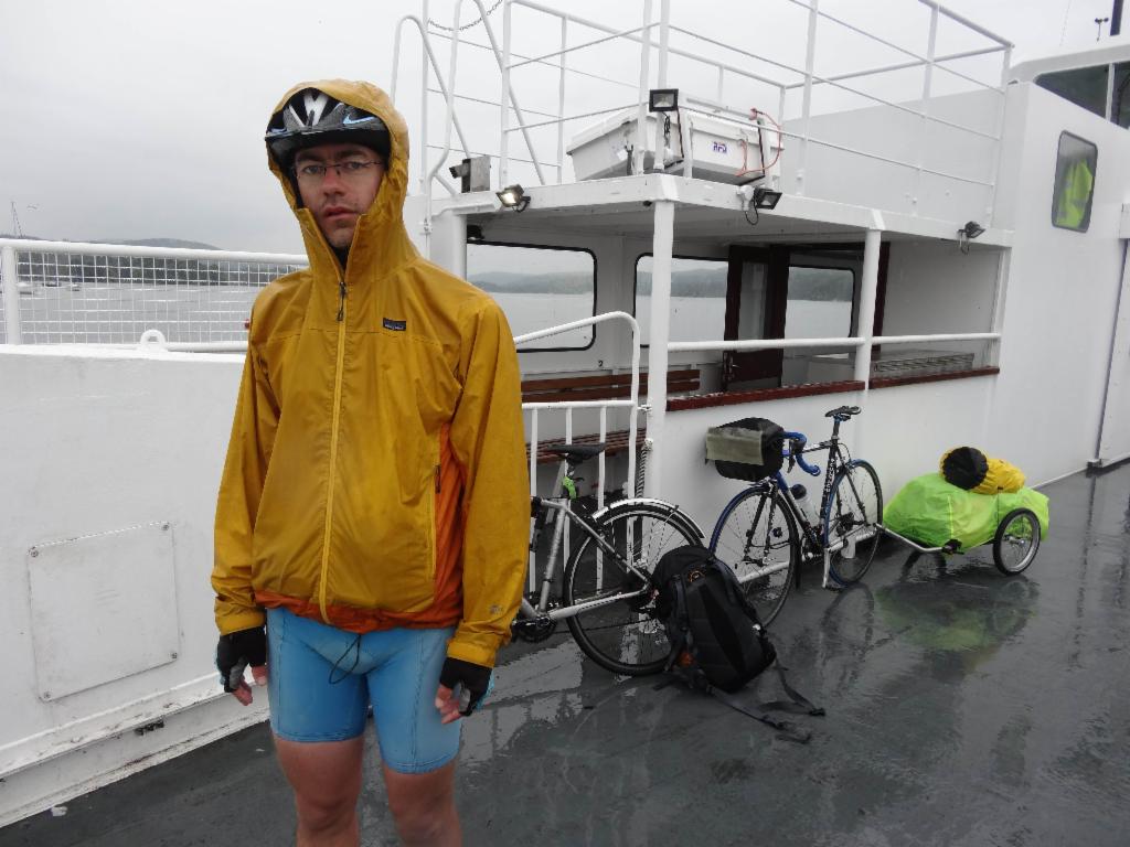
Ferry across Windermere
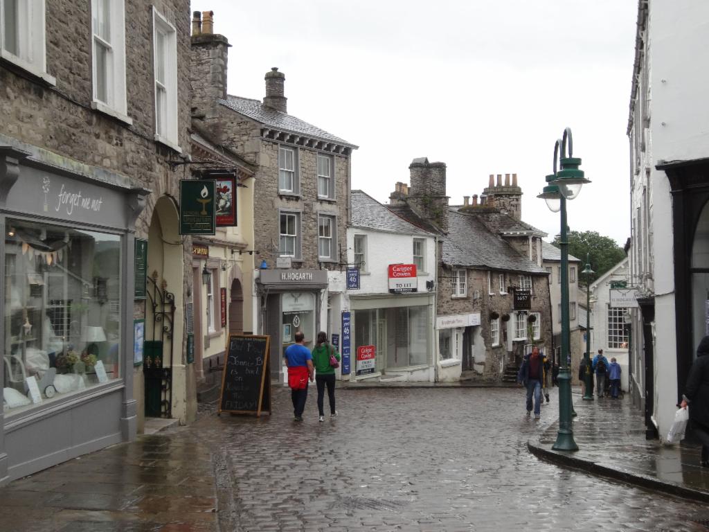
Kendal